

Museum of Sardinia’s Castles
In its rooms you can go on a journey through time, to medieval Sardinia with its fortresses, wars, treaties, intrigues and stories halfway between fantasy and reality that have survived to this day, with special focus on the events of the four Sardinian judicates of Calaris, Arborea, Torres and Gallura. The Museum of Sardinian Castles is located in the heart of Burgos, in the rooms of a late 19th-century manor house, which belonged to a family of local landowners. The building, which has been refurbished and renovated, has three floors. The museum itinerary is structured into various thematic spaces. One part contains temporary exhibitions on the subject of castles, another displays thematic maps that indicate the coastal towers of the Spanish era and the strategic defence points on the Island, constantly subjected to attacks due to its geographical position, in the centre of the Mediterranean trade and military routes.
There is also an area of the museum entirely dedicated to the reconstruction of rural life. You can deepen your knowledge of the work instruments from the past and of the tools of different shapes that illustrate man’s work and toil. In an area of the museum, there is an exhibition of old and recent photos on the subject of castles. The itinerary ends with a multimedia room that allows you to enjoy a historical reading of the approximately one hundred castles of Sardinia.
Walking a few hundred metres to the east, along a cobbled path, you will reach the Castle of Burgos, also known as the castle of Goceano. It stands in an isolated position on the top of a rocky massif, a position that helped make it practically unassailable. You can still see the fortress’s triple surrounding wall, the perimeter walls and the large tower, over fifteen metres high.
After the visit, it’s worth taking a walk around the narrow streets of the village, observing brick houses with gabled roofs and losing yourself in the medieval-looking alleys of the historic centre. A good way to relive the medieval atmosphere of Burgos is to participate in Prendas de Adelasia, a festival that takes place in December.
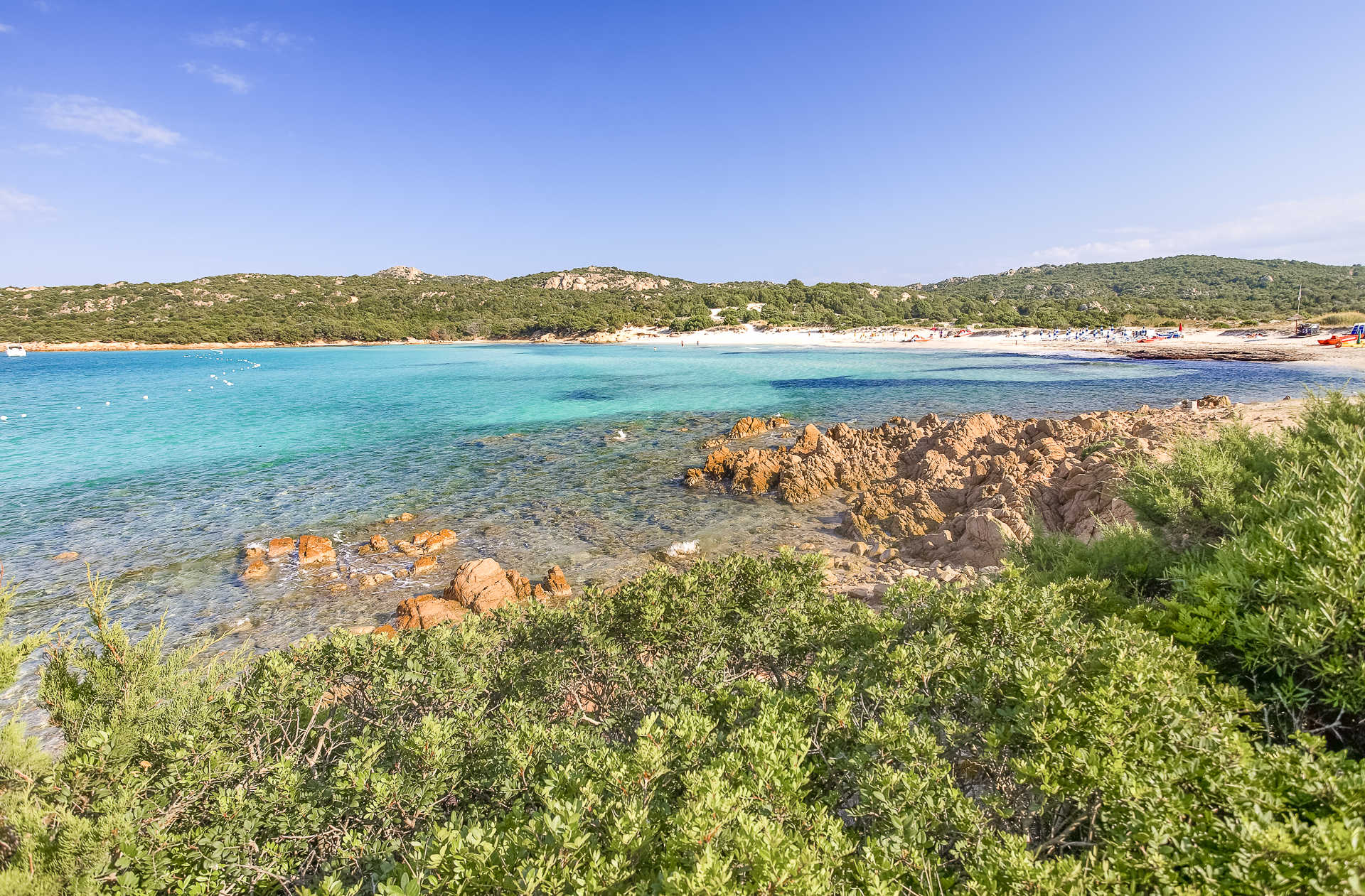
Grande Pevero
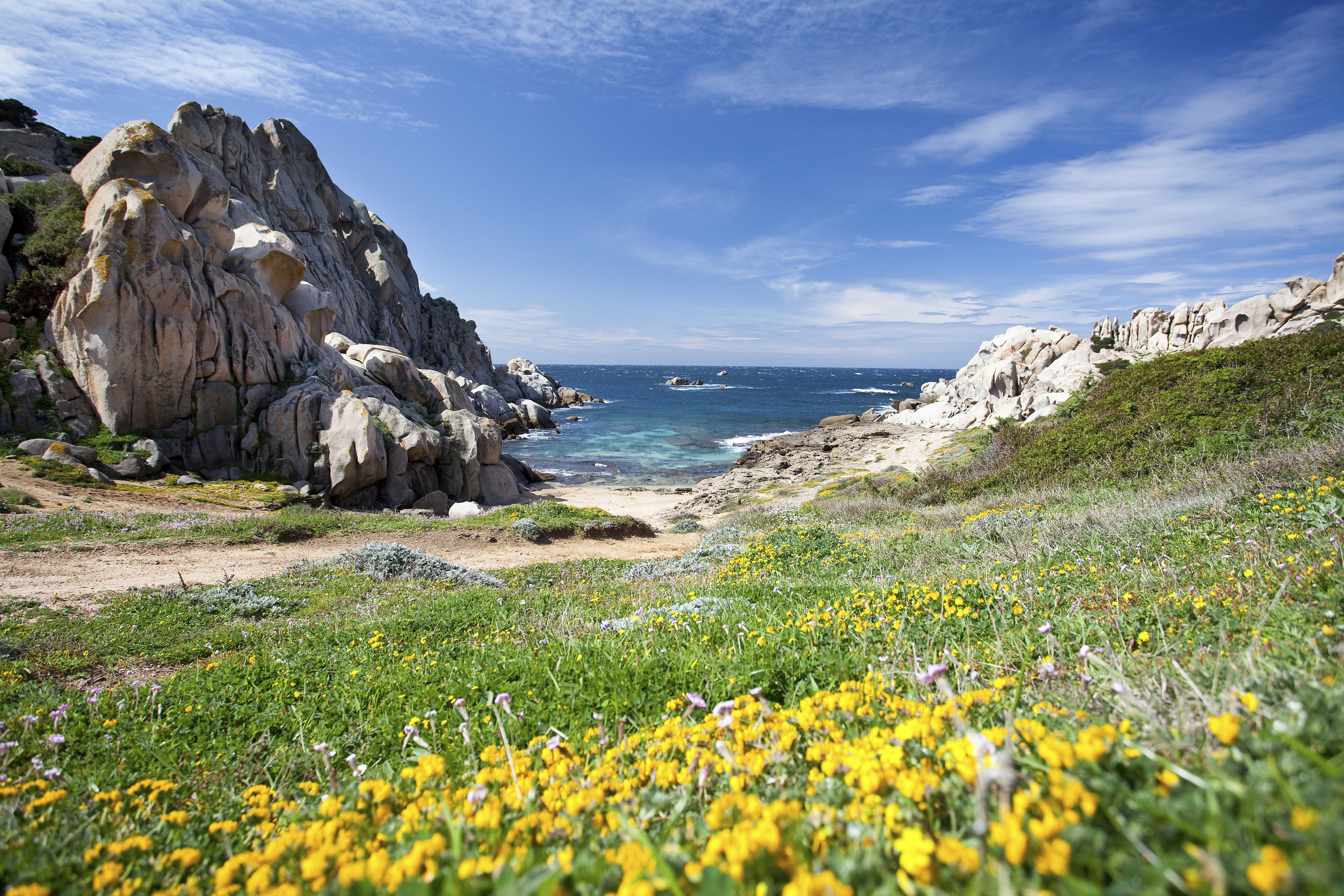
In a picturesque half-moon bay in the heart of the Emerald Coast, beloved by VIPs and paparazzi, lies one of the world’s most glamourous and exclusive beaches. Only a few kilometres from Porto Cervo, in the Arzachena territory, lies the placid Grande Pevero, named after the gulf of same name. This is an arched beach of white, soft sand, almost impalpable, approximately three hundred metres long, lapped by the changing colours of the sea, with hues that change, as in a game, from azure green to transparent on the shoreline. White smooth granite rocks and green vegetation line this beach, enclosing it into a symbolic embrace. Here you can breathe the scent of hundreds-old juniper trees. The sea is shallow and deepens gently, which makes this beach particularly suitable for children and less experienced swimmers. During relaxing walks, you can find shelter in little coves immediately adjacent to the beach.
To its back sits the Patima pond, behind which there are manicured gulf courses that make this a very popular destination among golfers. Not too far, in the centre of the gulf, separated by a promontory and sitting in a solitary, wild landscape, you will find Piccolo Pevero, less than half the size of its “big sister”, and it, too, very beautiful and popular.
From the beach, you can admire the group of islets called Li Nibani – the seagulls, in Gallura dialect – named after the birds that inhabit them. Two and a half kilometres to the south are other marvels of Porto Cervo: the beaches of Romazzino and del Principe (named after Arab prince Aga Khan, founder of the Emerald Coast), and Li Ittricceddi. At the opposite base of the emerald promontory, let yourself be amazed by another bay with four small, lovely beaches:
Cala di Volpe, Liscia Ruja, Petra Bianca and Petra Niedda. Continuing south, do not miss the small beaches of Cala Capriccioli: fine, light sand that dives into the azure see, protected by yellow, pink and reddish granite rocks. Not far from all the Emerald Coast beaches, you will find parking areas with surveillance, bars and restaurants, diving centres, paddleboat rentals, and beach equipment for rent.

Porto Faro
A jewel nestled in the heart of Palau, a short distance from the inhabited town of Porto Faro is one of the most characteristic beaches of northern Sardinia, the name of which derives from a white lighthouse whose painted tip overlooks a small inlet carved into the locality of Punta Palau. From here, you can savour the panorama of the entire national park of the archipelago, from the “big sister” of La Maddalena to the smaller islands of Santo Stefano and Caprera.
Within the cove is a picturesque beach, characterised by fine white sand, lapped by the crystal-clear sea with a shallow and sandy seabed. Strolling along the cove or snorkelling, you will be fascinated by the sight of pink granite rocks eroded by the waters to take on quite unique forms. Not surprisingly, just a short distance away is the monument that most characterises Palau, the Roccia dell’Orso.
Porto Faro is surrounded by Mediterranean scrub that extends almost to the sea. It is not particularly crowded even in summer, being the ideal place for those who love tranquillity and relaxation. Within walking distance, you will find all the tourist services you could need. Behind the lighthouse is a tourist village perfectly inserted into the dense vegetation and bathing facilities available. Nearby, there is also a little private pier suitable for mooring small- and medium-sized boats so you can set out on an exploration of the Maddalena archipelago.

Suni
It sits on the basaltic plateau of Planargia, overlooking the valley of Modolo. Suni is a town of just over 1000 inhabitants a few minutes from Bosa, with which it participates in Strade della Malvasia event: where visitors can taste this prized sweet wine. In the Medieval period, the town was first part of the Giudicato of Torres then, following a brief spell under Malaspina family control, it passed to the Giudicato of Arborea. The town extends around the Church of San Pancrazio (15th century) and the Parish of Santa Maria della Neve. Saint Pancrazio’s Feast Day is celebrated in mid-May with processions, traditional song and dance, and an ardia. Saint Mary’s Feast Day, on the other hand, is celebrated in early August with a Folklore Festival. In late June, there is the Festival of Saint Narcissus, in the charming country church dedicated to him. In late September, saints Cosma and Damiano are celebrated.
Near the parish, in the town centre, a residence that has retained its original architecture has been transformed into the House Museum of Tiu Virgiliu, a ‘living’ example of 19th and 20th century popular culture. It contains over a thousand objects, artefacts and machines used by craftsmen and farmers in displays including a cobbler’s workshop and a weaving corner. A photographic exhibition talks about Suni’s Pre-Nuragic and Nuragic sites. Periodic exhibitions focused on cereal processing and bread making, traditional dress and toys also take place.
According to legend, Suni is the modern Sa Idda Ezza (the old town), where Nuragic ruins including the Giant’s Tomb of Chighentolu were unearthed. The village is found near a 12th century Cistercense monastery. In reality, the area around the town bears signs of even older human settlements, dating to the Neolithic. The most important prehistoric sites can be found in the Suni Archaeological Park, which includes the Seneghe Proto-Nuraghe, the Nuraddeo Nuraghe complex and the Domus de Janas of Chirisconsis. Seneghe is a rare example of an accessible corridor nuraghe: dating to the Copper Age (2400-1800 BC), it is set on a basaltic cliff. A variety of Roman pottery has been found around the site. Nuraddeo is composed of a well-preserved 16-metre-tall keep surrounded by a three-towered bulwark. The remains of a village can be seen around the site. The hypogenic necropolis of Chirisconis, carved into the tuff, consists of 12 openings leading to single and multiple chamber burials: in all, it contains 21 small chambers with traces of red paint on the walls and access to a ‘vestibule’. Near the park, gleams the Pischina ‘e Paule pond, inhabited by numerous animal species. From here, you can set off on scenic walks through griffon nesting areas.
Costa Serena
The vegetation almost reaches the water, as if the myrtle and helichrysum bushes were tempted to dive into it, enchanted by the turquoise reflections of the sea. The greenery behind it surrounds a lagoon, while in front, it covers a small island. This is the captivating landscape characterising the beach of Costa Serena, one of the stretches of the Palau coast. The beach extends in a crescent shape of medium-fine grained golden sand. On the right, you will see a small port, while the view in front is embellished by a rocky islet entirely immersed in Mediterranean scrub. The beach is never overly crowded. It is suitable for children, thanks to the shallow waters, and is sheltered from the winds blowing in from the north. It is also frequented by water sports enthusiasts, especially lovers of windsurfing and kayaking. In addition to relaxing on the beach, swimming and enjoying sports on the sand and in the sea, you can stroll peacefully along the banks of the salt water lagoon behind it.
Beyond a small stretch of coast dotted with rocks, the coastline of Padula Piatta extends to the south-west and is also known as Cala Petralana, from the name of the river that flows to the beach, dividing it into two parts. The sand is soft and cream-coloured, with a sea of shimmering colours due to the reflection of the sunlight on the surrounding vegetation. You might want to linger on the beach at least until sunset and admire the wonderful colours as the sun sets on the horizon, the islet of Costa Serena and, further away, s’Isuledda or Isola dei Gabbiani (Island of the Seagulls). It is really a peninsula, connected to the mainland by a 50-metre-long sandy isthmus that opens out like a fan on two beaches, a paradise for sailing and surfing: Porto Pollo to the east and Arenaria to the west.
A few hundred metres as the crow flies separate the beach of Costa Serena from the Fortress of Monte Altura, evidence of the anti-French defence system that characterises the Gallura coast and the islands of the Maddalena Archipelago. It was built towards the end of the 19th century in local granite and, along with the batteries of Capo d’Orso and Baragge, it helped protect the northern coast. It was a ‘fortified citadel’, surrounded by walls, and the buildings within it were used as lodgings, dormitories, warehouses, workshops and even gardens and vegetable gardens. From the fortress, you can admire a breathtaking view of the Maddalena Archipelago. Also set in the stone and with a view of the open sea, you’ll find the Talmone military battery, which is at least a century older and can be reached via a path that starts just north of Costa Serena. You can imagine the soldiers wandering between the barracks and the turret, and in the lookout posts, always alert, staring out at the blue.
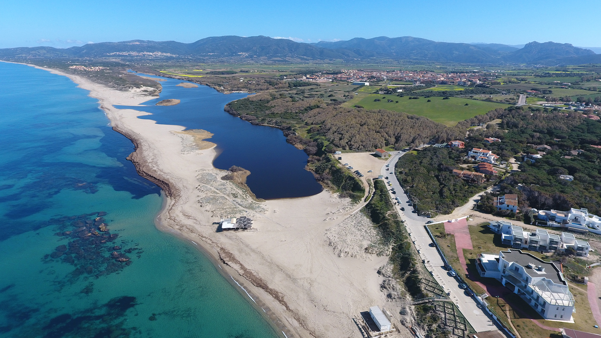
Valledoria
In the lower Coghinas valley, Valledoria accompanies the third river of the island to its mouth and faces the heart of the Gulf of Asinara, surrounded by lush landscapes. Valledoria is an agricultural and tourist town with over 4,000 inhabitants, with its main cultivation being artichokes, protagonists of cultural events in April and the basis of the local gastronomic tradition, whilst the processing of gold and coral forge the strong artisan tradition. Valledoria has been an independent municipality since 1961, arising from the merger of the localities of Baia Verde, Codaruina, La Ciaccia, La Muddizza, Maragnani, San Pietro (and Santa Maria Coghinas, which then became independent in 1983), firstly being the hamlets of Castelsardo and Sedini. The centre is Codaruina, whose name refers to the ‘periphery of the ruins’ of the ancient and glorious city of Ampurias. The original agglomeration was formed by the influx of agricultural entrepreneurs from Gallura who occupied the fertile and vast depopulated plains, while the toponym ‘Valle dei Doria’ derives from the noble Ligurian family that dominated the Anglona historical region in the 13th century.
Between the end of the 20th and beginning of the 21st century, numerous tourist facilities and services were built to enhance the seven kilometres of soft and golden sands, interrupted only by the outlet of the Coghinas river and some rocks in Maragnani. The San Pietro beach offers a contrast in colours with the sparkling sand and blue sea. The Baia delle Mimosa is then a stretch of white sand framed by dunes covered with greenery. San Pietro and La Ciaccia are destinations for those who enjoy breezes and kite surfing, coming from all around Europe. The whole territory is an exploration of nature: the plain is dotted with abundant gardens, lush pines and eucalyptus woods, gentle elevation and plentiful water. Before entering the sea, the Coghinas river forms a wetland extending over 50 hectares, the lacustrine area of the Valledoria beach, inhabited by herons, anatidae, widgeons, dabbling ducks and, along the banks in the reeds of rushes, tamarisks and willows, by coots, moorhens and water rails. Sea bass and mullet swim in the brackish waters. The area is ideal for horse riding, trekking, snorkelling, kayaking, sport fishing and sailing.
The first settlements in the area were on the hills of Muddizza then in the plains, as the swamp gave way to cultivable land. The fecundity, easy access from the sea and the navigability of part of the river all contributed to the fortunes of Ampurias, to which the Sardinian Church attributed great importance. Indeed, it was amongst the first episcopal hubs of the north, maintaining its authority until 1503 and strengthened by incorporating the diocese of Civita (Olbia). The mouth of the Coghinas river constituted an integrated port system, which the excavations in Zilvara and Santa Maria Maddalena helped bring to light. Documenting its evolution is the archaeological museum of the village, which also exhibits stelae from a Roman necropolis.

Cala Conneri
A calm emerald green sea, speckled with turquoise reflections and a few rocks emerging from the water, caresses the shoreline, giving way to soft, white, almost impalpable sand. All around, stunning pink granite cliffs, covered with fragrant junipers, rosemary bushes and sea daffodils, enclose and guard this private and secluded cove. The description helps to understand why Cala Conneri is nicknamed the ‘cove or beach of love’. It occupies a small stretch of the eastern coast of Spargi, the fourth largest island of the Maddalena Archipelago National Park. The feeling of having reached an intimate and romantic corner of paradise also comes from the small size of the beach, which is sheltered from the winds and can only be reached by sea, on private or rented boats and authorised charters departing from the ports of La Maddalena, Palau and Santa Teresa Gallura.
In summer, it’s a destination not to be missed on guided tours of the archipelago’s beaches: the sun’s rays highlight the colours of the clear sea and the intense white that makes the beach stand out, while its waters are shallow and the seabed is sandy near the shore. The view opposite the beach is enriched by the jagged outline of the western coast of the island of La Maddalena. The emotion is just as strong in the off-season period: all you will hear is the sound of your footsteps sinking into the sand, surrounded by the colours and scents of wild nature and the feeling, at least for a moment, that the Cala Conneri landscape is for your eyes only.
The whiteness of the beaches and the colourful reflections of the sea are also typical of the other beaches of Spargi, which stretch out along the eastern and southern sides of the island that has a curious almost oval shape. Cala Corsara is divided into four small beaches, separated by rocky outcrops and enriched by sand dunes covered in shrubs. A little further to the east you will find Cala Soraya and Cala Granara. The first has a distinctive arch shape, a turquoise sea and a large rock in the centre of the sandy shore. The second is one of the most popular destinations in the park. It is divided in two by a promontory and has small sand dunes, on which there are helichrysum flowers and sea daffodils. At Cala Canniccio the sand takes on an amber hue, adding variety to the landscape, which is also coloured by the surrounding Mediterranean greenery, the reddish shades of the rocks and the blue of the sea.
The island’s hinterland is almost inaccessible and is covered with thick rockroses, strawberry trees, junipers and lentisks. Off its coast, there are lots of wreckages, including the famous shipwreck of Spargi, a Roman cargo ship dating back to the 2nd century BC that lies at a depth of 18 metres. Part of the cargo is on display at the Nino Lamboglia Museum of La Maddalena.
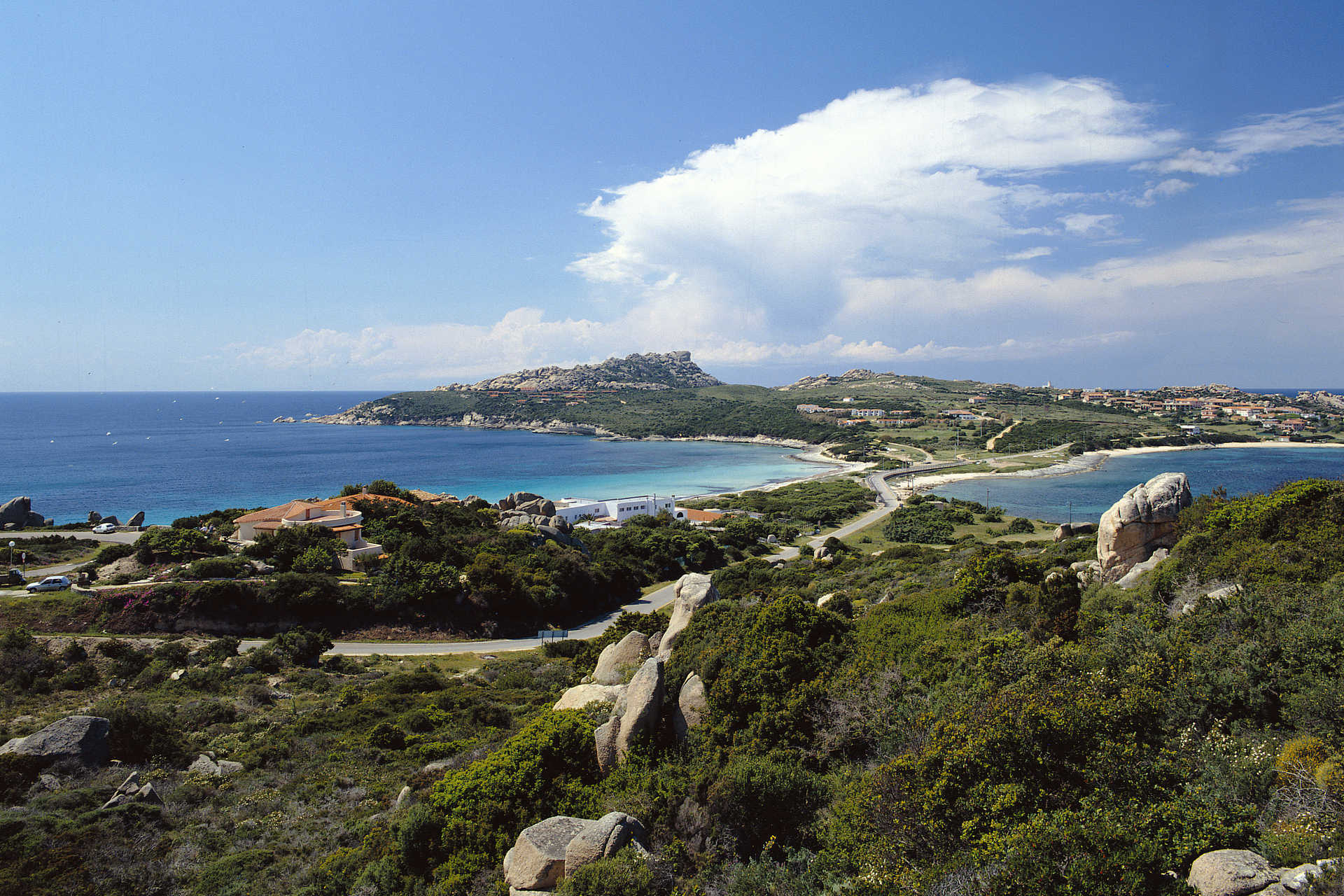
Rena di Levante and Rena di Ponente
In the territory of Santa Teresa Gallura, four kilometres from the residential area, along the isthmus that joins the peninsula-promontory of Capo Testa to the mainland, there are two beautiful beaches: to the west there is Rena di Ponente (or La Taltana) and, to the east there is Rena di Levante. Their position makes it possible to enjoy the calm sea, choosing one or the other, based on the direction of the wind. Striking granite cliffs that the wind and sea have modelled into strange and original shapes, making the scenario even more captivating,are coloured by the green Mediterranean vegetation. The purity of this stretch of sea is amazing, earning it the Blue Flag award, and it is particularly suitable for children, for relaxing walks in the water and interesting diving.
The beach of Rena di Ponente has soft white sand and is washed by the colours of the sea, ranging from turquoise to blue and emerald green. Rena di Levante has a low cliff that slopes down to the beautiful Capicciolu(or beach of Zia Colomba), with its golden sand and transparent, shallow waters. This was the site of the Roman colony of Tibula and traces of its roads are still visible. It was the point of departure for ships laden with granite, used to adorn the palaces in Rome. Close to the Reno di Ponente beach, you will see granite rocks that the wind and water have modelled into cylinder shapes that resemble Roman columns.
On the western side of the cape, there is another symbol of the Santa Teresa coast: Cala Grande-Valle della Luna: impressive granite rocks, shaped over thousands of years by the force of the weather, take on an unusual shade of white when lit up by the moonlight. Here, you will find secluded little coves with crystal clear waters. Before reaching the peninsula, leaving the residential area of Santa Teresa, the little rocky coves of Santa Reparata are also worth visiting. Not far from the historical centre of this Gallura locality, you can enjoy the dazzling colours of Rena Bianca, a city beach of immense beauty, watched over from above by theSpanish tower of Longosardo. To the east of the village there are numerous other gems to be seen: Cala Sanbuco, La Marmorata and, in moving towards Palau, Valle dell'Erica, Porto Liscia-Sciumara and Conca Verde.
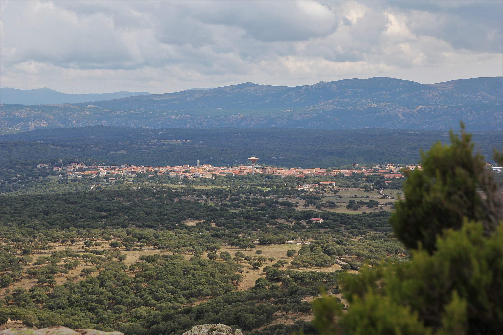
Alà dei Sardi
It is located at an altitude of almost 700 metres at the top of a plateau, next to the lush slopes of Mount Acuto, which gives a name to the territory to which the village belongs. Alà dei Sardi, a village with less than two thousand inhabitants, an enclave in the Logudoro area of Gallura, is part of a 'mosaic' made up of rugged, silent granite elevations with bizarre sculptures shaped by the wind, forests of holm oaks and oak trees, the kingdom of the mouflon and the eagle, staggering valleys with streams forming little lakes and the waterfalls of Su Fosslu Malu and flat dirt roads with stretches of Mediterranean scrub, where the trials for the Rally d'Italia Sardegna, a round of the world championship, takes place. From the village, you will see the Gulf of Olbia and the majestic outline of Tavolara and from the forest of Lithos, the mountains of Barbagia.
The first document to acknowledge Alà dates back to 1106. The name may have Paleo-Sardinian origins, linked to the Basque alha, meaning 'pasture', referring to the extensive pastures. Other possibilities may be the Latin ala - a roman army was stationed in the area - or the Punic word meaning 'placed high up'. The 'dei Sardi' specification was assigned by regal decree in 1864. The present-day village emerged in the 17th century around the Church of Santa Maria (1619), which was rebuilt between 1880 and 1961, becoming the parish church of Sant'Agostino. The façade is made of granite, enriched by statues of saints, while the majestic seventeenth-century mosaic of Our Lady of the Rosary is kept inside. The patron saint is celebrated at the end of August with religious celebrations and associated folk performances, where the splendid traditional costumes of Alà are on show, and the ham festival. The historical village centre is made up of houses and little buildings with 'austere' granite façades and wrought iron fixtures. In this setting, along the narrow streets, you will see unexpected granite architecture pop up: the wells of 'E Mesu Idda and S'Oltu Mannu, old town hall and small castle of the Dessena family. On the façade of Palazzo Corda (1850), 'the castle', a mural commemorates the last bardana (1870), meaning looting at the expense of the wealthy. Other churches in the centre are San Giovanni Battista and Sant'Antonio da Padova. Two kilometres from the village, in the Sanctuary of San Francesco d'Assisi, the origin of which is linked to legend, a celebration takes place early in October and attracts ten thousand worshippers. The processing of cork, granite and stones by the famous maistos of Alà is the main resource of a village undergoing considerable development since the year 2000, and boasts (with Buddusò) the largest wind farm in Italy. The centuries-old agricultural and pastoral tradition is still alive, with renowned products: beef and honey.
The territory was already inhabited in the Neolithic age. The greatest evidence is Nuragic: almost twenty sites, including towers, villages, tombs of Giants and sanctuaries. The main ones are Sos Nurattolos, dating back to the Iron Age, consisting of a sacred fountain, meeting hut, sanctuary and dwellings; the well-preserved nuraghe Boddò, and the village of Su Pedrighinosu, with circular buildings and a forge. The site was later inhabited by the Balares, a non-native rebellious people. Balare and Alà are phonetically similar and this is not a coincidence, if you consider that in the local dialect of Alà the 'b' at the beginning of a word is typically dropped.
Cala Grande - Valle della Luna
A little valley, about 500 metres long, consisting of impressive granite rocks shaped by the force of the weather over thousands of years. Cala Grande (or Valle della Luna) is located in the western part of the promontory of Capo Testa, in the territory of Santa Teresa Gallura, approximately four kilometres from the residential area. You will see hidden little coves appear between the rock faces, with turquoise and crystal clear waters, made magical by the contrast with the golden colours of the rocks and the green of the dense Mediterranean scrub, in which there are strawberry trees, myrtle and heather.
Since the late 1960s, the promontory has been chosen as a home by a group of hippies and naturists, who have helped to keep it unspoilt. It was named Valle della Luna because of the unusual white colour of the rocks in the moonlight.A spectacular setting in which peace and nature rule, as in the other beautiful places in the valley: the coves ofl’Ea and Mezzu. Here, you can enjoy breathtaking, evocative landscapes, particularly popular with diving enthusiasts, which can be found everywhere during a visit to the whole area of the promontory.
Valle della Luna is one of the symbols of the long, splendid Santa Teresa Gallura strip of coastline, which offers you a myriad of must-see beaches: during your holiday, you can visit one or more per day. Starting with Capo Testa, which is joined to the mainland by a strip of sand forming Rena di Ponente (or Taltana) to the west and Rena di Levante to the east. Also near the peninsula-promontory, the little rocky coves of Santa Reparata are also worth visiting. A short distance from the old town centre of the renowned locality in the Gallura area, you can enjoy the dazzling colours and the transparent purity of Rena Bianca, a city beach of inestimable beauty. To the east of the residential area, you will find the picturesque Cala Sanbuco and the large and well-equipped La Marmorata. Continuing on in the direction of Palau, you will find the granite pools of Valle dell'Erica, Porto Liscia-Sciumara, the home of windsurf, and the captivating peace and quiet of the Conca Verde.