

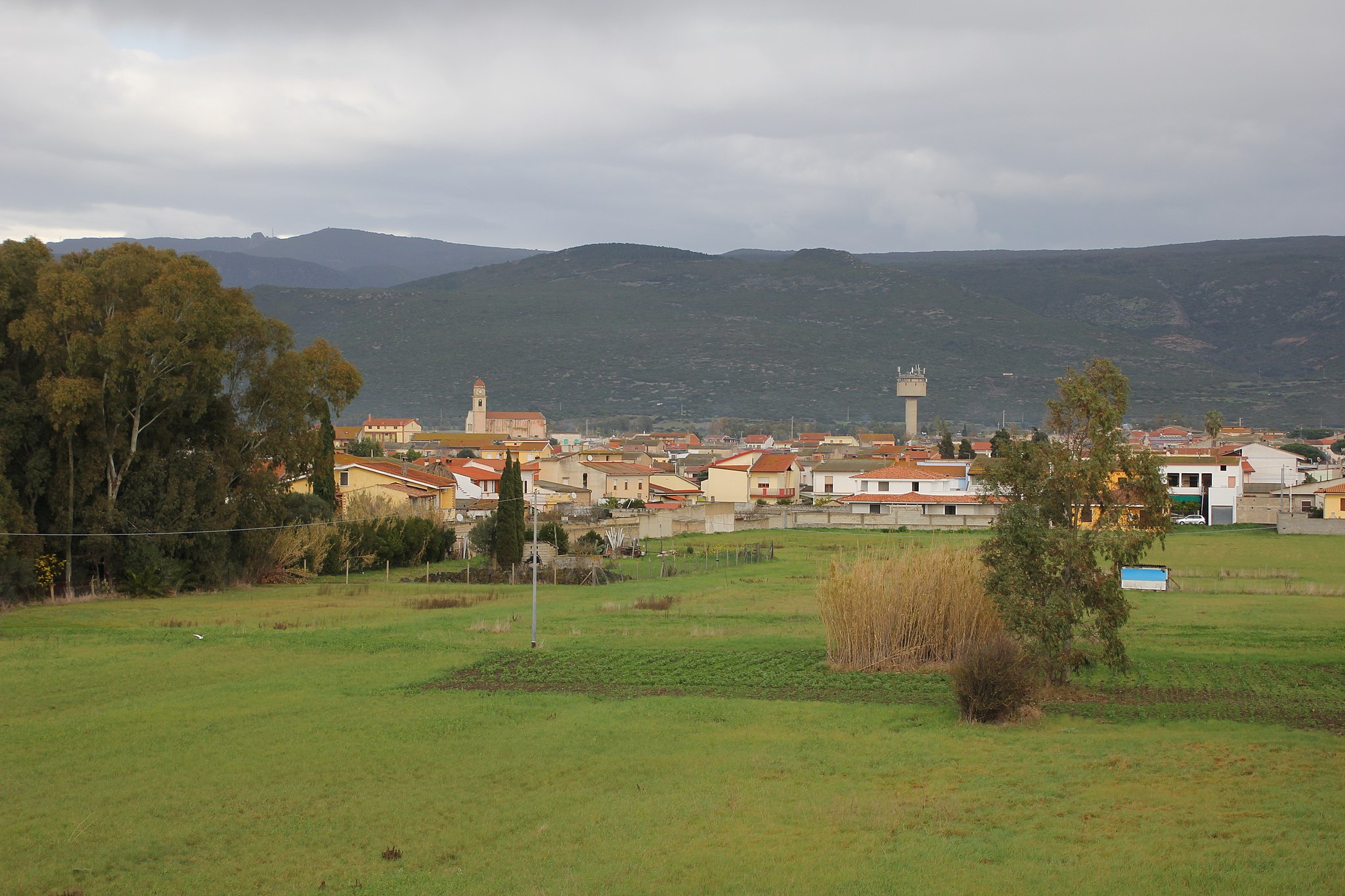
Ilbono
At an altitude of 400 metres above sea level on the southern slopes of the Gennargentu massif, Ilbono is surrounded by a rolling landscape, where the porphyritic rocks of Monte Tarè stand out. Grains, legumes, orchards, vineyards and olive groves are cultivated here, irrigated by the streams that run through fertile hills. Ilbono is a town with over 2,000 inhabitants. In the Ogliastra province, it lies along the ‘road of longevity’ stretching from Lanusei to Tortolì. Since 2005, Ilbono has been an oil city, holding the Sagra di Olio e Olive (oil and olive festival each March that is not to be missed. Another leading sector is artistic craftsmanship. In Funtana de Idda, the main piazza, the narrow and winding historic streets of the village converge. Here stands the parish church of San Giovanni Battista, built in the 17th century on the site of a building that was perhaps Romanesque, whilst the Chiesa di San Cristoforo (the patron saint of which is celebrated at the end of September) was erected between the 17th and 18th centuries. In the countryside, rise up the small churches named after San Rocco and San Pietro, where finds from Roman times have been discovered. The most beloved festival is in honour of the Madonna delle Grazie at the beginning of July. Legend has it that a chest with the statue of the Madonna washed up on the beautiful beach of Cea and was transported to the village. Much beloved are also the rituals of Settimana Santa (Holy Week). Throughout the celebrations, the Ilbono women show off their traditional dress.
The name Ilbono derives from silvone or sirbone (wild boar), due to their abundance during Antiquity. The territory also preserves human remains from the Neolithic period (end of the 4th millennium BC), such as the documented Domus de Janas in various locations, including Tèxere, where seven menhirs were also found, and especially in the archaeological site of Scerì where, in addition to two hypogeal tombs excavated in two boulders (of a monocellular type), a Nuragic complex is maintained, perfectly integrated with the natural context and in a strategic position. On a granite tower stands a Nuragic complex in blocks of granite, consisting of a main tower with a circular layout (almost five metres high) and an added body (48 metres long and 36 metres wide), with an attic below. A village lies in an area that is not as steep. Discovered in some of the huts are materials that provide evidence from the Mid- and Late-Bronze period, from the 15th to the 12th century BC. The Nuragic remains are to be found all throughout the Ilbono territory, one of the highest-density areas of Ogliastra, with a dozen being single-story with megalithic dividers and walls. Some towers have Nuraghi Teddizzò and Mont'e Forru (replete with village). Some have Tombs of Giants nearby, with two in Pèrda Carcina. Indicating the area’s Romanisation are the remnants of an inhabited area, a necropolis and a road in Piranserì and a settlement in Alinusolu. Two military discharge papers were also found: from 79-81 and 127 AD, issued by the emperors Domitian and Trajan.
Portisco
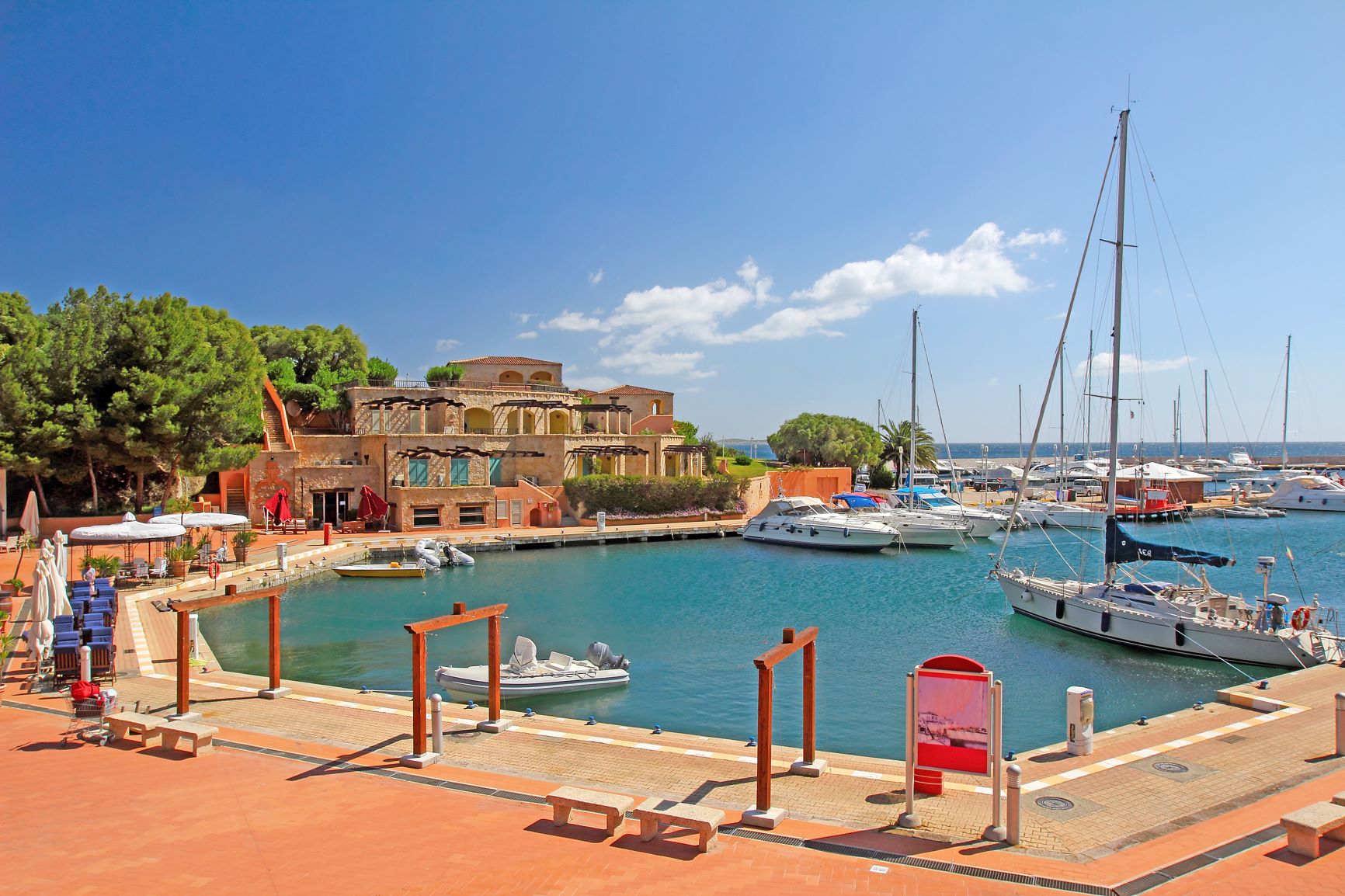
Embraced by a spellbinding landscape, ‘strategically’ positioned for exploring one of the most captivating coastal stretches of the Mediterranean and well connected to the port and airport of Olbia, Portisco is an ideal destination just outside the Costa Smeralda, suitable for all types of tourists and equipped with every comfort. Villas and residences, hotels and beaches in the renowned resort occupy the western part of the Gulf of Cugnana, along with a picturesque and well-equipped tourist port, the Marina di Portisco, continuously prized with the Blue Flag award as a tourist port since 2016, thanks to its clear waters, environmental protection and quality of services. The opposite end of Portisco is represented by a strip of semi-outcropping rock that ends near the granite islet of the same name, covered in Mediterranean greenery and embellished with wild, deserted coves.
Between the port and the Island, there is a strip of fine-grained white sand, with shallow waters and a few rocks. You will be surprised by the two colours of the sea - turquoise near the shoreline and cobalt blue offshore. The beach is perfect for families, thanks to the gently sloping seabed and the numerous services present, parking, refreshment areas, beach equipment and boat rentals. That’s not all... it is also an attraction for diving and snorkelling enthusiasts, especially around the rocky coves.
The scenery is magnificent: on your left, there’s the cliff and the islet of Portisco, while on your right, beyond the marina, is the Gulf of Cugnana and, in front of it, at the opposite end of the bay, Portisco's ‘neighbour’, namely Porto Rotondo. From the port, you can take a boat to discover the Costa Smeralda beaches, the islands of Mortorio and Soffi, with their little coves and natural pools, and move towards the Arcipelago della Maddalena Park, 60 islands and islets with magical and protected beaches.
If, however, you are moving by land along the ‘panoramic’ provincial road SP 94, you will cross the southern border of the Costa Smeralda and you can admire its jewels: starting from Rena Bianca, named after the white colour of its sand, where the cliffs frame the emerald green sea, while the shoreline is tinged with pink due to the small grains of quartzite. Continuing north, you will come across Razza di Giunco, where the beach dotted with pink granite rocks alternates with fjords, islets and promontories, and Petra Ruja, ‘coloured’ by distinctive red rocks. The pink water’s edge returns at Liscia Ruja, the largest Costa Smeralda beach, surrounded by Mediterranean scrub, followed by the bay of Cala di Volpe, one of the best-known destinations of the ‘Costa’. Its landscape is fairytale-like: the deep blue sea, with its granite rocky outcrops, opens up before myrtles and junipers.
Uras
At the feet of the lovely park of Mt. Arci, blessed with the obsidian reserves that provided it with its economic importance, the town sits on a plain cut through by various rivers. Part of the area is home to cultivated fields, while the other is covered in Mediterranean brush. Uras counts less than 3,000 inhabitants on the border between southern and central Campidano. It is steeped in rural traditions and excels in textiles. The historic centre is graced with traditional buildings made of rough unbaked clay bricks, homes that encircle the large Baroque (1664-82) church of Santa Maria Maddalena. A square bell tower with domed octagonal top and clock was erected next to it in the early XVIII century. The patron saint is celebrated in late July.
The town has two other interesting churches. On the outskirts is the church of Sant’Antonio with a lovely bell-gable. The back wall, once inside, is graced with a stone altar decorated with vegetable motifs. The saint is celebrated in mid-June. The church of San Salvatore has gone down in history for the battle that took place nearby it on 14 April, 1470, and saw Leonardo Alagon victorious over the Aragonese army of Viceroy Carroz. Near the church is a Nuragic structure, some of whose stone ruins were encompassed in the church. It may have been built over a sacred pre-Christian site, perhaps a temple of water worship. San Salvatore is celebrated on the Tuesday after Easter Monday with equestrian jousts, the sa cursa de su pannu, in commemoration of the bloody battle. Alagon’s victory is not the only famous historical event to have taken place at Uras: it was mentioned as one of the towns that signed the peace treaty between Eleonora d’Arborea and the King of Aragona. In 1515 it was preyed on by Saracen raiders and in 1546 destroyed by Barbarossa. A century later, it was brought back to life.
The origins of Uras date to the 3rd millennium BC, to the era of the pre-Nuragic culture of the Ozieri. Ceramics dating to that period were found in sa Grutta manna, while in Roja Cannas, on the slopes of Mt Arci, the largest reserve of obsidian mined during the Neolithic Age was discovered. Uras played a leading role in the commerce of this precious mineral. The town was densely populated during Nuragic times: there are 22 megalithic towers, two Giant tombs and the huge Nuragic complex of sa DomuBeccia, dating to between the XV and XI century BC, less than a kilometre from town. DomuBeccia is a massive five-lobed basalt building made up of a triangular bastion (with three towers) around a main tower and courtyard, and by a hexagonal outer wall with six towers with diameters of between five and six metres each. South of the complex was a large village of 150 circular huts that are well preserved. On the northern part you can see the remains of the Giant tomb. Uras was also a Punic city, but above all an important outpost along the strategic Calaris-TurrisLibisonis road during Roman times.
Arzana
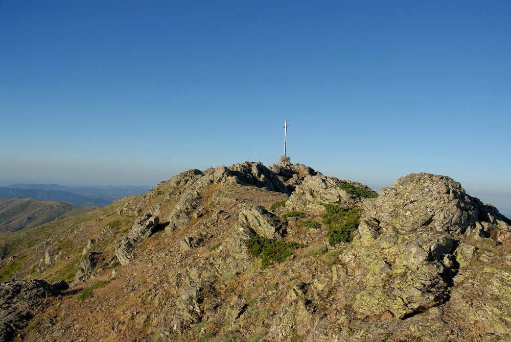
Arzana lies in the heart of Ogliastra, with lush forests and crystal clear springs, at the foot of Mount Idolo, on the slope of the Gennargentu massif, looking out to sea. On clear days, from this part of the massif that, with Punta La Marmora, touches the highest peak on the Island (1834 metres), you can see very distant Sardinian territories. It is an area rich in watercourses that sometimes turn into waterfalls and transparent little lakes: the spring of Funtana Orrubia is not to be missed and nor are the Pirincanis waterfall that flows in a narrow and evocative gorge. In the Flumendosa valleys, stretches of very ancient forests still remain, like the Tedderieddu forest, in particular, where you will find some of the oldest yew trees in Europe, as well as junipers, broom, alders, cistus and holm oaks and where mouflons, wild boar and deer live undisturbed.
The territory of Arzana was frequented starting from the Nuragic age. Bearing witness to this are the Domus de Janas necropolis of Perdixi, the Nuragic complexes of Unturgiadore, Sa 'e Cortocce, Sa Tanca and the village of Ruinas, while in the same area of Tedderieddu, in the village of Silisé and inside the village, at Su Baingiu - where thermal baths were found - ruins from the Roman era were discovered. In the Giudicale period, the village was first under Calari and was then incorporated into the kingdom of Gallura. Lastly, it became part of the Catalan-Aragonese kingdom. Among the religious buildings, the parish church of San Giovanni Battista, rebuilt in the mid-nineteenth century, stands out. Inside it, you will see a medieval cross from Silisé and a seventeenth-century monstrance.
Arzana is one of the symbolic municipalities in the Ogliastra Blue Zone, meaning that it is one of the six areas in the world with the highest percentage of centenarians and elderly people in good health, a unique circumstance studied by the Istituto di Genetica Molecolare (Institute of Molecular Genetics) of the CNR (National Research Council). Longevity, one of the qualifying dimensions of the extraordinary quality of life in Sardinia, is based on the co-existence of genetic heritage, environmental and social well-being and the quality of food. In fact, like the other Ogliastra villages, this one stands out for its delicacies, starting with culurgionis, tasty cheese ravioli that you can enjoy with tomato sauce. In the autumn, during the mushroom season, Arzana gives the best of itself: every year, in November, the Feast of the Golden Porcino Mushroom takes place. You can enjoy this unique experience, reaching the village on the Trenino Verde, a tourist railway line that runs from Cagliari to Arbatax through landscapes of indescribable beauty.
Osini
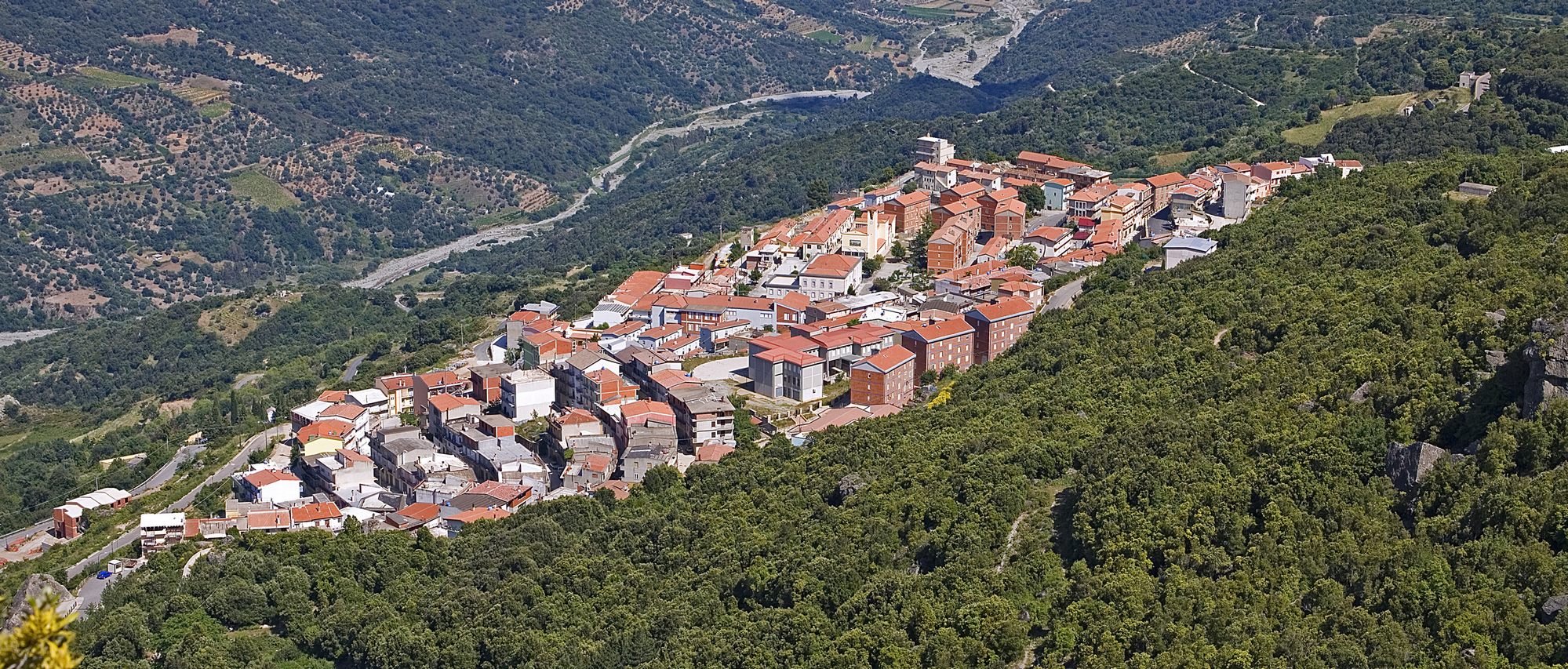
A town with two lives. The modern-day town of Osini is located a kilometer north of the original one after a flood devastated it in 1951. Old Osini came about in the Middle Ages and was first under the giudicato of Calari, then ruled by Gallura, followed by the Aragonese and Spaniard, but is now a ghost town with empty houses and the XVII church of Santa Susanna. It comes back to life only two days a year in August, when the saint is celebrated. Although modern Osini has only 800 inhabitants, it is graced with artwork done by such Sardinian artists as Maria Lai, Costantino Nivola and Pinuccio Sciola, and blessed by a beautiful mountainous setting of gorges, ravines, steep cliffs and valleys clad in verdant Mediterranean vegetation: there is a woods of oak trees, there are olive groves and vineyards that grow the grapes to make fine cannonau wine.
When you get to the top of the Taccu of Osini, a high plains at an altitude of about a thousand metres, the view you’ll enjoy is over the town itself and all of the Ogliastra, including the lovely Scala di San Giorgio. This gorge is a natural monument set in Sardinia’s most forbidding wilderness: a dauntingly narrow passage between two steep, dolomitic and calcareous walls. The sanctuary in honour of the patron saint, who is celebrated every year on 24 April, was set in this very opening. Legend has it that St. George, bishop of Suelli, read a prayer at the feet of the high plains, which he would have had to either climb over or skirt around, after which, miraculously, a passageway opened in the rock face.
After a short walk, at an altitude of about a thousand metres, you’ll find the Serbissi nuraghe in very good condition. It was inhabited from the Early Bronze Age to the Late Bronze Age (XVII-X century BCE). and is now an archaeological park where thousands of years of history and natural beauty blend seamlessly: the buildings, a rare example of a nuragic complex on high ground, stand out over a panorama of calcareous cliffs with steep walls, on which they sit by means of an unusual technique of terracing. The structure, one of the most important of the Nuragic civilization to have reached us, is made up of complex nuraghes with four towers, a village, cave, two giant tombs and, not far away, two single tower nuraghes, Sanu and Orrottu.
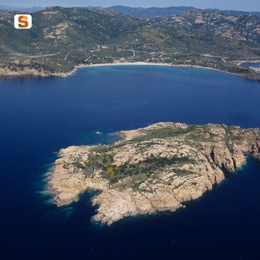
Cala Canneddi
Cala Canneddi is found on the Isola Rossa (Red Island), in the commune of Trinità D'Agultu e Vignola. The sand is spotless and more-or less fine-grained and has multicoloured pebbles at the water’s edge, a number of different sized and shaped rocks and several imposing extremely beautiful dark pink masses at its end. On the Li Canneddi Headland, before the Tinnari Coast, the beach of Cala Rossa is found in a magnificent natural environment, among bright sand, pink-coloured rocks, characterised by the presence of quartz crystals, and last but not least. the deep-blue sea and the green of the vegetation around the shore.
Seneghe
It climbs up Mount Sos Paris, on the eastern slope of Montiferru. Surrounded by holm and cork oak forests and hydrated by beneficial springs, the name of this town derives from s’ena (meaning spring). Seneghe is a farming town of 1,800 inhabitants that has retained its charming city centre and rich archaeological heritage in the heart of a landscape ideal for excursions and rich in olive trees (65 thousand in 200 hectares). The town is known for producing honey and above all, olive oil, which was awarded the Ercole Olivario Prize, the highest national honour, in 1994. The town is a founding member of the City of Oil. Famous initiatives dedicated to olive oil take place here: the Montiferru Prize award ceremony, is held in the 17th century Casa Aragonese at the end of the year, and in late November, Prentzas Apertas, an opportunity to taste local cheeses and sweets along the streets of the city centre as well as in the olive oil mills. Historically, the town’s economy also relies on animal farming and craftsmanship: Bue Rosso meat, casizolu cheese, wood, stone and iron works, musical instruments and traditional clothes are local specialties.
Villa de Seneghe along with its most important church, the Church of Santa Maria de Sa Rosa, located at the town’s entrance and dating to the 11-12th century, was mentioned in the Condaghe of Santa Maria di Bonarcado. In the beginning of June, it hosts the most captivating of festivals, as well as an ardia (horse race). The town is situated around the Baroque-style (ex) Parish of Immacolata Concezione. Consecrated in 1893, its 36-metre high dome soars above Sos Paris. The more recent Parish of San Sebastiano Martire was completed five years later. Piazza del Balli, the pulsing centre of the town, and the 17th century Church of Sant’Antonio da Padova, testimony of the Spanish period, are located just a few hundred metres away. The squares are dotted with wells and fountains. On January 20, a bonfire for Saint Sebastian marks the beginning of Carneval of Seneghe, which ends on Fat Tuesday with the spectacular dances of sas andanzias. The rituals of the Holy Week, accompanied by the four voice a cuntrattu choirs, are evocative. Song is closely linked to poetry: in early September, as if by magic, the town fills with literature enthusiasts for the International Festival of Cabudanne ‘e Sos Poetas, named the best poetry event in Italy in 2009. The festival is preceded by a few days by Musica Senza Confini. June is a time for religious festivals with feast days of Saint Antonio and Saint John being celebrated as well as an ardia dedicated to saints Pietro and Paolo.
From the town, nestled between mountains and plains, you can undertake excursions to Montiferru with its breath-taking views of Campidano, the Sinis peninsula and the peaks of Gennargentu. The peaks are covered mainly with holm oaks and holly: the forests of Pabassiu and Su Monte with their century-old trees are worth exploring. The area has been inhabited since the Neolithic, as seen from the dolmen and menhir, and densely populated since the Bronze Age: about one hundred Nuragic monuments surround the town and make Seneghe a town with one of the highest numbers of Nuragic sites and half of the archaeological itineraries. Among the Giant’s Tombs, Serrelizzos and s’Omo de sas Zanas stand out; while among the well-preserved nuraghes, the corridor nuraghe of Narba, the four-lobed Zinzimureddos, the three-lobed Campu and the single-towered Lande and Littu are worth visiting. However, the most impressive of all is the majestic four-lobed royal nuraghe of Mesu Maiore. The most notable of the copious artefact finds are a female head in marble, a small lion’s head and a bronze medallion. The paving stones of the road leading from Cornus to the village of Serrelizzos have remained intact since the Phoenician period. The most significant remains of the Roman dominion are the thermal springs of Funtana Fraigada. You can also experience the decadent charm of industrial archaeology in an impervious, abandoned location: the Su Enturgiu mine and mining town surrounded by forests. At the times of the Carthaginians, the area was already being scouted for iron deposits however, it was the Spanish to begin excavations and the Savoy to continue in the 18th century.

Sorradile
Stretching along a gentle slope overlooking Lake Omodeo and surrounded by hills with alternating almond groves, olive groves, vineyards and ancient oaks, Sorradile is an agricultural-pastoral town with 400 inhabitants in the Barigadu region, which is part of Borghi Autentici d’Italia (the official authentic villages of Italy), serving as a ‘linkage’ between the plain and the mountain in the Tirso valley. It was originally called Oiratili, a Villa donated in 1156 by the Barisone Giudice (ruler) of Arborea to his wife, Algaburga di Catalonia. Exalted in its narrow streets is the red of the trachyte adorned the houses it decorates and lit in a plethora of shades when illuminated by the sun. Two districts form the village: Corte ‘e Susu, built in ‘terracing’ style, from which you will see views of lake and hills, and Corte ‘e Josso, further downstream, where there is the Parish Church of San Sebastiano. Built in 1642 on a Romanesque layout, it is a sumptuous example of sacred art of the 17th-century picapedres, blending Romanesque, Gothic, Renaissance and Baroque elements. The patron saint is celebrated twice - on 19th January and mid-May, together with the Sagra dei Dolci di Mandorle (almond sweets food festival) and Magasinos Apertos. On 16th January, the Fuochi di Sant’Antonio Abate light up the parish churchyard. A highlight in the village is the Chiesa di San Michele Arcangelo, rebuilt in the 15th century, along with two impressive shrines in the countryside with respective muristenes, resplendent with lights and colours and resounding with songs and dances during the novenas. In the church of Santa Maria Turrana, perhaps dating back to 1573 (but originally from the mid-13th century), celebrations are held in early September with a procession that accompanies the wooden statue of the Virgin Mary (who has a dark face) to the Sas Iscaleddas wood, followed by nine days of saying the rosary and laudas and s’Issadorzu, the last night of the celebration. In San Nicola (ever since the second half of the 12th century), in the church of the lost village of Nurozo, celebrations are held in mid-September.
The territory is a trekker’s paradise: in the Salto di Lochele, amidst cork oaks and downy oaks, one can admire a gorge in which flow the waters of the Taloro which, along with the Tirsoflow, which joins the Omodeo, the largest body of water of the Island, rich in nature and history. When the water level is low, a petrified forest and various Nuragic structures can be admired. On one of its banks stands the greatest testimony of the third millennium BC, the Domus de Janas of Prunittu, a total of 15 multi-chambered sepulchres, amongst which is Tomb X, known as Sa Cresia. Other Neolithic necropolises are those of Sas Lozas, consisting of five Domus with architectural-decorative motifs, and of Isterridorzu, formed by six hypogea. The Nuragic legacy is noteworthy, with remains of huts, a Nuraghe that was transformed into an oven for baking tiles, the mono-tower Urasala and another ten Nuraghe structures submerged by the lake. On the banks stands the religious complex of Su Monte, similar to the Sanctuary of Santa Vittoria. A wall encloses two minor structures, which includes a hut, and the temple, of which the base can be seen, composed of an entrance and circular chamber with a ‘altar-basin’ and a model of a Nuraghe in the centre. The area has been inhabited since the ancient Bronze Age (1800-1600 BC) to the Late Punic Age (250 BC). In the exhibition dedicated to the excavations of Su Monte, there is an impressive reproduction of the altar-basin, ceramic finds, lithics and votive bronzes.
Bottidda
Bottidda is set 400 metres above sea level at the foot of Mount Rasu and on the hill of sa Corona, in a mountainous area covered in flourishing woodland of elms, oaks and chestnut trees, moving into gentle hillsides, rivers and natural lakes. The town is in the Goceano area, surrounded by protected natural heritage that has been developed for tourism, and the local economy is based on agriculture and sheep-farming. The name is derived from the ancient village of Gocille, which evolved through various phases to Gotille, Botille, Botilla through to the modern-day Bottidda.
The town centre has flourished since the Middle Ages and today hosts ancient homes and small squares decorated with characteristic murales. There are two particularly noteworthy monuments. In the town, the parish church of Madonna del Rosario, built in the late 19th century in Neoclassic style, hosts a wooden statue of Christ on the cross that is the only one of its kind in the area. On Mount Rasu, around 900 metres above sea level, a Franciscan convent stands in the midst of splendid scenery, and is considered to be the first settlement by the order in Sardinia. It was founded around the year 1220 by a disciple of Saint Francis. The building was renovated in the early 20th century, but still retains some of its original elements: the monks' cells and a stone trough. Next to the main building you can admire a centuries-old chestnut tree that may have been planted by the first Franciscans to settle in the convent. Twice a year, on 2 August and 4 October, numerous worshippers meet to celebrate the saint. Another unmissable celebration is the Bonfire of Sant'Antonio (16 January), with cultural events and religious ceremonies. A large bonfire is lit, accompanied by s'inghiriu: a horse rider rides six times around the bonfire, carrying su pani 'e s'ardia and the saint's standard. Worshippers perform the same rite with the local pastries sas tiliccas, offered as a gift to visitors. Archaeological sites in the area include the sa Corona nuraghe that dominates the hill of the same name.
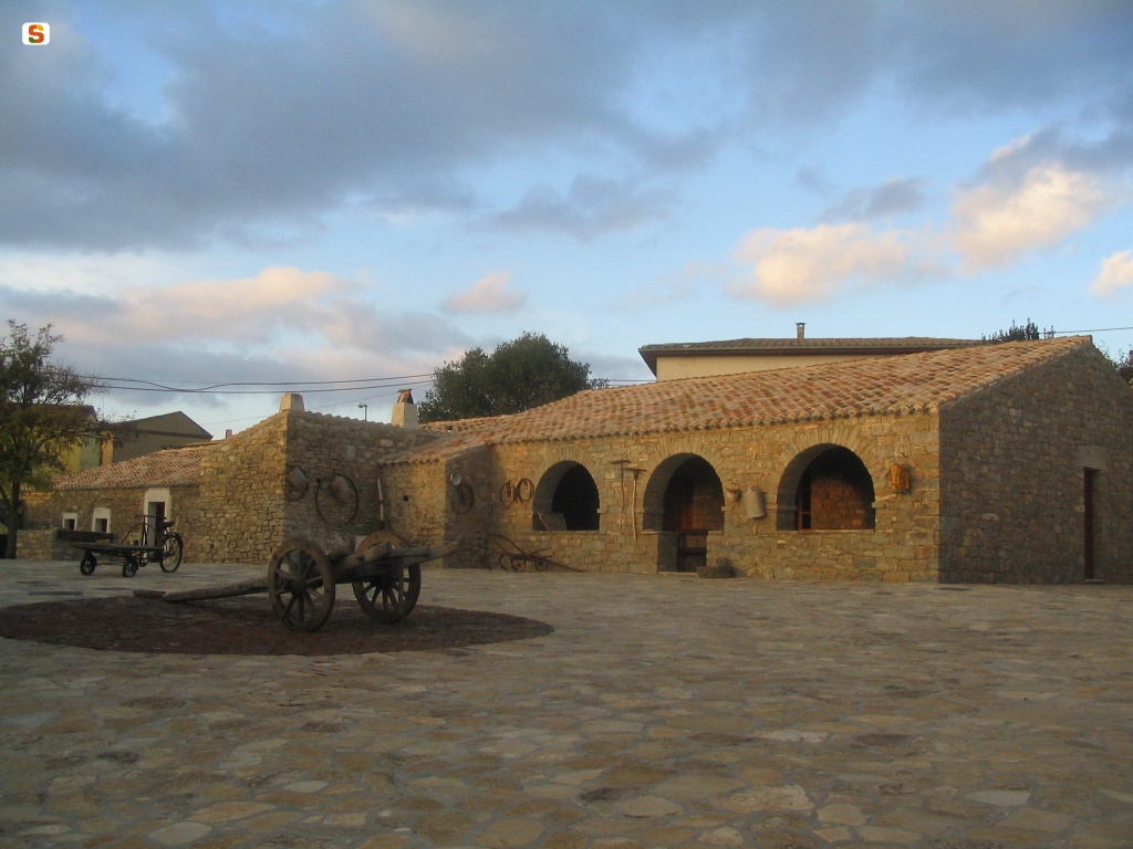
Is lollas de is aiaiusu
The vocation of Mandas is clear from the etymology of the place name, attributable to the Sardinian Mandara and Latin Mandra, or ‘livestock enclosure’, with the area having long been an important agricultural-pastoral hub. Not by chance was Trexenta, a borderland between Campidano and Barbagia, referred to as the ‘granary of Rome’. The wide and fertile valleys of Mandas, irrigated by numerous waterways, have been characterised over the centuries by the production of wine, oil and wheat. As a result, agropastoral life is also linked to traditions and habits that have been brought back to life in the ethnographic museum is Lollasa 'e is Aiaiusu, (‘the grandparents’ rooms’), a name that bears great significance. It arises in the centre of the village, in a manor house dating back to the end of the 18th century, reproducing the environments within traditional country houses thanks to the furnishings and objects from various daily activities - the loom room, the bedroom, sa lolla (entrance), the kitchen, the equipment room, the wine storage area and the oven room.
The exhibits are linked to the artisan tradition of weaving, basket-making, copper and wrought iron, still active in Mandas. There is also the production of famous cheeses, which can be appreciated at the end of July at the Sagra del Formaggio (cheese festival). The house-museum overlooks an external courtyard in which there is the church and convent of Sant’Antonio Abate, dating back to the 12th century, and a short stretch of Roman road (the Kalaris-Ulbia). The most important religious building is in the outskirts: inside the parish church of San Giacomo, built between 1585 and 1605 in Gothic-Catalan style, there are works by Spanish and local engravers: a set of wooden works with a Crucifix, Virgin Mary and St John, 17th-century multi-coloured statues and various 18th-century wooden altars. Amongst the civic buildings, not to be missed is the majestic 19th-century town hall.
The only town in Sardinia to have been elevated to the status of Duchy by a Spanish king (Philip III in 1614), for a long time Mandas was the junction of the railway that led from Cagliari to Mandrolisai and Ogliastra, today used as the tourist line of the Trenino Verde (Green Train), allowing visitors to follow in the footsteps of the English writer Lawrence, who described the itinerary set amongst cultivated hills, gorges, rocky walls and the north-eastern shore of Lago Mulargia. The territory was intensely inhabited in the Nuragic period. The greatest remnants are the Tomb of Giants of s'Arruina de su Procu and the su Angiu complex.