

Is Pruinis
Is Pruinis is found on the Island of Sant'Antioco in the municipality of the same name, and is reached by going along the road that leads to the beaches out of the town of Sant'Antioco. The island is the largest of the smaller islands in Sardinia and is connected to dry land over an isthmus probably built by the Carthaginians and improved upon by the Romans. Its coasts are jagged in the south, where cliffs are found, and it is sandier in the north. The two most important towns are Calasetta – having a well equipped marina - and Sant'Antioco, which has numerous facilities. The beach of Is Pruinis is very long and has coarse sand.
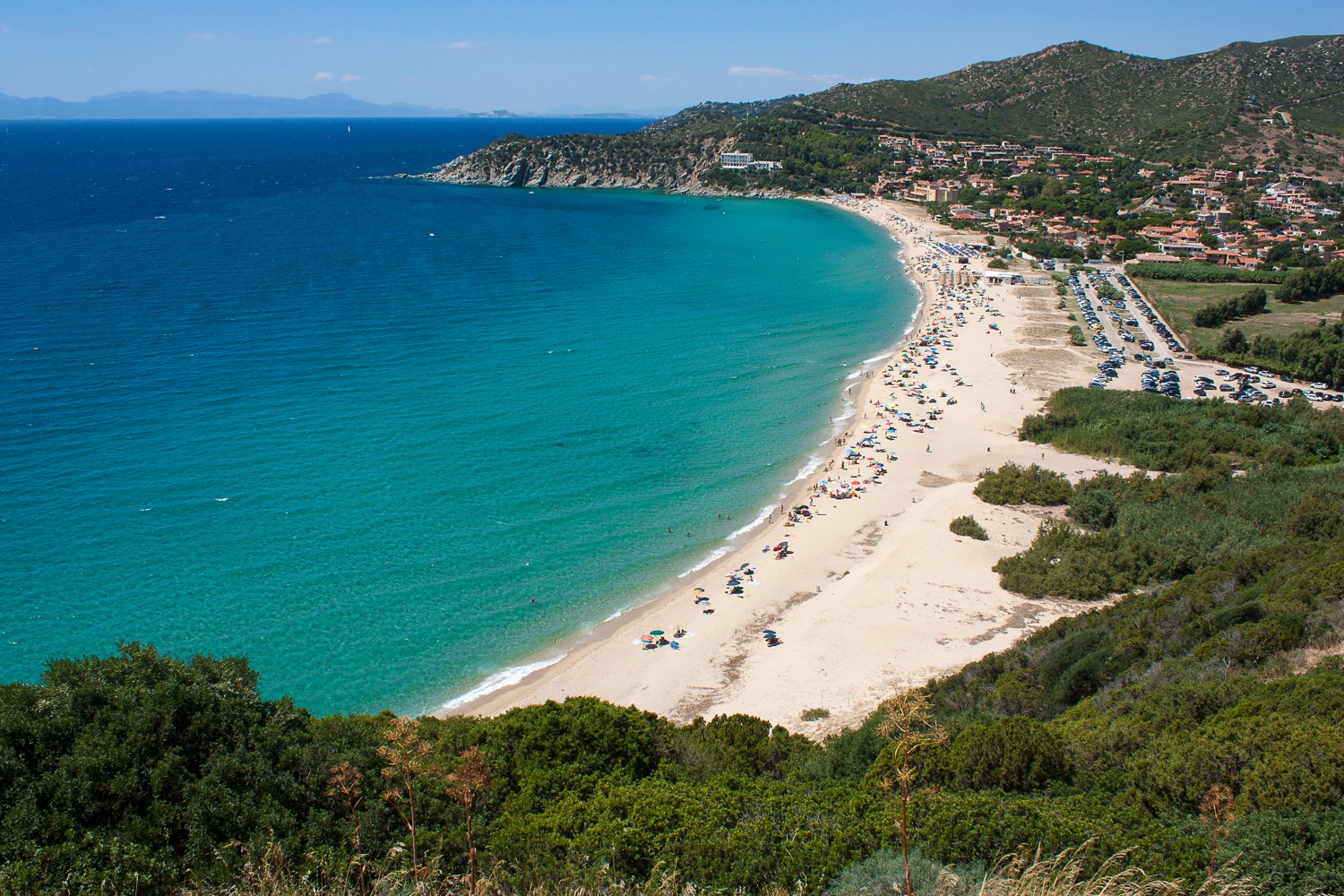
Solanas
About a kilometre of golden sand, between the promontory of Capo Boi, dominated by the Spanish tower of the same name, and a rocky peak covered in Mediterranean greenery. It is washed by a crystal clear, shimmering sea, reflecting shades of sky blue and emerald green. It is not a remote corner of paradise, but the beach of Solanas, a coastal district of the municipality of Sinnai. The village is a good 36 kilometres from the residential area and, in fact, it is an administrative area ‘overlooking’ the sea, in the eastern part of the Golfo degli Angeli. You can admire a large, spacious beach surrounded by captivating scenery, where the colours of the water and the vegetation covering the promontories on the edges of the beach stand out.
On the sandy stretch at the foot of Capo Boi, there is also a sand dune. The water is shallow by the shore and then quickly gets deeper and full of fish, which you can admire with a mask and snorkel. Thanks to the exposure to the wind, you can enjoy windsurfing and kitesurfing. You can also rent rubber dinghies and boats in order to observe the nearby stretches of coast, as well as exploring the depths, the little underwater caves and ravines, during exciting scuba diving: in fact, there is a scuba diving school in Solanas. Among the services available, there is a car park, refreshment areas and beach equipment rentals. In the village, you will find everything you need for a comfortable and relaxing holiday: accommodation facilities, supermarkets, chemist shops, bars and restaurants.
From the beach, you can get to the tower of Capo Boi via a trekking trail across the promontory, making your way through the Mediterranean scrub. From up there, at a height of 120 metres, you can enjoy a breathtaking view of the eastern part of the gulf. To your right, you can see the beach of Solanas all the way to its farthermost end and, on the left, on the opposite side of the promontory, the little coves of Pisanu and Sirena. Beyond, you will notice the western coast of Villasimius, Capo Carbonara and the island of Cavoli.
To the west of Solanas, there is another coastal enclave: that of Torre delle Stelle that, from an administrative point of view, belongs almost entirely to Maracalagonis. Here, you will find the beaches of Cann’e Sisa and Genn’e Mari, surrounded by greenery, with their white sand and a crystal clear sea. To the east, with the unusual ‘three-arched’ beach of Porto sa Ruxi, the spectacular coastline of Villasimius begins.
Fordongianus
It was once called Forum Traiani, when it was a main town in the island’s hinterland founded by the Romans during the Late Republic, when under Emperor Trajan it became a trading post between communities living inland and the Roman controlled populations of the gulf of Oristano. Today, Fordongianus is is home to less than a thousand people in the Barigadu region, famous for the thermal wellness spa constructed around hot mineral-water springs that have a constant temperature of 56°C all year round and provide a variety of health benefits. A detail the Romans were already aware of: the town sits on the left edge of the lush and fertile Tirso River Valley where warm Aquae Ypsitanae curative waters emerge from deep within the earth. The Roman baths here date to the first century CE and are now an archaeological attraction. Two establishments can be visited, one where a vaulted ceiling covered a rectangular pool with porticos along the sides and the other with a changing room. The floors were covered in mosaic tiles (you’ll see traces of them) and the ceiling was covered with a blue glass paste. Water flowed to it with great reliability via a network of canals, wells and cisterns. The importance of these baths is evident in the two statues of the god Bes, a divinity of health worship, and by a sacred area devoted to nymphs.
Fordongianus is also known for its red, green and grey trachyte quarries, the source of the stone used by the locals to build and decorate their houses. The XVII century casa aragonese is well preserved and was lived in until 1978. It is now a museum and a rare example of late-Gothic Sardinian architecture. Not far away is the XVI century church of San Pietro Aspostolo, made of red trachyte and rebuilt in modern times. A few kilometres out of town, near the thermal baths and the Roman amphitheatre, is the little church of San Lussorio, built by monks of the St. Victor order in the XII century over an early Christian crypt. The muristenes, once used as accommodations for pilgrims, are enchanting, especially when, during festivities in late August, they are enlivened by the faithful in prayer.
The area around Fordongianus is dotted with traces of prehistoric settlements: the stone domus de Janas di Domigheddas chambers and di Gularis necropoles carved into the rock in gorgeous natural settings, and the Paranu Antoni and Putzola nuraghes on the steep slopes of mounts Maiori and Ollastra, shaped into the most bizarre forms by centuries of the wind and rain. The most important Nuragic legacy near Fordongianus – at Villanova Truschedu – is the Santa Barbara nuraghe, with an original tower to which a second, smaller building connected by a walled-in passageway was later added. Just past San Lussorio is the area of Balargianus, made up of woods, vegetable gardens and vineyards. A climb to the top of monte Grighini, rich with quartz deposits, is a exciting outing. In its valley is the Casteddu Ecciu giara, with steep walls, home to the remains of a nuraghe and a castle, from which you can climb down to admire the monolith of su Crastu Ladu.
Bultei
The modern-day town centre was probably founded just before the year 1000, in an area where the town of Usulvì once stood, famous for a Camaldolese convent and destroyed in the early Middle Ages. Bultei is an old agricultural town with around 1000 inhabitants in the Goceano area, in the foothills of the Marghine mountain chain and on the border with the province of Nuoro. The area is mainly mountainous, and has traces of settlement dating back to the Neolithic, including several domus de Janas and other Bronze Age Nuraghic remains. The most interesting is the Tilariga Nuraghe, dating from the 15th to 11th century BC, which stands on a small hill above the town, formed of a central tower and a bastion with another three towers.
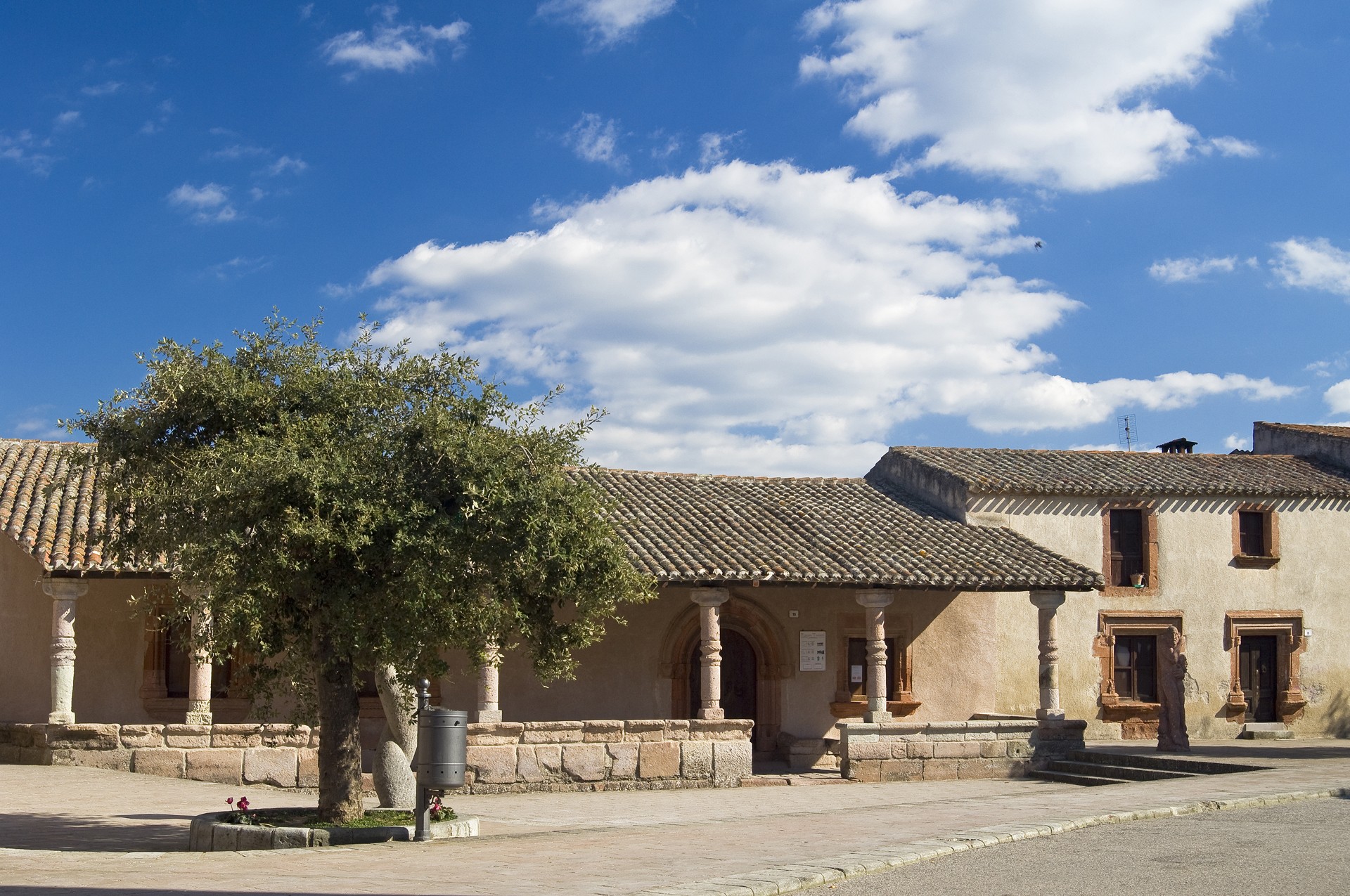
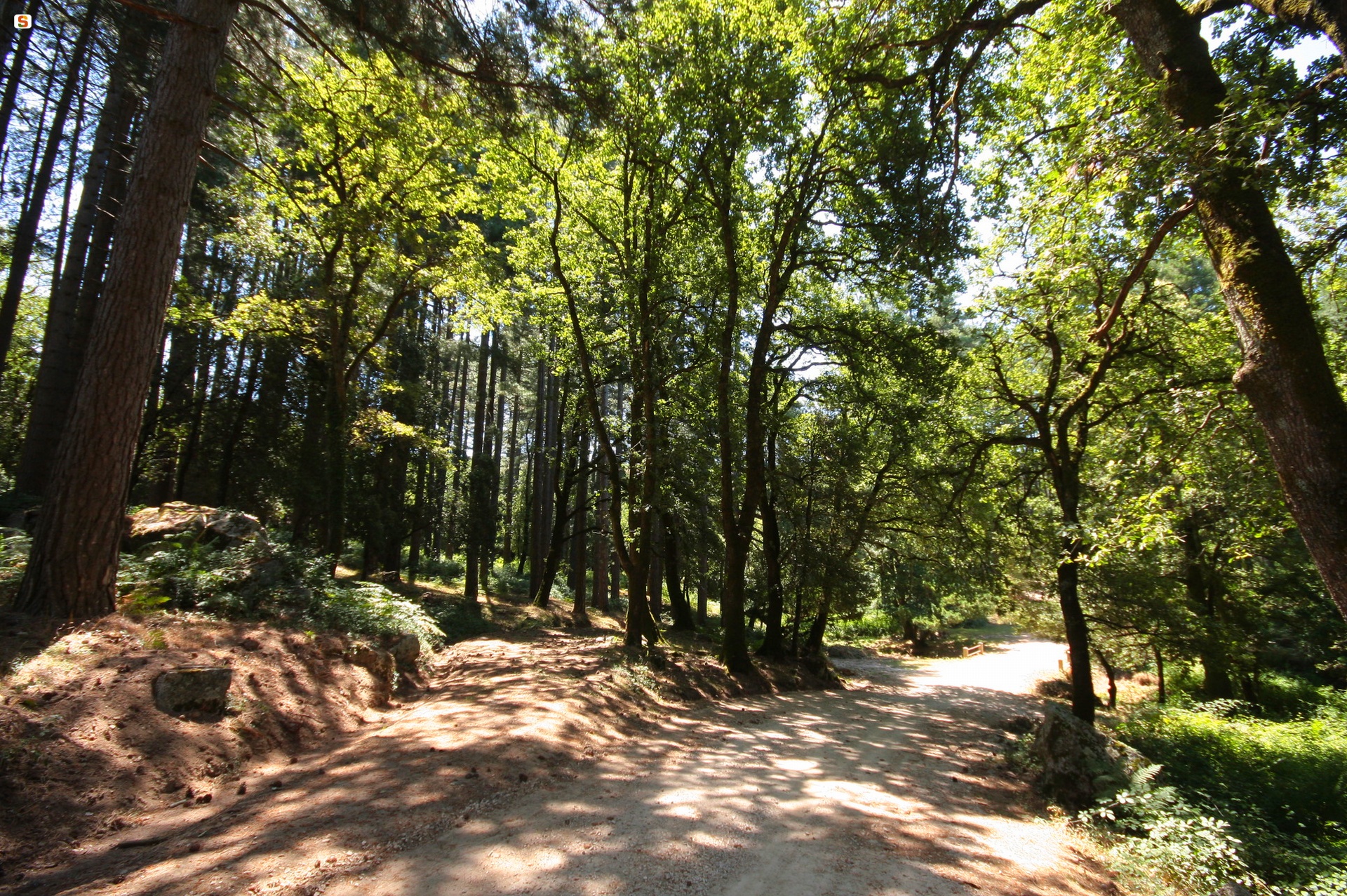
The town has a distinctive layout: the houses are set out in a horseshoe shape, set against the sides of the deep valley of the Rio Tortu, which flows into the River Tirso. There are numerous 19th century buildings in the town centre. Bultei's natural resource is the excellent quality cork worked by local craftsmen, while the town is surrounded by one of the few surviving original forests of northern Sardinia. Natural springs can be found amongst the holms, downy oaks and oaks: the Soletta and Spedrumele springs were the main source of water for the population up until the late 20th century. All the surroundings stand out for their greenery: Mount Paidorzu is a wooded area that can be reached by easy paths. The sa Fraigada building is located along the "peaks road" towards Pattada, surrounded by a yew forest; nearby is the Fiorentini forest, from which you can admire a splendid panorama over the surrounding valleys. Here, don't miss a visit to the small church dedicated to the Madonna di Fatima. Talking of rural sanctuaries, at su Campu, near Bultei but in the territory of Benetutti, you'll find the Church of San Saturnino di Usolvisi, in Romanesque style, dating back to the 12th century, donated to the Camaldolese monks by the Bishop of Castro, built with blocks of red trachyte on the foundations of a Nuraghe. Right by the church you'll find the renowned spa resort of San Saturnino, on the site of the Roman baths known as Aquae Lesitanae (from the ancient town of Lesa), which can still be visited today.

Torralba
Set among hills and valleys dotted with Nuragic Age remains, Torralba is a town in the Meilogu area of the old spent volcanic Logudoro region and boasts some thousand inhabitants. The first official mention of it was a citation of the villa in 1064-65. Known as Toralba or Turralba (from turris alba), it grew on a plain near a church called Santa Maria, of which nothing remains. Not far from that, in 1615, they built the Gothic-Renaissance church of San Pietro Apostolo, home to a wooden altar with statues of three saints, a baptismal font and a XVIII altar piece graced with paintings from the XVI century. The town’s streets are paved and embellished with stone benches and fountains. The bonfires of Sant’Antonio Abate are lit mid-January while the town’s main festival takes place with a characteristic procession on horseback on the Monday after Pentecost in the XVII century church of the Spirito Santo, three kilometres out of town. If you are there during these festivities you’ll get to taste the special breads (fresa and untinadu) and sweets (mantogadas, casalina and sa gozzula de s’ou). Don’t miss the church of Nostra Signora di Cabbu Abbas out in the countryside. It was constructed in Romanesque-Pisan style of limestone blocks outside and trachyte on the inside. In the timpani on the façade you’ll see an anthropomorphic sculpture that seems to depict a paleo-Christian deity. The sanctuary of San Lorenzo in Rebeccu is of the same period, while the necropolis of Sant’Andrea Piu, where you’ll see byzantine frescoes that once decorated a paleo-Christian church, is from the Middle Ages.
The many streams and brooks made the valley appealing for man to settle since Neolithic times, as proven by the domus de Janas of su Siddadu, santu Jorzi and Nughedu. The population grew in the Bronze Age and the concentration of the Nuragic remains has led it to be called the Valley of the Nuraghe. There are some thirty nuraghe, and ten Giant tombs in 37 km2 The most important of these is the Santu Antine, the largest complex after su Nuraxi in Barumini, built between the Middle Bronze Age and the Iron Age (XVI-IX century BC). An architectural gem made of massive blocks of shaped basalt, 17 metres high, a fortress-cum-castle that dominates the entire valley. The monument features a three-storey main tower (15m diameter) around which there is a triangular bastion with three towers. The remains of a 14-hut village that was lived in during Roman times can still be seen today. The most outstanding of these is the meeting hut, and another large hut in front of which bronze items were discovered, now on display at the Museum of the Nuraghe Valley in Torralba, which exhibits relics and artefacts found during digs in and around the valley, including an ethnographic section with crafts. Santu Antine is represented by a model and objects like founder’s tongs, part of a model of a nuraghe and a little bronze dog found there. Another section of the museum features items from Roman times and the Middle Ages: in the garden are mileposts from the III-IV century BC that reconstruct the layout of the territory.
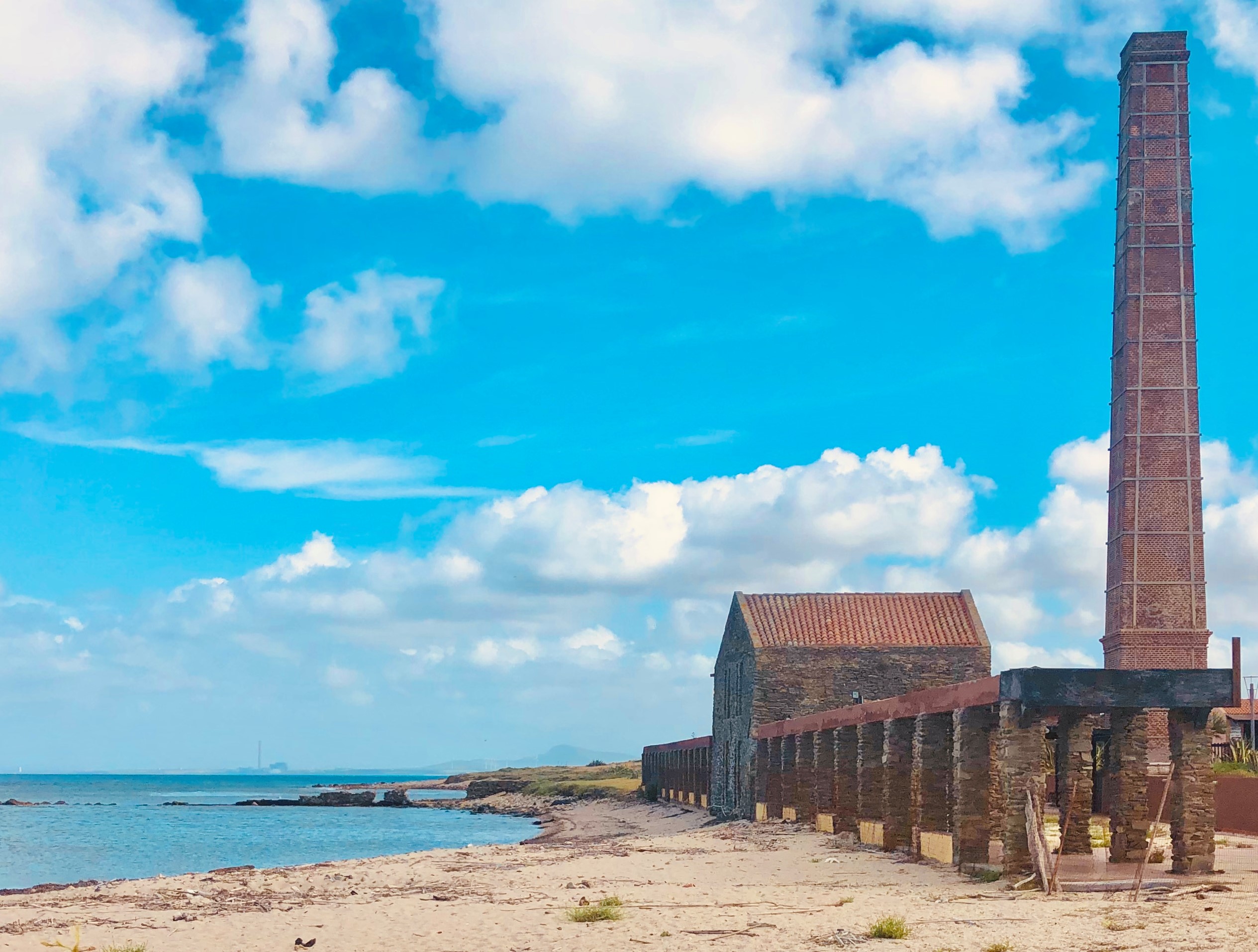
Tuna Trapnet Fishing Museum - Stintino
Sardinia is also a fishermen’s island. Above all, Stintino, a maritime village set in one of the most stunning landscapes in the northwestern part of the island, features not only one of the most beautiful beaches in Europe, La Pelosa, but also the classic wooden lateen sail ‘gozzi’ fishing boats. For decades, until after the advent of the ‘development of tourism’, starting in 1885, the year the village was founded by 45 families of Ligurian origin from the village of Cala d’Oliva on the island of Asinara, the life of its inhabitants was marked by fishing, particularly tuna fishing.
One of the rare historical Sardinian tuna fisheries has existed near the town for about a century, while inside the town, it is commemorated by the Tonnara (tuna fishery) Museum, not surprisingly named ‘Commemoration of the memory’. It was built in 1995 and its exterior is identical to one of the typical low houses in the village. When entering, however, you will feel as if you are diving into the deep blue sea of the Stintino coast. Its set-up revolves around a tuna fishery rebuilt to scale (one to 200), very similar to the ancient ones. In the six chambers, you can relive the frenetic and vain attempts of the fish to escape as they seek a way out through mesh in the long maze of nets. Inside the museum, you can retrace all the phases and the most intense moments of their capture and you can learn the history, anthropology and notions of the biology of tuna.
The story begins in the ‘great chamber’, where objects commonly used by the crew in the tuna fishery are on display. The tools are compared to those of other Italian and foreign regions. Inside, the historical ‘Tonnara Saline island’ has been accurately reproduced with a scale model. You can also admire models of the ‘barcarecci’ boats that made up the fleet. The second chamber is the ‘bordonarello’: your journey here will be a scientific and educational one based on the biology of tuna. A map shows the tuna routes in the Mediterranean while a special section allows you to learn the secrets used to preserve the tuna. When you get to the third chamber, the ‘bordonaro’, you can dive into the past by retracing the history of the tuna fisheries in the Gulf of Asinara, in particular that of the Saline in Stintino. Thanks to the fishermen’s diaries and historical documents, you can learn about the organisation of the tuna fishery in detail: the crew’s duties, at sea and on land, and the role of the rais, the fishing master. Going deeper into the ‘museum network’ you will come to the ‘bastardo’ chamber, where copies of ancient documents and images are on display. The second to last chamber is the ‘camera di ponente’ (western chamber), set up with period photographs and works by contemporary artists. The excursus ends in the ‘camera della morte’ (death chamber). Careful scenography, consisting of images, lights and sounds, will project you into the atmosphere of the ‘mattanza’ (tuna slaughter). On a screen, there are vintage and modern films on the ‘final act’ of the fishing. To appreciate all the aspects, a visit to the museum is particularly recommended in July, combined with the delights of the tuna festival.

Nostra Signora d'Itria - Orani
The Church of Byzantium ‘evangelised’ Sardinia for six centuries, leaving a profound mark. Today, the veneration of saints typical of Greek Orthodox tradition still remains. In Orani, in the Nuoro area, you will find significant traces of it: Santu Nicolau, name of a place in the countryside, the rural sanctuary of Sant’Elias, where the people of OranI flock to today, like in Antiquity, with processions of horsemen in festive dress and the banner of the saint and, above all, there is the church of the Madonna d'Itria.
Built in the 17th century, it gives its name to one of the town’s districts and was part of a system of places of worship positioned as a border between the town and the countryside. The architecture is inspired by Gothic-Catalan motifs: the single nave has pointed arches made of trachyte. You will be captivated by the cross vault, which is frescoed with scenes of angel musicians. Also remarkable is the central niche of the altar, where you can see the wooden statue of the Virgin of Itria with the Child in her arms and wearing damask robes.
However, the element that makes Sa Itria truly original is the façade: you can admire an engraving by Costantino Nivola (1958), depicting the Battle of Lepanto in 1571, in which Catholics and Muslims fought against each other. It is commemorated as the victory of Christianity over the infidels. The great Sardinian artist portrayed two human figures that, based on the symbols engraved, symbolise religious belonging. Nivola’s work is complemented by the colour blue: a stripe at the bottom that brings to mind the sea during the naval battle and one at the top, virtually uniting it with the sky that protected the Christian fleet. The work is so well-integrated with the architecture that it is difficult to think of the façade without the engraving.
The veneration of the Madonna of Sa Itria is widespread throughout Sardinia and culminates in Orani on the last Sunday of August with religious functions and a pagan festival. The same devotion is also felt in Gavoi (at the end of July): novenas with the worshippers staying in the sanctuary’s cumbessias, lunches based on roasts, libations, chants and equestrian jousts. The palio de Sa Itria is one of the most exciting and famous on the Island.
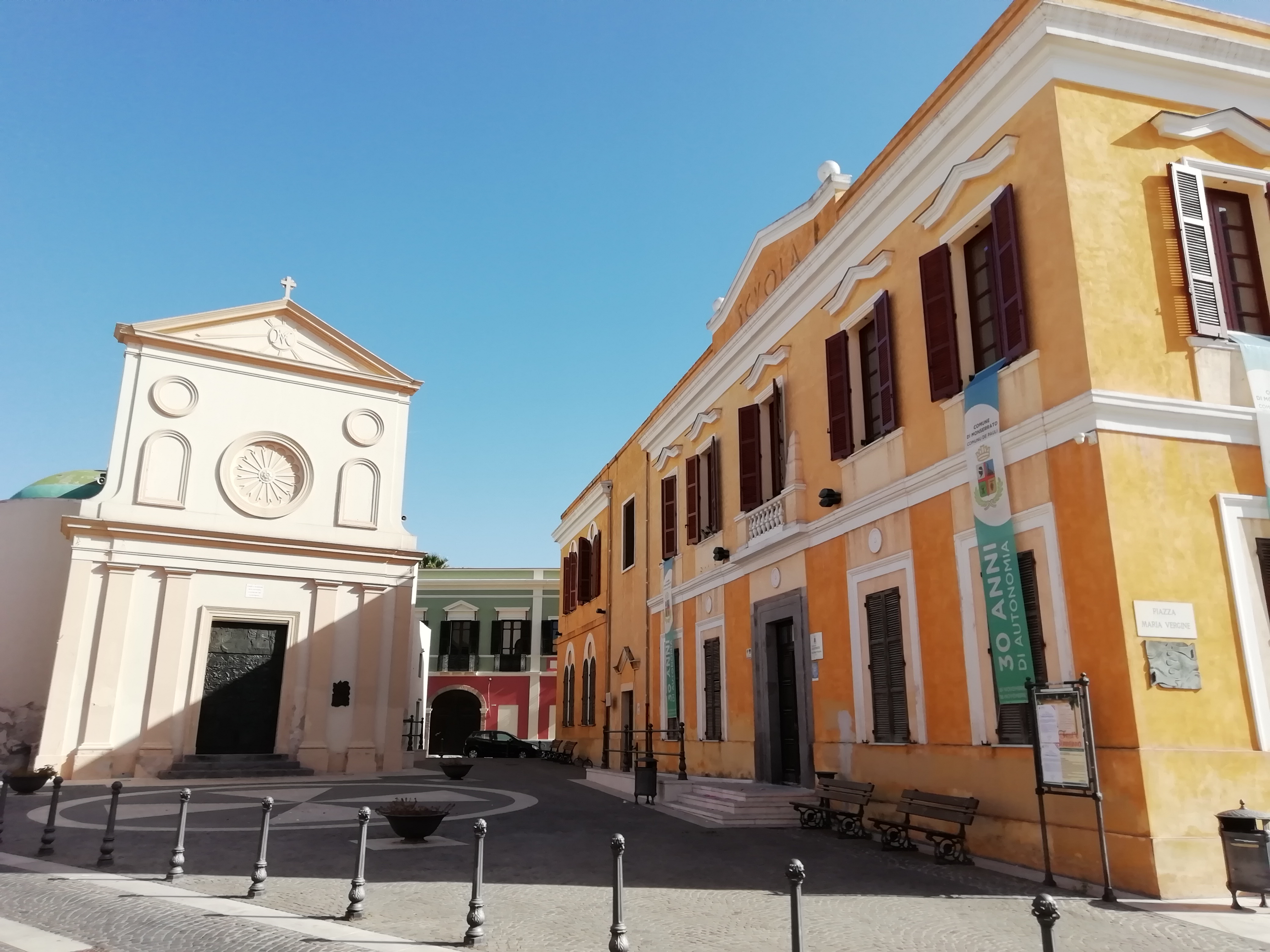
Sant'Ambrogio - Monserrato
Its origins can be found in two sources, one from 1654, in which construction had not yet begun, and the other from 1716, in which the building of two side walls was commissioned. It was in this period of time that the Church of Sant’Ambrogio was built in Pauli Pirri, a village that, in 1881, took on its current name of Monserrato. Today, its outline characterises the historic centre of the little town, on the outskirts of Cagliari, where Saint Ambrose is the patron saint, celebrated on 7 December. The architectural style is Gothic-Catalan, but when you observe the façade you will notice several unusual elements: an original double sloping roof and the battlements that decorate the lateral buttresses placed diagonally with respect to the main building. Above the portal, there is a pointed arch with an eyebrow element and an oculus, characteristic elements of Gothic architecture. The bell tower stands to the left of the entrance and was rebuilt in the late 19th century after the collapse of the original structure.
Inside, there is a single-nave layout with a barrel vault, onto which six side chapels open up through pointed arches, with dividing walls that were opened in recent times, creating the effect of side naves. In the chapel of the presbytery, you will see a star-shaped cross vault, with five distinctive hanging gems. On the sides of the triumphal arch, two niches contain the statues of Saint Ambrose and Saint Jospeh. Since the mid-19th century, the church hall has contained a marble pulpit and the high altar in multicoloured marble and gilded wood, sculpted in bas-relief style. You will notice another distinctive feature on the corbel to the right of the triumphal arch, where the symbol of the Sanjust family, who owned the fiefdom of Villa Pauli since 1426, is engraved.
500 metres from the church, you will find a small marble cross, placed on a column dating back to the Roman era. The monument, built in the 16th century and known as sa cruxi ‘e marmuri, bears an image of Christ. As well as marking the territorial limit of the Church’s jurisdiction, the point where the cross stands also indicates the place where executions took place. Then, a short distance from the parish church, walking through the narrow streets of the historic centre, you will see the imposing wooden portals of the Campidano houses, built in ladiri – bricks made of mud and straw – and tuff and characterised by the lollas, large loggias that surrounded the central courtyard.
Monserrato has a great wine-making tradition: its winemaking cooperative is the oldest in Sardinia and fine wines such as Nuragus, Monica, Moscato and Nasco are produced there. It is no coincidence that one of the most eagerly-awaited events is the grape harvest festival in September.
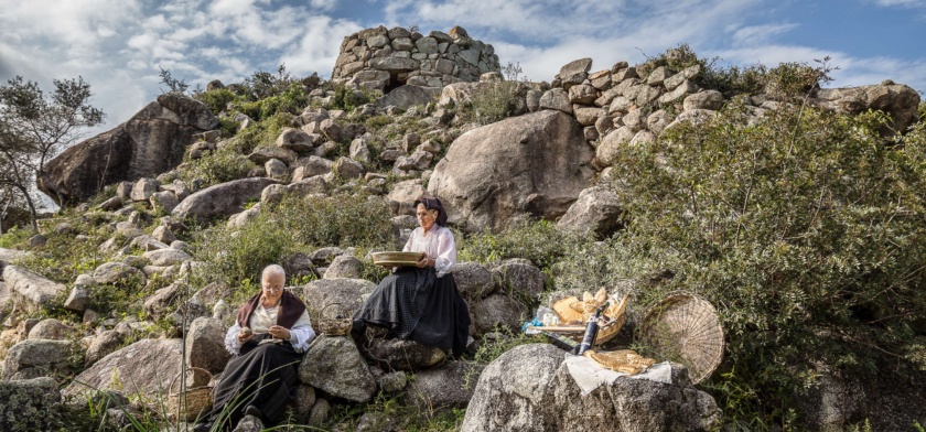
Archaeological Park of Scerì
It is one of the most interesting examples of the talent of Nuragic Age architects to exploit natural elements for the construction of their buildings. The Scerì complex sits in a strategic position perched on the top of a granite tower, partially surrounded by a river, in the Ilbono area. Once inside this archaeological park, you’ll find a nuraghe, a village and two domus de Janas (in Sardinian, a House of the Fairies).
The largest building is a nuraghe, a complex version with an added wing, all built out of medium-sized squared granite blocks. The remains of the main tower, of which just under five metres still stands, is circular. The entrance features a well-hewn architrave and leads to a rectangular antechamber that once led to an inner room. Another architrave entrance, this one trapezoidal, is found at the northern end and leads to a curved corridor, at the end of which is the adjacent building. You will note two niches along the corridor, one on either side, and on the right, you’ll see another opening that leads to a second corridor which is, however, blocked with rubble. Under the tower you’ll find several natural cavities integrated with stretches of wall. At a lower level there was a counter wall with an entrance on the eastern side, it too integrated with rocky outcrops in several places.
Adjacent to the nuraghe was a large village of huts, used both for living and working, where materials were found that allowed the site’s Nuragic phase to be dated to between the Middle and Recent Bronze Ages (15th to 12th centuries BCE). West of the complex you’ll come across two domus de Janas, both single-celled, carved into two large boulders during the Middle Neolithic (4th millennium BCE). The first one has an entrance preceded by a small pavilion. It features a small, oval room. The second was damaged when the front of the boulder near the entrance collapsed, but you can still admire the precision of the sanding on the walls and floor.
The area of Ilbono is home to numerous historical landmarks: at least a dozen nuraghe, most with a single tower, and a variety of Giants’ tombs. Less than nine kilometres separate the town from another famous Nuragic complex in the Lanusei area. Nestled in a fairy-tale landscape on a meadow at an altitude of 1,000 metres, lies the Seleni Woods Archaeological Park. Surrounded by oak, chestnut and poplar trees you will visit a nuraghe, a village of some 200 huts, two Giants’ tombs and two sacred springs.
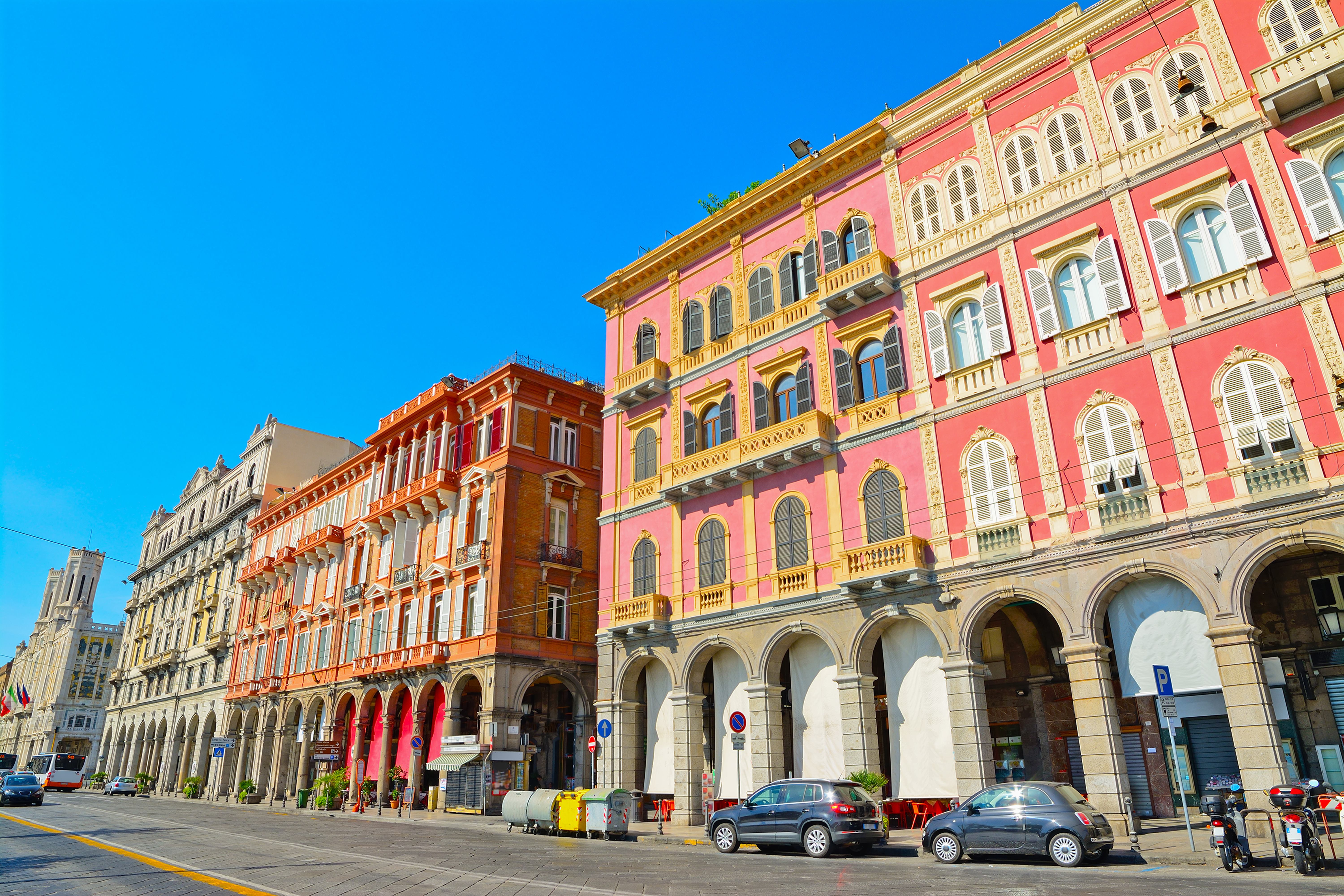
Palazzata in via Roma
For more than a century, it has been one of the symbols of ‘modern-day’ Cagliari, a varied and elegant mixture of colours and architectural styles overlooking the porticoes of Via Roma, which have become a destination for walks and shopping for tourists and residents, accompanied by the scent of the sea breeze. The seafront of the historic Marina district is characterised by a series of buildings constructed from the end of the 19th century, mainly in Art Nouveau style, with neo-Gothic and Renaissance additions. Before then, enclosed between the bastions of the church of Sant’Agostino, at the junction with the present-day Largo Carlo Felice, and the Dock, where the present-day Viale Regina Margherita starts, there were modest two-story homes, in which shops and trattorias were often opened on the ground floor. There were also facilities for leather tanning, while other huts, ‘specialised’ in the sale of fish, occupied the space adjacent to the pier. These were demolished for the construction of the port, starting in 1881, and a few years later a series of buildings started to appear, which you can admire today in all their splendour.
In reality, they were added to the pre-existing Palazzo Devoto, built in 1870 and next to the late seventeenth-century church of San Francesco da Paola. The first were the Magnini Palaces, on the two corners between Via Roma and Via Baylle. Later, Palazzo Vivanet was built and was the first example of neo-Gothic architecture in the city, with a series of porticoes with pointed arcades; Palazzo Garzia, between Via Napoli and Via Barcellona, and Palazzo Leone-Manca, which contained the Olympia Cinema until recently. Beyond the church, Palazzo Vascellari-Beretta and Palazzo Ravenna were built, between which there is the modern building in which the Regional Council of Sardinia is located. The stretch facing Piazza Matteotti is dominated by the Palazzo Civico (Town Hall). It was inaugurated in 1907 and represents the choice, with a strong ideological nature, of the municipal administration in office at the time, led by Ottone Bacaredda, to move the centre of the city’s power from the ‘aristocratic’ Castello district to the Marina district. The building is made of white limestone, with Art Nouveau decorations and references to Gothic-Catalan models: you will particularly be drawn to the two octagonal turrets and the four obelisks in the corners.
Marina is a district to explore, losing yourself along its narrow little streets, looking around the shops and tasting the town’s traditional dishes at the numerous restaurants and taverns. In the ‘heart’ of the district, stands the Parish Church of Sant’Eulalia. In its basement, you can visit the archaeological area and the monumental crypt. Next to the church, you’ll find the Treasure Museum, containing a vast artistic heritage from the adjacent sanctuary and the churches of Santa Lucia and the Holy Sepulchre, as well as the documents from the parish archive and the archconfraternities of the Crucifix and the Holy Trinity.