
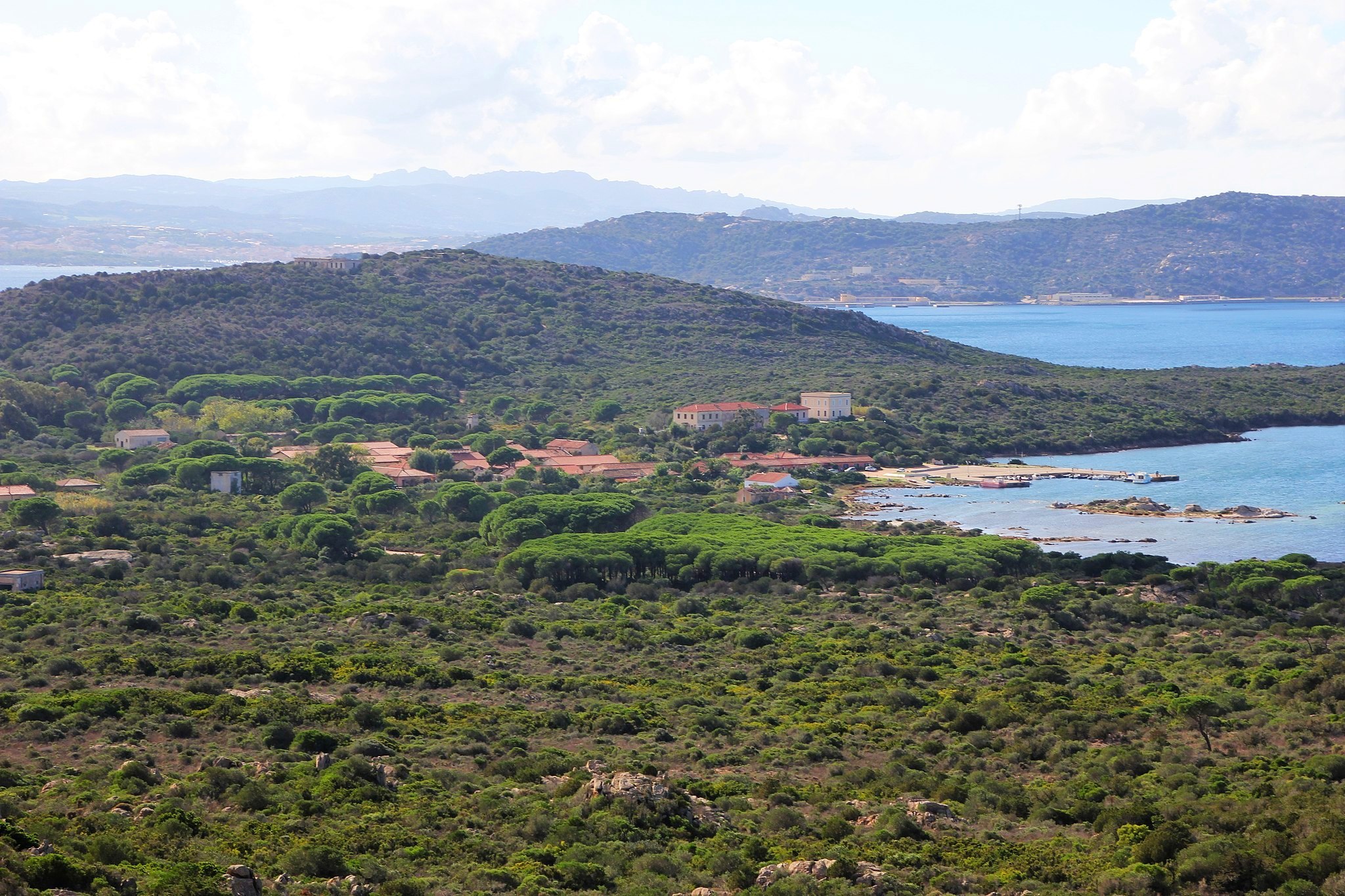
Stagnali
Once a strategic military outpost, today it is an environmental centre and the symbol of the link between the past and the future, with views over the turquoise hues of the sea. The town of Stagnali looks out over the beach of the same name on the south-western side of Caprera, the second largest island of the Maddalena archipelago. Its origins date to the early 20th century, when the then Ministry of War built a garrison with barracks, storerooms, offices and stalls there. The complex, known as the ‘baraccamenti militari’, was home to the 3rd Company of the Bersaglieri Battalion. Its task was to defend the archipelago against enemy landings on the numerous beaches of the island. Stagnali is no longer a military outpost and now enjoys a new and varied existence: it is the island’s only in habited town and home to several structures belonging to the National Park of the Maddalena Archipelago, which includes an environmental education centre run by the park.
Stagnali is home to the Museum of the Sea and Maritime Traditions, the mineralogy-naturalistic museum and a dolphin research centre. The first one tells the story of the archipelago’s inhabitants and their relationship with the sea. At the mineralogy museum you’ll learn all about the rocks that make up the archipelago and the various types of sand that make up the beaches, as well as seeing a variety of fossils. There is even a section displaying meteorite fragments from some of the most famous impact locations in the world. The dolphin research centre monitors and works to safeguard the cetaceans that live in the surrounding waters, as well as organising excursions for visitors to see them first hand in their habitat.
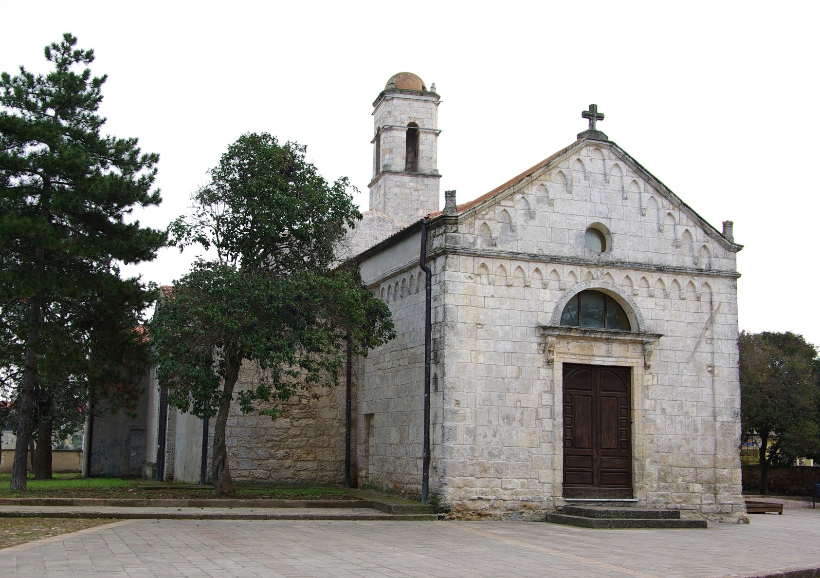
In town, you can visit the little church dedicated to the Madonna della Pace. Once a military warehouse, a chapel was put in there in the mid-20th century. Abandoned for many years, the building was completely renovated and the church was inaugurated in 1998. Inside you’ll see frescoes and an altar made of granite ashlars. The town has a little harbour with a masonry pier built at the time the military was establishing itself there, but it is now used by both boaters and fishermen. A small beach lies next to the landing place, with golden medium-large grained sand and clear turquoise water dotted with rocky outcrops.
The village is a great starting point to go explore the attractions Caprera has to offer. As you head south-east, you will cross over an isthmus, graced on both sides by the Due Mari beaches. Further east is Relitto Beach where the wreck of a motorised sailboat lies on the beach facing a sea blessed with emerald reflections. Caprera is famous above all as the home of the Hero of the Two Worlds, Giuseppe Garibaldi. You can retrace his fascinating history and legendary exploits visiting the Garibaldi Compendium, and then proceed to enjoy the beaches on the northern side: Cala Serena, Cala Napoletana and the so-called Tahiti of Sardinia, Cala Coticcio.
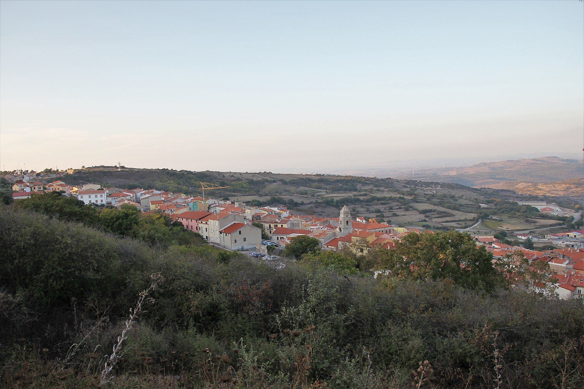
Villanova Monteleone
Federico Fellini set some scenes of ‘Bible’ in one of his valleys, by the Temo spring. Although rising to 600 metres in height and located 16 kilometres from the sea, Villanova Monteleone has the peculiarity of having the Lake Temo nearby and to administering a long stretch of coast with ‘pearls’ like the beach of Poglina, expanses of light and impalpable sand that plunge into the turquoise sea, alongside the Chiesa della Speranza. The village, populated by 2,300 inhabitants, is located in the hinterland of Alghero, between Planargia di Bosa and Logudoro Turritano. From the road connecting it to Alghero, called the Scala Piccada, once the location of a hillclimbing rally, views over the Riviera del Corallo can be admired.
The village is renowned for its textile art (carpets and curtains) and the weaving of baskets. In the centre, in the 19th-century Palatu ‘e Sas Iscolas, there is the ethnographic museum Sa Domo Manna. Alongside is the 16th-century parish church of San Leonardo da Limoges (whose patron saint is honoured on 11th June) in Gothic-Aragonese style, later rebuilt in Neo-Gothic forms in 1789. It safeguards two 18th-century wooden altars. Other places of worship in the village are the 17th-century Church of the Madonna del Rosario and the Oratorio di Santa Croce (16th century). Three kilometres from the town, set amongst centuries-old trees, stands the shrine of Nostra Signora di Interriors, erected in the 16th century. The façade was modified in the 18th century, whilst the bell tower rests on an arched portico, where there were once the cumbessias. Festivals are held here in honour of the Nativity of the Virgin (8th September) and of St. John the Baptist at the end of August, a celebration linked to the origins of Villanova Monteleone. The village, founded in Su Zentosu by inhabitants of Monteleone Rocca Doria, was invaded by the Barbarys in 1582. The survivors moved to a more inland area (Santa Maria), where they rebuilt the village, whilst those who were captured were saved by the army of Marquis Boyl of Putifigari. At the beginning of summer, the Anglo-Arab Sardinian horse exhibition-market is held. Then comes the Sagra della Pecora (sheep festival) at the beginning of August.
Within the territory, rich in springs, arises Mount Minerva, a spectacular bastion with a flat summit, deriving from an extinct volcano and today covered by a forest. On its slopes rises a testament to prehistoric times: a burial ground with eight Domus de Janas. The greatest Neolithic heritage (starting from 3500 BC), however, is the necropolis of Puttu Codinu, consisting of nine funerary hypogea with an entry corridor, anticella, funerary chamber and lateral chambers. Bull horns have been carved into the walls, being a symbol of prolificity, alongside decorations that reproduce the roofing of the huts. Tombs VIII and IX stand out. In the cork and holm oak woods of Monte Cuccu an archaeological park emerges, containing a complex from the Iron Age (900-800 BC), formed by the trilobed Nuraghe Appiu with a village of about two hundred huts, another single-tower Nuraghe and a Tomb of Giants with two Dolmens. Nearby, there is also a megalithic circle and a Megaron temple. Other not-to-be-missed buildings are the Tomb of Giants of Laccaneddu and the Nuraghes on Monte Luna and Monte Sa Rughe.
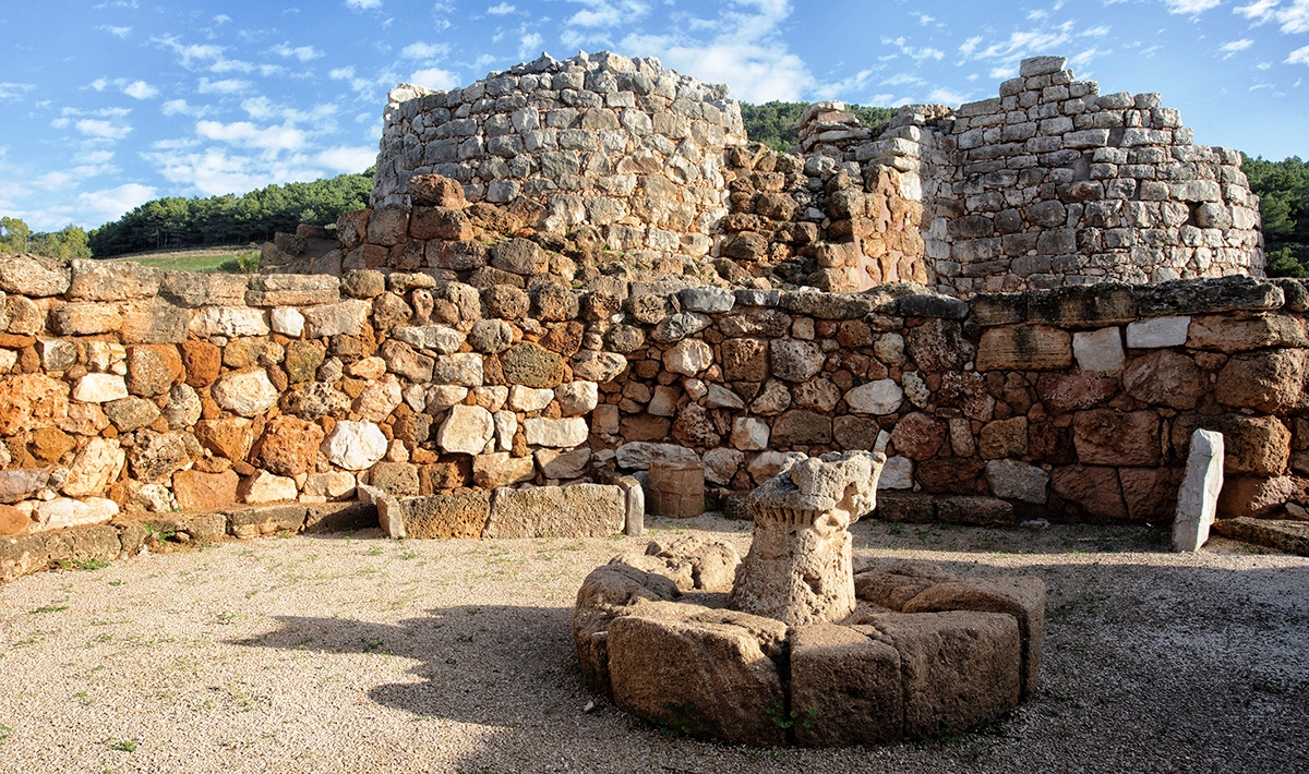
Nuraghe Palmavera
The architecture of their construction testifies to the extraordinary skills of the fascinating and mysterious Nuragic civilisation. The Palmavera complex is located on the promontory of the same name, one and a half kilometre from the sea, within the Porto Conte Park, in the province of Alghero. Built with blocks of limestone and sand, consisting of a central body with two towers and a bulwark, plus the huts of a village: today there are less than 50, but experts estimate that number to have ranged between 150 and 200 when the village was inhabited.
The village was built in several phases. The first phase (15th-14th centuries BC) included the main tower, eight metres high and with a diameter of ten metres, inside which there is a large central chamber with beehive roofs. A flight of stairs led to the upper level and a terrace. Later (9th century BC), another tower was added, connected to the first by means of a patio and a corridor. The large meeting hut was built in the same period. Inside it stands the chief’s round seat. Among the various decoration items found in the dwelling there was a small model of Nuraghe, a pre-historical art item typical of other Sardinian complexes (as many as 16 were found at Mont’e Prama). Today, inside Palmavera you can admire a copy of the model, while the original is held at the G.A. Sanna Museum, in Sassari. During the third construction phase (9th-8th century BC), a perimeter wall was built, with four towers. The village was later destroyed by a fire and repopulated during the Punic and Roman era.
Around Palmavera there is a track you can face on your mountain bike to go on a journey through time. In the Porto Conte bay – Portus Nympharum for the Romans – you can visit another Nuragic site: Sant’Imbenia (15th-8th century BC), the oldest Phoenician maritime stop on the island, where trade was done with the East. It remained in the core of commercial routes for Phoenicians, Etruscans and Greeks up to the 7th century. Not too far are the remains of a Roman villa, built for the otium – leisure – of the owner, with estates all around it. It consists of decorated rooms and service areas. To the north are the remains of a thermal bath area.

Ossi
Sitting at an elevation of over 300 metres, it is immersed in a landscape where hills and green valleys alternate with white rocky cliffs. Ossi is a town of almost six thousand inhabitants in Coros, the north-west section of Logudoro, not far from Sassari. It has maintained its original Logudorese Sardinian language and ancient traditions intact through time. Many legends exist about its birth: in early Medieval period, it was a village of houses arranged around a Romanesque church. After the Malaspina family, and the Giudicati of Torres and Arborea, the town passed into the hands of the Crown of Aragon. Although its feudal masters alternated over the centuries, daily life in the village, which was dictated by work in the fields, changed little. Today the fields of this fertile territory washed by Riu Badde, Riu Pizzinnu and cool springs are mostly occupied by olive groves and vineyards.
At the beginning of the 17th century, in the centre of town, the Parish of San Bartolomeo was built. It has one nave with a barrel vault and houses priceless wooden statues (dated to sometime between the 16th and 19th centuries). It is honoured with a celebration at the end of August, the town’s most popular celebration with a procession in traditional dress. The town also contains the churches of Santa Croce and Santa Vittoria. The latter was built in the 12th century and reworked in the 14th and 17th centuries. Their celebrations are in mid-September and mid-May, respectively. The 17th century Baronial Palace, which may have originally belonged to the Guyò family, is the town’s most valuable building. It houses the Ethnographic Museum. The museum layout leads through every day, rural spaces and environments, with exhibitions of tools for farming and ancient crafts. In the countryside, the churches of Nostra Signora di Silvaru (12th century) and the Romanesque Church of Sant’Antonio, built using limestone near the Punic-Roman sites and the Necropolis of Mesu ‘e Montes are worth a visit. The most important archaeological site in Ossi, the necropolis was used from Late Neolithic to Middle Bronze ages. It was excavated into a rock ridge located ten kilometres from the town and includes 18 multi-chambered Domus de Janas. Of particular note, tombs I and II with 12 chambers each, decorated with a variety of features, a ceiling reproducing a gabled roof and a circular hearth sculpted into the floor; and tombs III, IV and XVI, all of architectural interest, with a curved stele in the centre of the exedra. The necropolises of Noeddale, in the outskirts, are contemporaneous, or almost, to Mesu ‘e Montes. Here the tombs of Casa’, another example of a multi-chambered Domus de Janas (with 11 rooms), of s’Isterridolzu and of Littos longos catch the eye. The Necropolis of s’Adde ‘e Asile and the megalithic tomb of Ena ‘e Muros slightly predate the Nuragic period, to which about a dozen intact towers (and many collapsed) and the village of Sa Mandra ‘e Sa Giua (where a lot of artefacts were unearthed) have been attributed.

San Saturnino di Usolvisi
It stands isolated on a small hill near the banks of the Tirso river and was built on the remains of a trefoil nuraghe, presumably in the mid-12th century, six kilometres from Bultei, the territory in which it is located, and six from Benetutti: the parishes of both Goceano villages claim ecclesiastical jurisdiction over it to the diocese of Ozieri. The church of San Saturnino owes its fame to its simple Romanesque architectural forms and also to the landscape and the archaeological value of the site where it stands. The first news of the sanctuary of Sancti Saturnini de Usolvisi dates back to 1163, the year in which it was donated to the Camaldolese monks - who had also built the stupendous Basilica of Santissima Trinità di Saccargia - by Attone, bishop of Castra. An early Christian inscription on stone, found in 1957, refers to the Byzantine age, suggesting the antiquity of the sacred place, the spiritual centre of a small village (that later disappeared) of Usolvisi, which developed continuously as a settlement along with the nearby Roman baths of Aquae Lesitanae. On the plain of San Saturnino, eight springs of thermo-mineral water with beneficial and curative properties have been counted and are partly exploited by the present-day thermal establishments. In addition to the ruins of the nuraghe, recent excavations on the plain have also unearthed pre-Nuragic remains and Roman ruins.
The perfect wall surface of the small building was made using perfectly-squared trachyte ashlars. Their reddish colour gives the monument an unusual appearance, accentuated by its slightly elevated position. The use of local red stone and the art in the placing of the blocks are clear signs of the ‘hand’ of Tuscan workers, perhaps the same ones who worked in the nearby Nostra Signora di Mesumundu at Anela, also donated to the Camaldolese by Bishop Attone. The corners of the linear Romanesque façade are reinforced by sturdy corner pilasters. In the centre, there is the architraved portal with a stilted arch and the same pattern is repeated in the side portal. Three single-lancet windows, two rounded arches on the sides and one in the curve of the apse light up the single nave, which is also made from slabs of volcanic stone from local quarries and covered by wooden trusses. A bell gable, which may have originally been on the façade, is now at the back of the building, above the apse.
In the church ‘contested’ between the parishes of Benetutti and Bultei, a mass is celebrated to honour the saint on 30 October. Regarding the dispute, which started between the end of the 19th and the beginning of the 20th century, in 1870 the historian Giovanni Spano already spoke about “a village called Bulterina with a parish church called San Saturnino”. It all began with the death of a parish priest in Bultei who, while on his way to celebrate mass in the church, lost his life wading across the Tirso river. After that, the key to the church was handed over to the parish priest of Benetutti, on the other side of the river, to safeguard the parish priests of Bultei and allow it to be opened safely. Since then, the keys have remained in Benetutti, without any episcopal act either then or now.

Telti
It is immersed in an evocative landscape between wind-shaped granite masses and imposing forests of holm and cork oaks, wild olives and Mediterranean shrubs. Telti is a typical hill town of Gallura, populated by over 2000 inhabitants – in part scattered in the surrounding countryside – who make their living mainly through farming and shepherding. Local companies specializing in fresh pasta and granite, iron and wood products are currently experiencing a strong growth. Telti has been an autonomous municipality since 1963, when it broke off from Tempio Pausania. Its name derives from Tertium, which was a Roman military station on the fork in the Olbia-Gemellae road. In the Medieval Period, it became Villa Torcis, a village involved in a long war in the 14th century between the Crown of Aragon and the Giudicato of Arborea. The modern town is of recent construction. Starting in the 18th century, with encouragements from the Pope, the various nearby stazzi (typical rural settlements) congregated around the two churches (at the time in the countryside): the Church of Sant’Anatolia (18th century) and the Church of Santa Vittoria, completed in 1899 in 18th century style, today located in the heart of the town. Both once served as religious centres for residents of nearby towns, who reunited there for worship. In the small historical centre, visitors can admire the unusual-coloured granite used in construction and various murals. Not far from the town centre, stands the Cultural and Natural Museum of Sardinia, which records the local community life, traditional domestic spaces, animals, plants and minerals. In the direction of Calangianus, stands the 17th century country Church of San Bachisio, who is honoured in May with a community lunch. The local rituals of the Holy Week and processions in traditional dress for the feast days of saints Anatolia and Vittoria are particularly fascinating.
The area is rich in springs and streams, which has resulted in particularly thick and thriving vegetation. The highest peak, Mount Pinu, tops off at 750 metres and is covered by a vast maritime pine forest. The discovery of burials in naturally produced cavities in granitic formations confirm human presence in the area since the Neolithic (5000-2700 BC). Some Domus de Janas, small artificial chambers excavated in the rock, have been dated to the following Copper Age. The area was densely populated in the Bronze Age: Nuragic, Ilienses and Balares cultures have built a series of nuraghes such as Putzolu, an elliptical nuraghe with three chambers and a corridor located in a town of the same name, and La Prexona di Siana, an originally three-lobed nuraghe with a keep linked to three more towers arranged in a triangle, located in Aratena. Various Punic coins confirm the probable existence of the village between the 9th and 3rd century BC.

Domus de Maria
A vastness of breath-taking natural beauty, from the beaches of Chia to the green mountains leading to the sea. The territory of Domus de Maria is characterised by a long stretch of coastline with sand dunes dotted with centuries-old junipers, imposing granite peaks with lush forests and hills covered with Mediterranean scrub releasing fragrant essences and vibrant colours. Built in the 18th century, the village today counts 1,700 inhabitants. The village and the coast come to life each year during the food fairs (dedicated to goat, wild boar, figs and fish) and local festivals. At the beginning of October, the patron saint of the Madonna del Rosario is celebrated, whilst for Pentecost there is a five-day event with a poetry competition in the Campidanese dialect and a procession of the Holy Trinity, accompanied by floats and knights in traditional costume.
The coast of the Chia village is seven kilometres long and a true stretch of paradise. The Torre di Chia grants access to a long sandy expanse interspersed with small headlands and lapped by the emerald green sea. To the west, cross the beaches of Sa Tuerra, Porto Campana, De Su Sali up to the Su Giudeu - the most beautiful of all and often chosen as the setting for TV commercials. Behind is the Stagno di Spartivento, home to many rare species. In front of the beach, a small island can be spied, accessible thanks to the shallow waters. In a sheltered inlet of the western extremity is Cala Cipolla. From here, the Capo Spartivento lighthouse can be reached, offering views of the Sulcis coast. The entire stretch of coast offers every comfort, rendering it a dream holiday destination. Take a dive not only in the sea, but also into the archaeology, where Chia now stands, the Phoenician-Punic (then Roman) town of Bithia once flourished. Amongst the ruins unearthed, the remains of a Tophet, a children’s cemetery, the road that led to the ancient city of Nora, and the necropolis, where one also stood the temple of the god Bes, whose statue is preserved at the National Archaeological Museum of Cagliari.
Another Domus marvel consists in the woods of holm oak, conifers and Mediterranean scrubland of Is Cannoneris, an oasis for hikers. The green expanse stretches beyond the horizon, crossed by a road and hiking trails. The forest is a wildlife oasis with specimens of Sardinian deer and fallow deer, with the flight of a golden eagle and a peregrine falcon a delightful surprise overhead. The landscape attractions are endless - particular rocky forms, sheer cliff faces, waterways, ancient trees and rare plant species such as enormous broom. Is Cannoneris is embellished with remnants of prehistoric civilisations, including the necropolis of Montessu and the sacred well of Val Tattino, along with the entire territory of Domus, as evidenced by the Muraghe Baccu Idda. Industrial archaeology is also a protagonist, with various abandoned mines.
Karales - The Roman Cagliari
A parallel city exists inside modern-day Cagliari, partially set into the urban weave and entirely visible, and partially hidden from sight. Cagliari’s thousands of years of history is a constant journey of discovery, to be studied, to be admired. Karales was one of the most important – if not the most important – Roman city of Sardinia. Set in a strategic position, it was an essential stop on the Mediterranean Sea and a flourishing city of commerce during Rome’s Imperial Age. Its original Phoenician name was Karalis, bearing witness to the town of vicus Karalis built adjacent to the pre-existing Punic city just after the Roman conquest of Sardinia in 238 BCE. In the 2nd century BCE, its name changed from the singular (Karalis) to the plural (Karales) indicating that the two cities had become one single urban centre. The city’s architecture then underwent further change partly due to Roman emperor Octavian’s statute, the municipium Julium civium Romanorum (38 BCE). During Rome’s Imperial Age, it enjoyed a tremendous burst of urban development with the construction of public buildings and private residences.
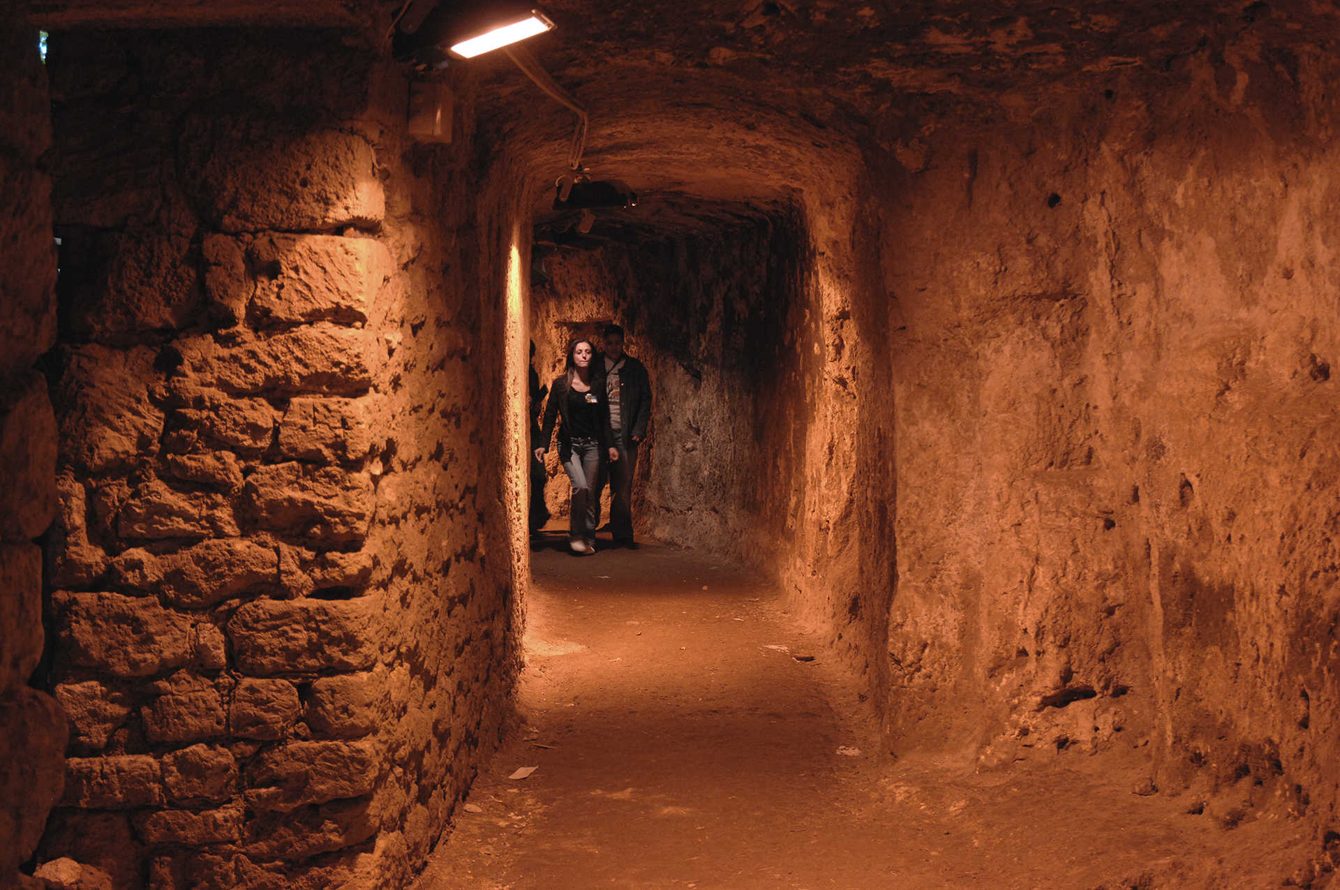
Thanks to documents and archaeological finds, historians and archaeologists have been able to recreate a map of the ancient city. The old city centre is the modern-day Castello and Stampace districts. What is now Piazza del Carmine used to be the old Forum, surrounded by temples and thermal baths. The most spacious 2nd century BCE baths have been discovered on Largo Carlo Felice and on Viale Trieste. Along what is now Via Malta, a temple-theatre from the Late Republican Age has come to light. Patrician homes were built nearby, on today’s Corso Vittorio Emanuele and the Sant’Avendrace district, as well as in the area where, some centuries later, the Basilica of San Saturnino was erected. The commercial hub and public housing were located near the port, now known as the Marina. The necropolis, where the Phoenicians had also buried their dead, were outside of the city limits on the hills of Tuvixeddu and Bonaria, where other patrician homes were also located. An aqueduct brought water into the city from Siliqua. The most celebrated and eye-catching remains span the southern slope of Buoncammino hill, the Roman Amphitheatre. After centuries of neglect and its repurposing as a quarry, it has now regained its role as public theatre. Six hundred metres separate it from a residential complex known as villa di Tigellio, a poet and cantor from the Augustinian period. The residence is actually the union of three domus: the “house of plaster,” so named for the rich plaster embellishments that decorated its walls; the “house of the painted panel”, graced with the remains of a mosaic floor; and, finally, the remains of what was once a thermal building. Another highly visible Roman landmark is the grotta della Vipera, so called for the serpents carved into the sides of its façade. It is a funereal monument built between the 1st and 2nd centuries CE by the exiled Lucio Cassio Filippo in memory of his wife, Atilia Pomptilla. Legend has it that she offered her life to the gods in exchange for healing her gravely ill husband. The sacrifice worked. The façade of the tomb had a pediment with a tympanum and two columns, although today only a capital remains. Inside, there are two burial chambers and a pronaos, in which the story of the couple is inscribed in Greek and Latin on a wall. No less interesting are the city’s 'hidden' traces, sometimes located in the basements of churches and modern buildings. The parochial church of Sant’Eulalia sits over a stretch of paved road, the remains of complex buildings and of a temple. A fullonica (a workshop for washing and dying cloth) graced with a mosaic floor emerges in the basement of a palazzo on Viale Regina Margherita. You’ll see cisterns and storage areas in the crypt of Santa Restituita and at the top of the Sella del Diavolo, or Devil’s Saddle. And, finally, some of the cavities at the orto dei cappuccini, once a quarry for the extraction of the limestone used in the construction of the amphitheatre, were repurposed as cisterns and, later, in all probability, as jail cells.
Santa Croce - Usini
Its origins are thousands of years old, with multiple construction phases. It has four names and it is not clear when it was built, despite being mentioned in an ancient document. There are numerous elements that make the church of Santa Croce di Usini unusual, starting with the names that have followed one another: in ancient times it was Santa Maria d’Usine, then it was known locally as Madonna de s’Ena Frisca, or of the ‘cool spring’, due to the presence of a spring nearby, and also as Santa Maria del Cimitero (of the Cemetery), as it was built in the area where the ancient burial place of Usini was located. Lastly, in the 19th century it got its current name from the brotherhood that took over its regency.
The building stands along the road that leads to the village centre, coming from Sassari, a particularly busy route. To be precise, the church is located just over halfway along the route that separated Sassari’s monastery of San Pietro di Silki and the Abbey of Nostra Signora di Paulis, now in ruins, in the territory of Ittiri. The title was mentioned in the condaghe of San Pietro di Silki: the reference to a ‘Church of Santa Maria’ would mean that it dates back to the first decades of the 12th century. Others, however, tend to place it between the 13th and 14th centuries. Of the original Romanesque structure, with a single nave and built in limestone, you can admire the façade and part of the sides decorated with a cornice and small pointed arches. The cornice continues on the façade, delimiting the pediment. The small arches appear here too, under the pediment and - with an elongated shape - under the slopes. The transept and windows date back to a second construction phase, while the bell tower, sacristy and a series of chapels were added later. The apse has a quadrangular shape, with a barrel vault. Inside, you will see Baroque-style multicoloured wooden altars and an unusual window to the right of the main altar, decorated with trilobate arches typical of the Gothic-Catalan style.
You can continue the tour of the architectural beauty of Usini with the Parish Church of Santa Maria Bambina, a ‘treasure chest’ of precious furnishings, the nineteenth-century homes of Casa Diaz and Casa Derosas and, eight kilometres from the village, the medieval church of San Giorgio di Oliastreto. The prehistoric evidence is no less interesting: the Domus de Janas necropolis of s’Elighe Entosu also called ‘of the seven rooms’ - dates back to the Recent Neolithic period, where Tomb 5 stands out, decorated with architectural details imitating a pre-Nuragic hut. In the area, renowned for the production of Cagnulari and Vermentino wines, you will also find nuraghi and traces of the Roman era.

Cala Spalmatore
The deep inlet of Cala Spalmatore, in the northeastern part of the island of La Maddalena, is well-known, and has been for centuries, to the fishermen who landed in the bay to ‘coat’ their boats with pitch and it is one of the major attractions of an archipelago and national park. A long pier that stands out in the centre of the cove is a reminder of the fishermen’s work. Today, protected from the elements, it is still a privileged and safe mooring place for numerous boats of various sizes.
At the end of the long fjord, reflecting the various colours of the water, there is a small beach - 70 metres long and 25 metres wide - one of the busiest on the island and equipped with all bathing and refreshment services. The sand is grainy with a pinkish tinge and yellow and black streaks, the result of mica and quartz. The sandy seabed slopes gently away from the shore and is suitable for both families and snorkellers. Behind the beach, you will find a small pond, the habitat of a large variety of animal species. The surrounding area is dominated by Mediterranean scrub.
The landscape is embellished with pink granite rocks and the Guardia del Turco lookout post. From the high ground, you can admire the entire surface of La Maddalena on one side and, on the opposite side, Caprera, which you can get to from an artificial isthmus a short distance from Spalmatore. From here, you can also set off to discover the entire Maddalena coastline, made up of cliffs, inlets and little coves. Following the road that runs alongside the island, you’ll find dunes of fine white sand on the beaches of Bassa Trinita, Cala Lunga and Monti d’a Rena. On the west coast, you can admire the small granitic bays of Cala Francese and, to the south, the brilliant colours of Punta Tegge and the enchanting Nido d’Aquila. Continuing along the Padule seafront to the east, you will enter the residential area of La Maddalena from the small port of Cala Gavetta: don’t miss a chance to visit the historic centre and the city museums.