

The authentic luxury of Sardinia
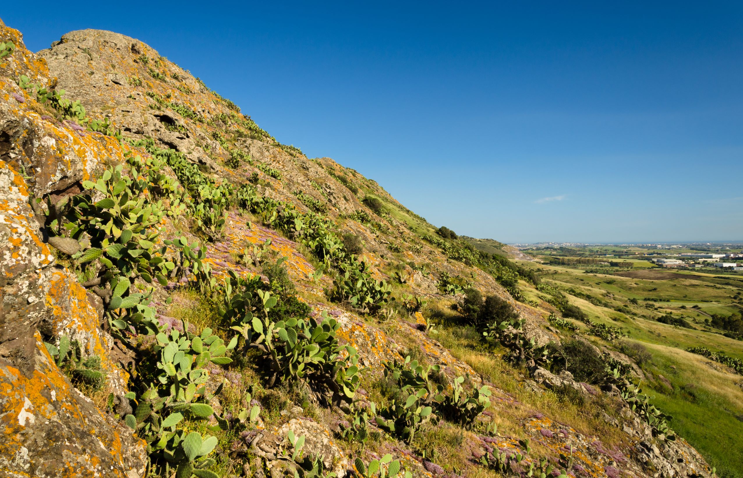
As soon as you set foot in Sardinia, your senses reawaken: dazzling light, infinite shades of blue and green, African multicolour sunsets, night skies with an oriental flavour and the wild scent of the earth and the briny sea air that pervade the island. Your gaze will be magnetically attracted by the happy outcome of a tormented and interminable geological life that left a legacy of ancient rocky mountains and lunar landscapes alternating with intricate woods and natural monuments, surrounded by a coastline so captivating that it looks like it has been catapulted here from other worlds. A generous island of positive energy, all to be captured.
Pantaleo
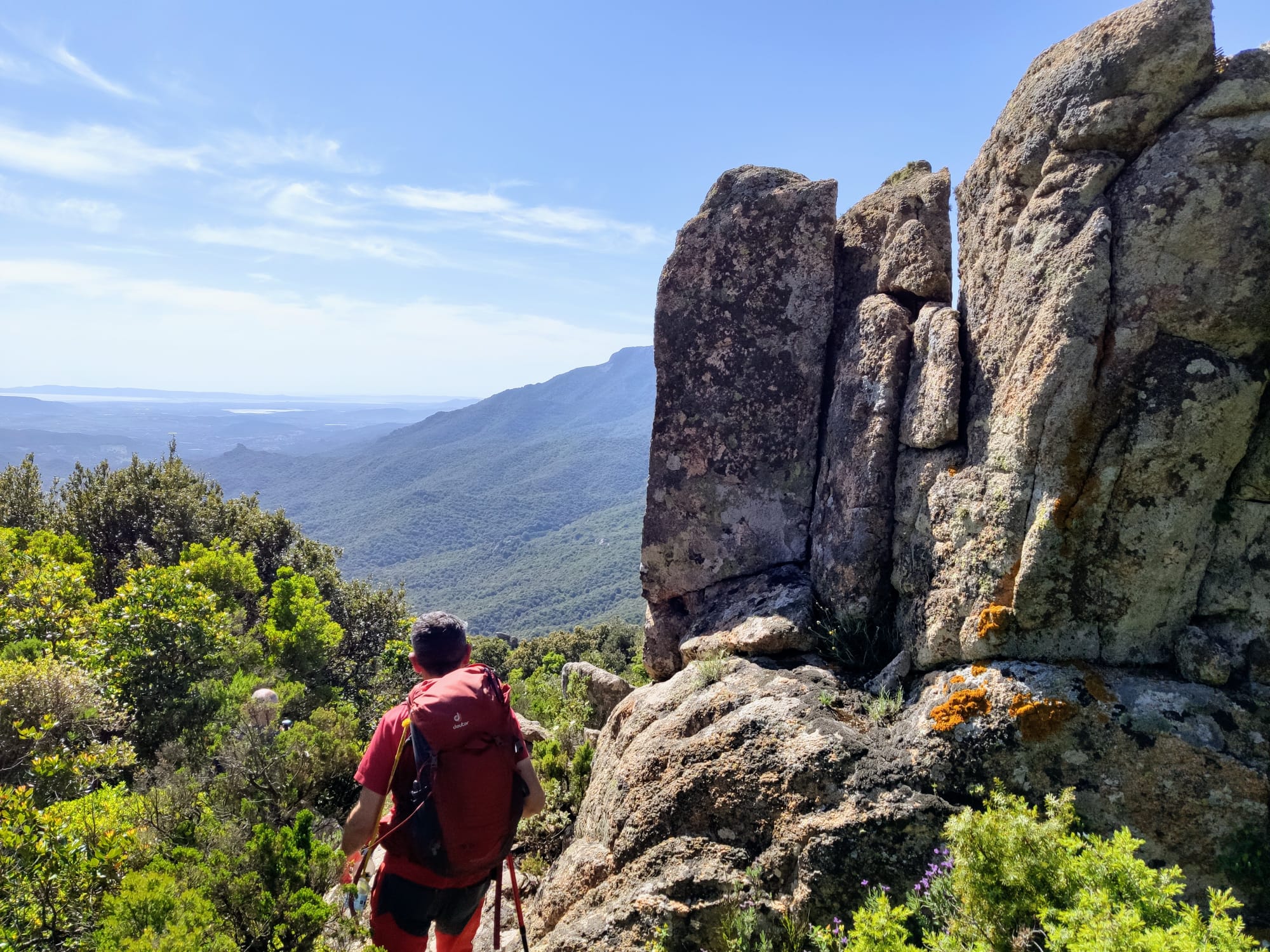
More than a forest, it is a true natural treasure: a third of its surface is a wildlife protection oasis, containing the most extensive holm oak forest in the world and the largest eucalyptus tree in Sardinia, and it is also home to an unusual ‘hybrid’ plant species. The state-owned forest of Pantaleo stretches for approximately 4200 hectares in the territories of Santadi and Nuxis and is part of the Regional Nature Park of Gutturu Mannu. Among the tree varieties, the holm oak is dominant, but you can also admire cork oaks, yews, hollies, Mount Etna brooms and examples of elder and Montpellier maple trees. Curious holm oak-cork oak hybrid trees have also developed and can be seen along the paths marked out for excursions. In spring, you can also admire colourful peonies.
The forest ‘rests’ on rocks that have various origins from all eras, starting from the Palaeozoic period. Much of it extends between granite formations, which you can see in pinkish coloured spikes, while there is limestone in the western part. The wildlife is equally interesting: Pantaleo is one of the habitats of the Sardinian deer and it also hosts colonies of fallow deer and weasels, while wild cats, martens and foxes find refuge there. Sardinian hares - at risk of extinction until a few decades ago - are bred in a wildlife centre, with around 200 specimens, and the centre can also be visited via an educational path. The birds of the forest are mainly migratory and various birds of prey, including the golden eagle, goshawk, peregrine falcon and sparrowhawk, nest here.
In the locality of is Figueras a resting place awaits you, equipped with tables, with streams flowing around it and hiking paths branching off. Walking along them, you will be able to see the tallest eucalyptus tree on the Island, which is 27 metres high and has a diameter of more than five metres, as well as traces of the activities of charcoal production and distillation of wood, which started at the beginning of the 20th century and continued until 1981. The charcoal produced in the forest was transported via railway, the route of which can still be seen, loaded on ships at Porto Botte heading to the French ports.
Pantaleo is nestled in a natural area of inestimable value, as it is adjacent to the state-owned forests of Pixinamanna, is Cannoneris, Monti Nieddu, Gutturu Mannu and Tamara Piriccu. In all, the complex stretches over 22 thousand hectares of greenery. In these oases, you can admire a huge patrimony of plant life and wildlife, as well as archaeological sites and traces of mining activity. If you then want to learn more about some species, you can move further north to the Oasis of Monte Arcosu, the largest WWF reserve in Italy: it is ‘inhabited’ by about a thousand Sardinian deer.

Nivola & Sciola, sculptors of Mother Earth
The silent poetry of Sardinian stones speaks in their works, from the prehistoric stones the nuraghi, the domus de Janas, the Tombs of Giants and the holy springs to those of the ancient rocks, witnesses of timeless geological eras and powerful cataclysms. It didn’t take much for Costantino Nivola and Pinuccio Sciola to capture the soul of their Land and the cosmic and material energy imprisoned within it. They have revealed all this in their sculptural works, with extraordinary sensitivity and an ability to summarise cubist, surrealist and primitive artistic tendencies.
Anchored in the seas of Sardinia
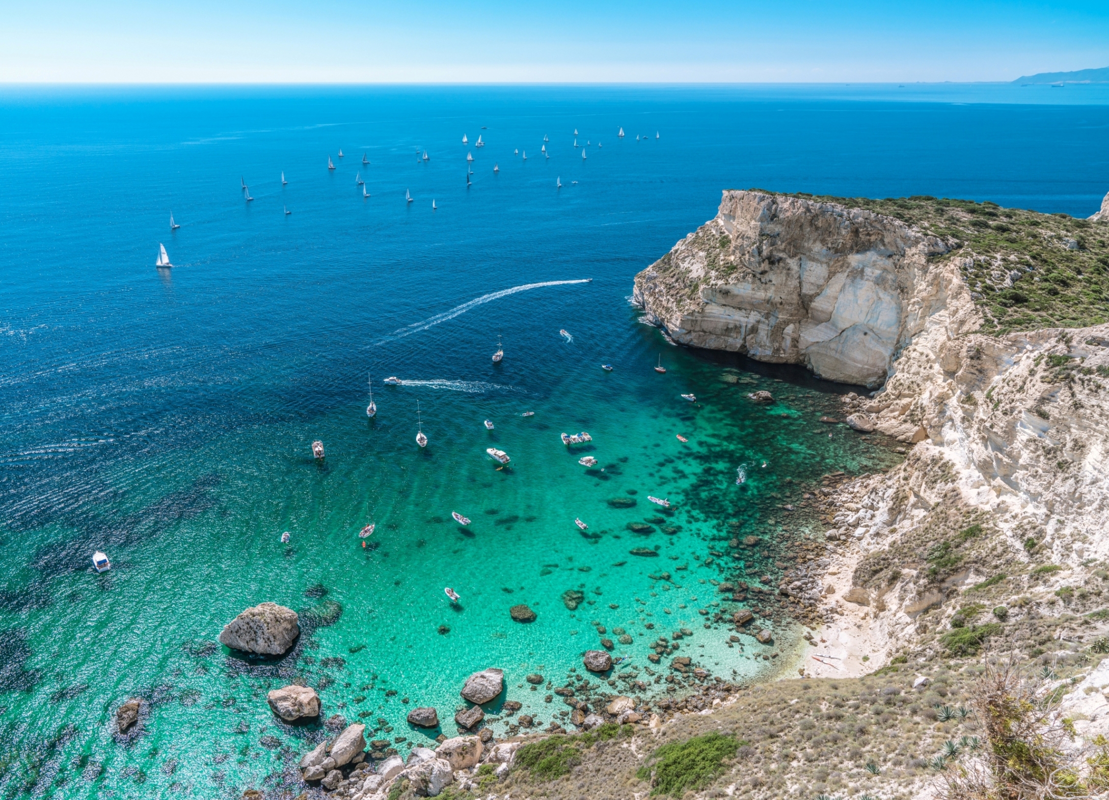
You can reach the most secret and isolated stretches of coast on a sailing boat, as well as hidden coves to be discovered amid the fjords, enchanting reefs and cliffs, to admire while zigzagging coast to coast, not to mention little archipelago groups surrounded by underwater life to explore by snorkelling, sand dunes and Caribbean beaches that can be reached by swimming or by canoe. Days on a sailing boat are spent between strips of Eden, memorable settings for unforgettable sunsets. It is a green, sensory, exciting and fantastic way to experience the Sardinian sea, chosen by boaters as a paradise of beauty, where boredom is banned.

Nuraghe San Marco
It is one of the most interesting examples of a Nuragic fortress ‘repeatedly lived in’ by the civilisations that followed one another over thousands of years. The nuraghe San Marco stands on the eastern outskirts of Genuri, on the slopes of the southwestern side of the Jara Manna, the largest and most famous giara. The basalt used for the construction of the monument comes from the plateau, which was also a ‘source’ of sustenance and resources for the peoples who inhabited the Marmilla region, while marl was used for the restoration work that took place in later phases. The building has a complex structure, consisting of a keep and three towers, and it is surrounded by a rampart with another five towers, except on the north side, perhaps because the builders considered the natural ‘protection’ of the Giara plateau sufficient.
Curiously, the south-east tower has a smaller diameter than the other two, while the wall to the north-east, which follows the profile of the central tower, has sometimes been interpreted as the wall of a fourth corner tower. In the space between the keep and the connecting curtain walls between the towers there is a sickle-shaped courtyard, which you can access through the entrance to the structure on the southern side. From the courtyard, which also has a well, you can enter the keep and the corridors that lead to the side towers. Inside the keep, the room is a cross-shaped space, with two frontal niches and a third opposite the stairwell. In the north-west tower, you will notice six embrasures, two niches and the absence of an entrance corridor. In fact, it opens directly onto the courtyard.
Archaeological investigations have led to the discovery that between the Recent and Final Bronze Age a destructive event took place, with relative collapses and subsequent reconstructions: San Marco probably witnessed a phase - still a mystery - of crisis and conflict between the Nuragic tribes between the 2nd and 1st millennium BC. The site has revealed traces of human presence in the Punic era and there was undoubtedly also a settlement there between the Late Roman and Early Medieval eras. At least eleven ‘new’ rooms were superimposed or placed on the nuraghe, some of which are thought to have been food storage rooms, while the courtyard and towers were used for various purposes, sometimes even for burials.
The nuraghe gets its name from a small country sanctuary, a few dozen metres away and surrounded by a park with centuries-old olive trees. The church of San Marco was probably built in the 16th century with a single nave layout. On 25 April, a celebration takes place there, that is particularly heartfelt by the population of Genuri, during which the countryside around the village is blessed and the saint is invoked in the hope of a good harvest.
Temple of Malchittu
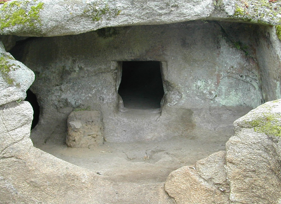
Some consider this temple an anachronistic monument, dating to a wrong period in time: this, the oldest megaron temple of Sardinia, seems to have anticipated all others by several centuries. The mysterious Malchittu temple is situated little more than two kilometres out of Arzachena and is the only religious building from the Nuragic period ever to be found in the area. Another feature that sets it apart is the fact that it is still in good condition. In fact, only the roof, gabled wood with a central beam, and the flooring, once pebbled, are missing.
The structure has a sub-rectangular floor plan with an apse at the end that consists of a vestibule and a bedroom. As is customary with in antis temples, the walls of the vestibule are actually the forward extension of the side walls. The entrance to the chamber is located at the back, graced with an architrave and a window. The 8mt-long main room is rectangular. You may notice that the right wall is slightly curved, having to leave space for a rocky outcrop. The wall has built-in seating to accommodate worshippers. On the opposite wall is a counter where offerings were probably placed. There are also two niches carved into the walls, while at the centre of the room you’ll see a ritual fire pit marked by slabs of stone held together with mortar made of mud.
The building was constructed using medium and large rough-hewn rocks and has been dated to the Middle Bronze Age (16th to 14th centuries BCE) due to the types of ceramic materials uncovered in the main room. This dating does not coincide with the other known megaron temples on the island, which usually date to between the 12th and 9th centuries BCE, and imbues it with a veil of mystery. Near the temple you will find the traces of a completely crumbled nuraghe, a circular hut with a diameter of some 6 metres, and burial sites dug into tafoni, cavities in the rock walls carved by the forces of nature.
Your archaeological tour Arzachena continues with a visit to the nearby Albucciu nuraghe, a ‘corridor’ style nuraghe set in a woods of olive trees, and the Moru Giants tomb, the area’s only ‘rowed’ one. Culture, environment and fun: the excitement continues on the Emerald Coast, the very symbol of elite tourism. Don’t miss out on a visit to Porto Cervo, and the gorgeous pristine Romazzino, Cala di Volpe, Liscia di Vacca and Liscia Ruja beaches.
Arbatax
Centuries ago, it was a dangerous place and the scene of pirate attacks. Today, the coastal district of Tortolì is a treasure trove of attractions. Arbatax extends around its port and at the foot of the promontory of Capo Bellavista, dominated by a lighthouse, about three kilometres from the most important town in the Ogliastra area. It became the main maritime port on the eastern coast, gaining importance thanks to the development of the nearby production area. Today, it still has a commercial role and one of connection of the Island to the Italian peninsula by ferries. Within the harbour area, there is a tourist marina, which has about 650 moorings. It accommodates boats of up to 85 metres and offers dinghy rentals and charter services: from here, you can set off to explore the wonders of the coast of Baunei and the Gulf of Orosei: the exclusive Cala Goloritzé, Cala Mariolu and Cala dei Gabbiani, the natural monument of Pedra Longa, the picture postcard beaches of Cala Luna, Cala Sisine and Cala Biriola up to the caves of Fico and Bue Marino.
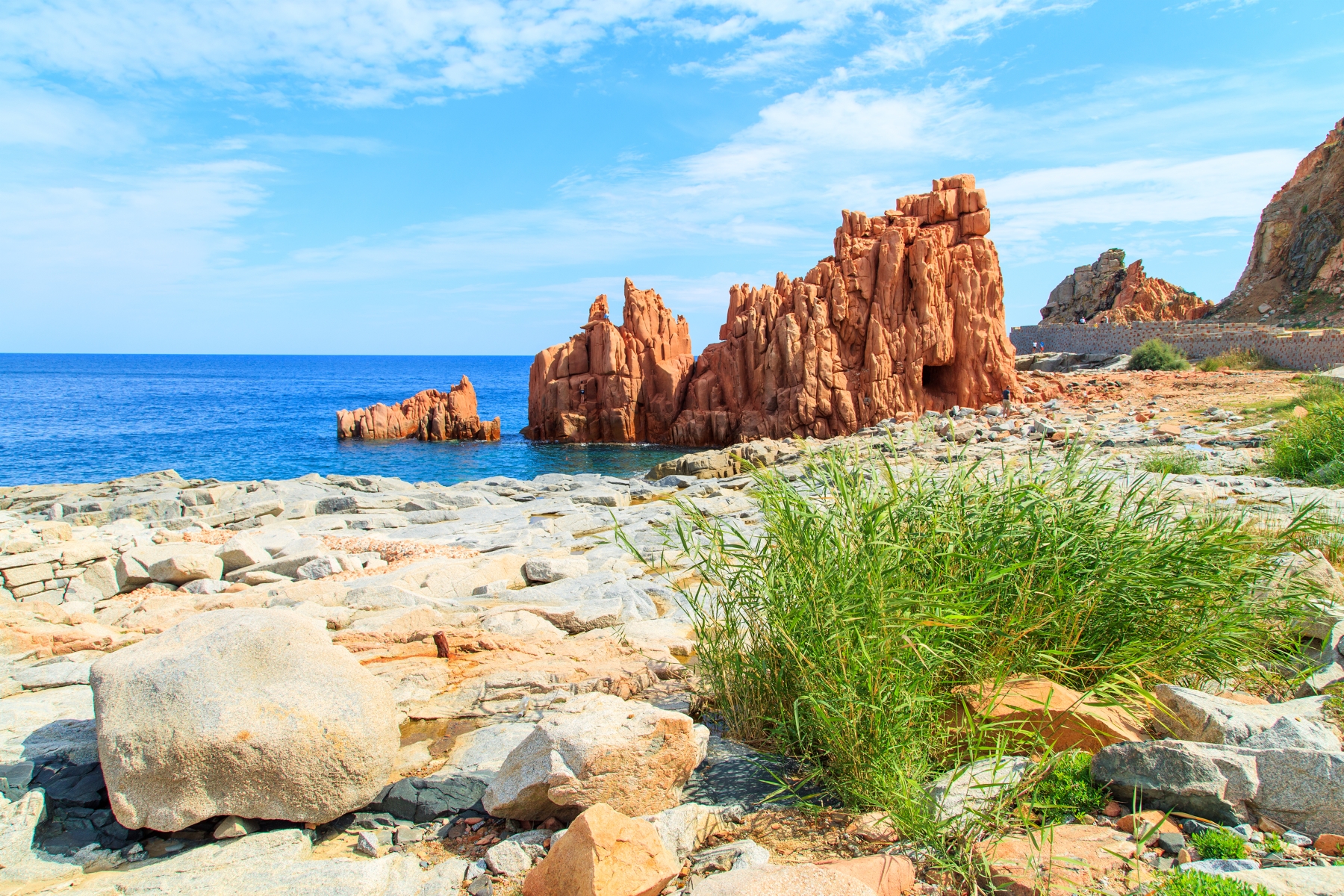
You won’t need to set sail to admire the Rocce Rosse: high cliffs of reddish porphyry and black diorite, next to the harbour, treating you to an unforgettable view. This setting is so distinctive that it has been immortalised in films and serves as a backdrop for music festivals such as Rocce Rosse Blues and Red Valley. The white tower of San Miguel, also known as the tower of Arbatax, stands out in front of the port. The tower may be where the locality gets its name: Arba ‘at ‘ashar is an Arabic expression that indicates the fourteenth tower, counting anticlockwise from the south. It was built in granite and porphyry around the middle of the 16th century, followed by the tower of San Gemiliano - which still exists - and the tower of Largavista, which was demolished to make way for the Bellavista lighthouse.
The Blue Flag, awarded by the FEE for water quality, environmental sustainability and level of services, flies on seven of the beaches along the Tortolì coast. Three of them extend around the village of Arbatax: to the north there is the beach of Ponente (East), between the port and the Pond of Tortolì. To the south, set in an inlet, you will find Porto Frailis, with find sand reflecting shades of silver and gold and a blue sea with hints of emerald green. Beyond the promontory, dominated by the tower of San Gemiliano, you will find the beach of the same name: it is the first part of the very long lido di Orrì and features golden sand, a deep blue sea, shallow waters and plenty of services available.
Necropolis of Istevene
Carved out of the granite rock and surrounded by a lush holm oak forest, it guards a small treasure: the necropolis of Istevene contains one of the very few Domus de Janas in the Nuoro area, decorated with symbolic motifs. Not by chance, in 2025 Unesco declared it a World Heritage Site, together with 16 other pre-Nuragic necropolises. The complex of tombs – called honcheddas – stands out along a mountainous spur, two and a half kilometres from Mamoiada, a famous village in the Barbagia area. There are six domus dug out at different levels of the rock face, half of them are single-cell and two of them are so small that they almost seem like niches.
To enter Tomb 1, you can walk along a short dromos – which is the entrance corridor - with a door in the back wall, through which you will come to a first rectangular room. A second room is connected to the first via a passageway in the south wall. Tomb 2 has an unusual dromos with a triangular layout, which leads into the main room, and has an elliptical shape. Here too, on the south side, there is an entrance to a secondary room, which in turn leads to a third quadrangular room. You can admire the most distinctive elements of the necropolis in Tomb 3: in the atrium, there are two entrances to two rooms that communicate with each other; one of them, which can be reached via the door in the back wall, is divided into two sectors by a step. On the walls, you’ll notice residual traces of red plaster and on the right side there are vertical incisions, while on the entrance wall there is a circular cupule; lastly, there are small pits in the floor, which are also circular in shape. There is a pillar in the centre, on which a raised bull protome has been carved.
The necropolis dates back to the final Neolithic or early Copper Age (3200-2800 BC), probably contemporary with another unique monument in Mamoiada: the Stele di Boeli, also known as sa Perda Pintà, meaning the decorated stone. It is a granite monolith almost three metres tall, displaying concentric raised circles, intersected by a vertical incision. In addition to these, there are 23 cupules carved into the upper and lower left areas of the front part. It was probably part of a group of similar menhirs lost over time.
Mamoiada is not just archaeology, but it is famous for its carnival masks, of Mamuthones and Issohadores, which you can admire during carnival and by visiting the museum of Mediterranean masks, as well as for its wine production, particularly Cannonau and Granazza, a native grape variety.
Mount Zara
At first sight, it is a ‘normal’ cone of volcanic origin, which stands out in front of the residential area of a town in Lower Campidano, but in reality it contains various Domus de Janas – two with an original appearance -, a monumental flight of steps that leads to a sacred area and a few villages, one of which is the protagonist of a sensational and controversial discovery. Monte Zara is one of the mountains that ‘protect’ the territory of Monastir to the east, while next to it runs state road SS 131 ‘Carlo Felice’, the arterial road that crosses the entire Island. From the road, proceeding towards Cagliari, you can see two adjacent cavities, located on the northern side: they are the Domus de Janas known as is Ogus de su monti, or ‘eyes of the mountain’. These are two tombs side-by-side but independent, with a well-sculpted entrance portal, antechamber and funerary cell.
On the northern side, there are another four tombs: one still has the main chamber only; the second, which originally had a well-entrance, reveals a niche and a counter inside the cell; the third tomb also seems to have a well entrance; while the fourth is larger in size and perhaps contained two counters. Another group of scattered domus occupies the southern slope of the mountain. The tombs date back to between the end of the Neolithic and the beginning of the Eneolithic periods, between the 4th and 3rd millennium BC.
At the top of the mountain, you will see a flight of 60 steps carved out of the rock, leading to two rock altars, with two wells nearby. Then, further downstream, on the western slope, lies the village of Bia ‘e Monti. The settlement, dating back to the 9th century BC, includes around forty circular huts and quadrangular buildings. The largest circular building revealed a millstone, an oven, earthenware with traces of oil and, above all, an artefact resembling a wine press, which contained traces of tartaric acid. The substance is produced during the pressing of grapes and therefore appears to bear witness to the production of wine in Monte Zara during the Nuragic age. Others, however, consider it to be a model of a nuraghe used for religious purposes.
Necropolises and villages were abandoned for several centuries and Monte Zara was frequented again for religious and funerary purposes in the Punic age and then the Roman period, during which a defensive wall was built. On the nearby hill of is Aruttas you can explore another necropolis, made up of five Domus de Janas dug out of a granite block. There is a leap from the Neolithic to the Middle Ages in just a few dozen metres: the adjacent peak of Mount Olladiri contains the remains of the Castle of Baratuli. A strategic position and difficult access made it very important between the 12th and 14th centuries. Among its owners, there was also the Pisan Gherardesca family, the same family that owned the Castle of Acquafredda in Siliqua.
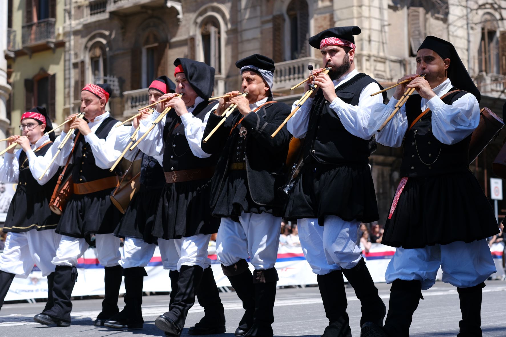
The launeddas & others, Sardinia in music
Once upon a time, there was no important moment in life or in the changing cycle of the seasons that was not accompanied by and celebrated with music. A profound bond, one with the sacred and profane aspects of everyday life that has changed but still continues today, on special occasions, when the sound of musical instruments, symbols of each community’s traditions, can be heard. The occasions are patron saint celebrations, events linked to local identity and big festivals, from the celebration of Sant’Efisio in Cagliari to the Cavalcata Sarda (Sardinian Cavalcade) in Sassari, as well as the festival of the Redeemer in Nuoro and during the rituals of Holy Week in numerous Sardinian towns.