
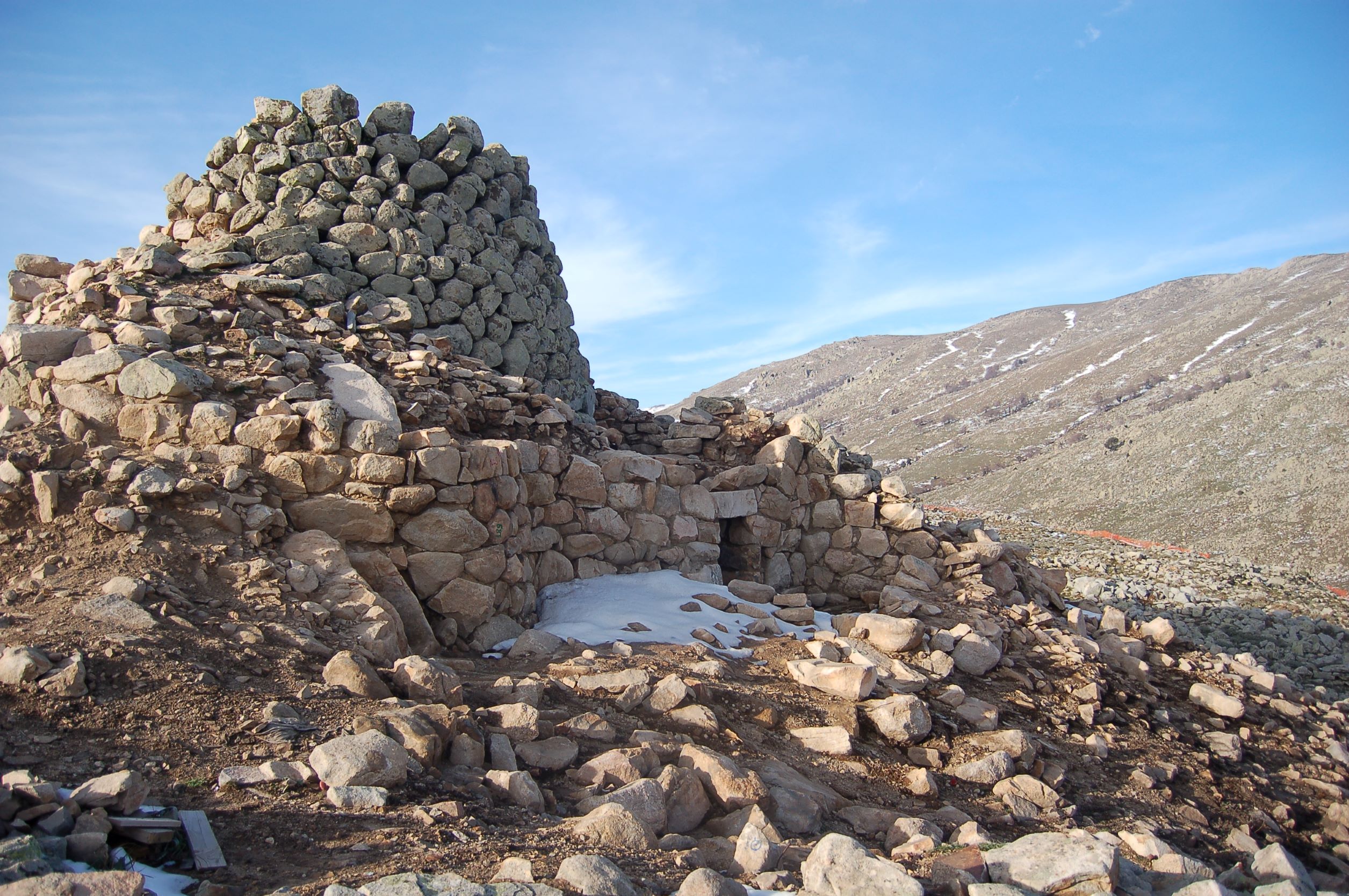
Nuraghe Ruinas
It stands on the slopes of Gennargentu, at an altitude of about 1200 metres, asserting itself as one of the ‘highest’ Bronze Age settlements in Sardinia. Furthermore, the traces of the village that surrounds it tell a story steeped in legend. The nuraghe Ruinas is ‘immersed’ in a mountainous landscape in Arzana, not far from woods, waterfalls and springs. Orruinas – as it is called by the people of Arzana – must have been a particularly important settlement: in addition to the nuraghe, it also has a Giants’ Tomb, (perhaps) a sacred well and above all a vast village of which around 200 huts can be seen today, although it is assumed that there were originally many more of them. The nuraghe has a trefoil layout, with about 8 and a half metres of the height of the keep still standing and the tholos roof of the main chamber still remains, while to the left of the entrance you will see the staircase that led to the upper room, which later collapsed.
The towers on the sides show signs of renovation work: in one of them, the main room was ‘sacrificed’ to allow the construction of a boundary wall, while a small room was saved, from which there is a staircase that led both to the upper floor and to a walkway on the curtain wall that connected two towers. Between the bastion and the keep you will notice the courtyard, with an irregular layout.
The village extended around the nuraghe, with mainly circular structures and a rectangular building, which some interpret as a meeting hut, given its considerable size of twenty metres by thirty. A few hundred metres north of the nuraghe are the remains of the Giants’ Tomb of reference of the village. The settlement has yielded numerous artefacts, among which a bronze statue, 12 centimetres tall with its arms outstretched in front of it, stands out. Some findings have been dated back to the Imperial age, thereby testifying to continued human presence at least until a historical period that may even have been medieval. In fact, there is a legend linked to the village of Ruinas, according to which it existed until the beginning of the 15th century, only to be abandoned due to an epidemic of the plague. Its inhabitants are said to have been accommodated in Arzana, in the Preda 'e Maore district, and therefore the territory in which the site is located, over 30 kilometres from the inhabited area, was ‘claimed’ by the Ogliastra village.
Visiting Orruinas is an opportunity to combine archaeology and outdoor activities: a trekking trail of about seven kilometres starts from the site and heads north, reaching Punta la Marmora, the top of Gennargentu and the highest peak in Sardinia. During the journey, you will see ancient sheepfolds and animals in the wild, until you find yourself gazing at spectacular landscapes and enjoying a unique view.
Forest of Niala
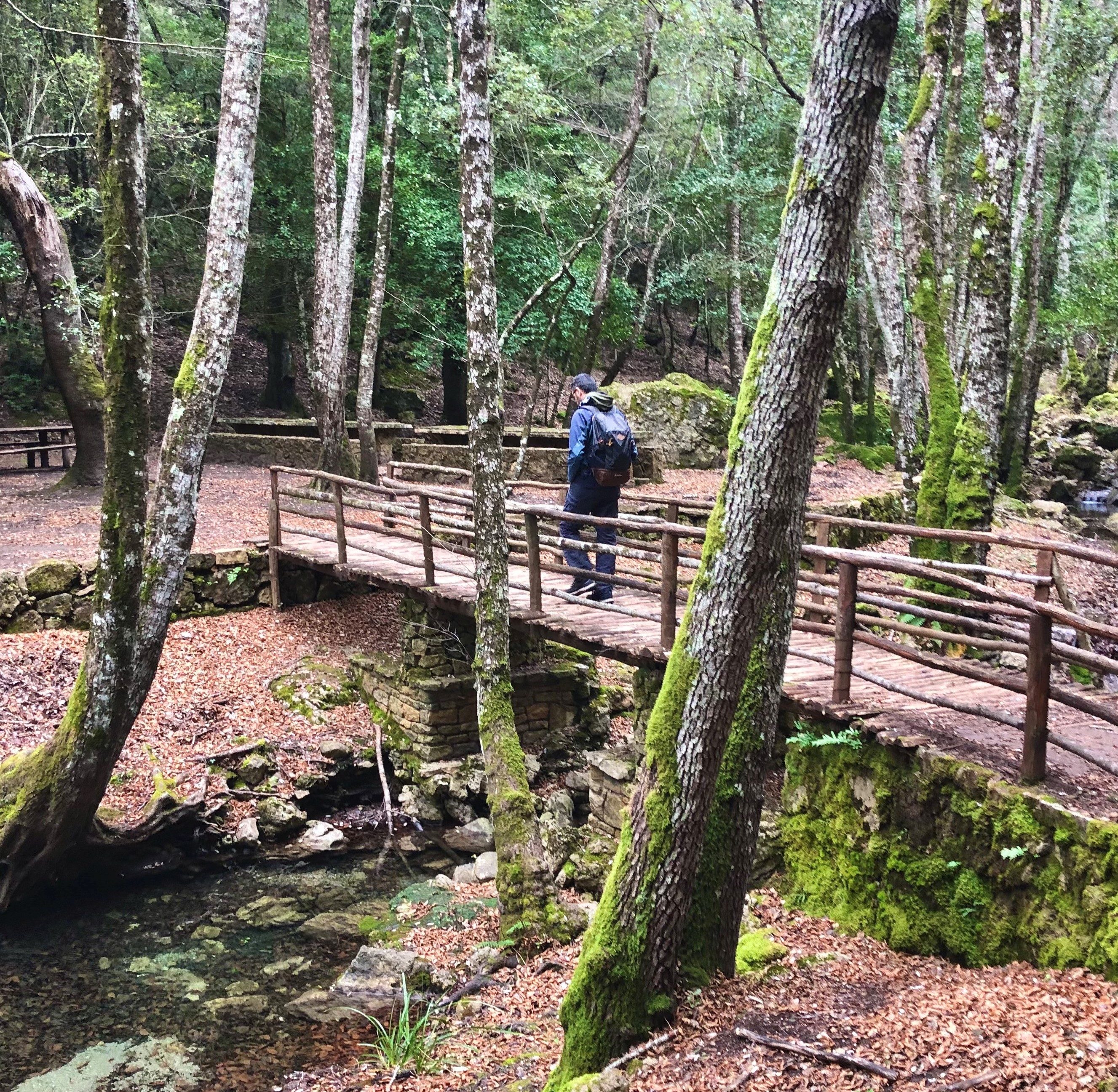
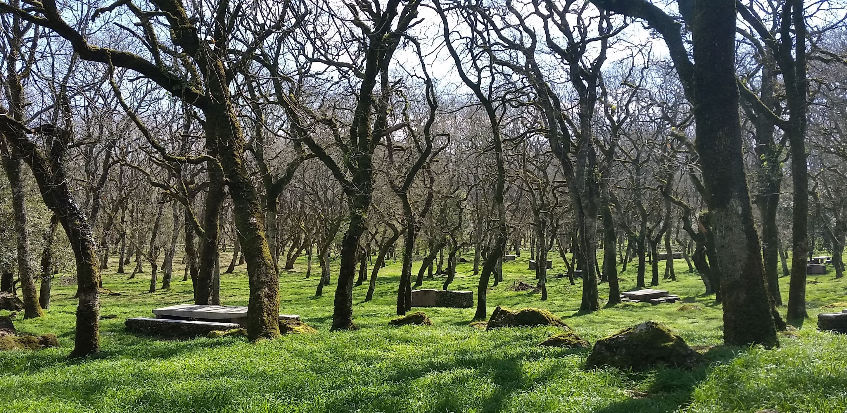
Those who visit it, cannot help but describe it with just one adjective: enchanted. The Niala forest, in the territory of Ussassai, next to the state-owned forest of Montarbu, is an oasis set in nature and full of attractions: lush expanses of holm oaks and Mediterranean scrub are crossed by torrents that generate waterfalls. The natural pools of Tuvu Nieddu, stand out and, during the hot season, you can enjoy a refreshing swim here. In springtime, you can admire several paths as they turn pink, thanks to the peonies in bloom.
Niala can be reached via various routes with a view of the distinctive ‘buttes’ of Ogliastra, including the Italia trail, along the Z20 section. Otherwise, you can get there from the Sentiero delle Aquile (Path of the Eagles) - to the west of Gairo Taquisara -, crossing through is Tostoinus, a place where you can admire a picturesque cuile, a small stone bridge and the remains of a Nuragic village. Part of the forest is crossed by railway tracks where, until recently, the Trenino Verde (Green Train) travelled along the Mandas – Arbatax stretch, so coming across a little station is no surprise, after which you can take a look at the fascinating bridge of Irtzioni, also called the San Girolamo bridge, from the name of the place in which it is located. It is an iron structure dating back to the late 19th century, considered by many to be one of the most distinctive features of the entire network that the little ‘trenino’ tourist train travels along.
Not far from the bridge, you’ll find a resting area, embellished by an installation, created by the artist Pinuccio Sciola: it is made up of ‘balls’, rocky spheres lying near a spring and a small lake. Here, there are also some rock arches and a few karstic cavities. One of the caves of Niala is called the ‘cave of the Madonna’, due to the shape of a rocky protrusion inside it, which brings to mind a Madonna with Child.
From the Niala forest you can carry on until you come to the Montarbu forest, through the forestry base of Taccu Mannu. In the most downstream part, the paths run through Mediterranean greenery, surrounded by strawberry trees, junipers and mastic trees. Montarbu is also a wildlife oasis, inhabited by deer, wild boars, foxes, squirrels, fallow deer and mouflons.
The immense natural heritage is the pride of Ussassai and so is the residential area. An excellent opportunity to visit it, is the apple festival in October, when the apple variety typical of the village, the trempa orrubia, or ‘red cheek'’ apple, is celebrated. You will be able to taste typical dishes such as culurgiones cun sa mècuda and is coccois prenas. Last stop is Trebigei, seven kilometres from the town, where the Romanesque sanctuary of San Salvatore stands, surrounded by stone cumbessias (dwellings for pilgrims).
Piscina Irgas
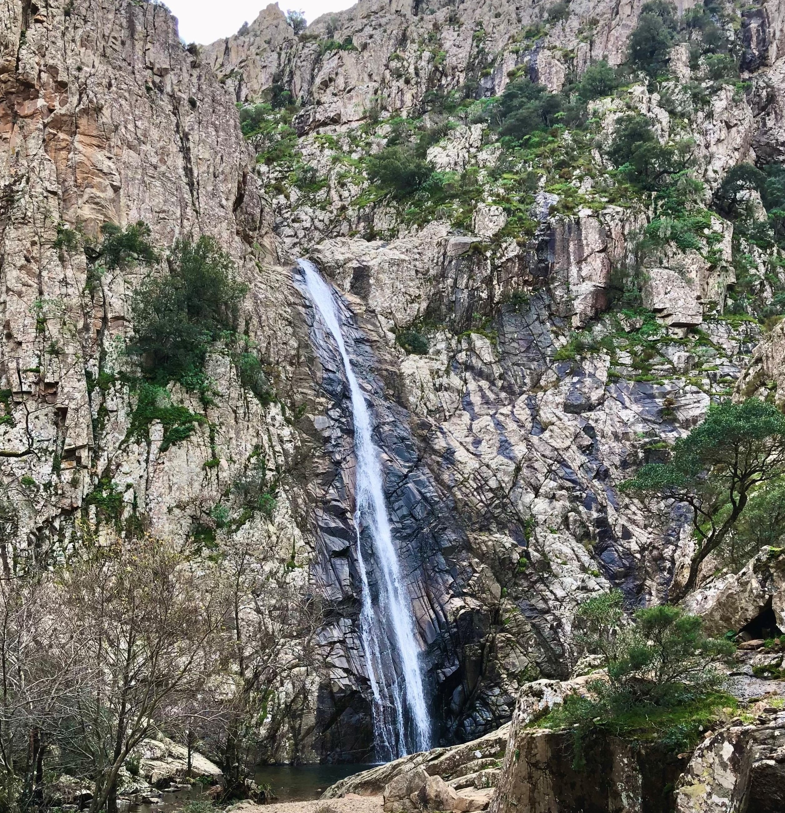
It’s hard to say which is more thrilling: the trail to reach it or actually seeing it once you get there. What is sure, however, is that to ‘conquer’ it you’ll enjoy an experience you’ll not soon forget. Piscina Irgas is one of three majestic waterfalls that furrow the granite rock faces at parco di Monte Linas – Oridda – Marganai, one of which, together with sa Spendula, lies within the borders of Villacidro, while the third, the highest, Muru Mannu, falls within the domain of Gonnosfanadiga. The waterfall is a preferred destination of enthusiasts of a variety of sports: hiking, canyoning and mountain biking, and it can be reached from diverse starting points.
Hikers generally set off at the entrance ‘gate’ of the Montimannu forest, some 15km from Villacidro, or from sa Duchessa, in the area of Domusnovas. The first trail bears the red/white banner marking CAI 113, which you’ll see all along the route. You’ll walk through an oak forest and cross to the other side of the Cannisoni river over a metal bridge, then hike up to the belvedere, at an altitude of some 600 mt. From here you can see Piscina Irgas from above in all its glory, not to mention the mountains of the Marganai massif and, further down, the gorge carved by the Oridda river. The walk continues downhill from here to the base of the waterfall not far away. The 45mt leap of the waterfall splashes into a lovely little emerald-green lake. The second trail passes through abandoned mining areas, towards the Oridda Valley, partly following – in the opposite direction – a section of route 11 of the Cammino minerario di Santa Barbara. An upwards section along the left bank of the Oridda river will take you to the top and another panoramic vista point, from which you can view, and hear, the waterfall from above. The trail, which is also marked with small stone figurines, will lead you down to the base of the fall. You can walk both trails – one going, the other returning – to create a 10km long ring walk.
Piscina Irgas, one of the first of Sardinia’s cascades to be equipped for canyoning, is now a favourite of those practising that sport, nestled in a gorgeous setting and blessed with plenty of fresh water. The route continues beyond the waterfall with fun smaller drops and pools. Mountain bike enthusiasts can set off along a trail which goes westward from the Campu s’Isca forest nursery to Bega Trotta point, and then northwards along the Oridda plains, and from there to the Piscina Irgas belvedere, then downwards along the Leni river back to the trailhead. The initial portion of the 113 CAI trail coincides with the route to get to Muru Mannu, which, with its 70mt drop, is Sardinia’s tallest waterfall! Closer to the village of Villacidro, and easy to reach, is sa Spendula, surrounded by a lovely park.
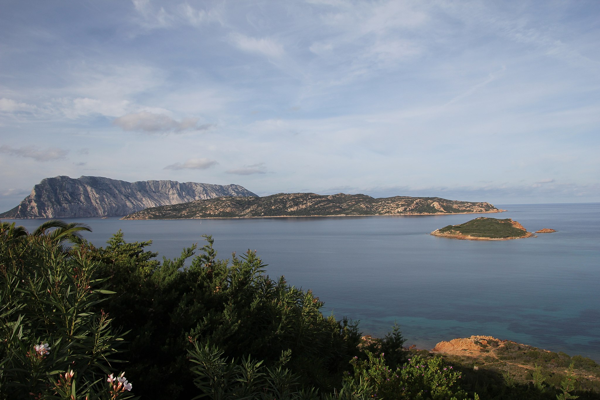
Molara
Here and there, it still contains traces of ancient human presence, but today it is above all an uncontaminated haven made of granite and covered in Mediterranean greenery, immersed in the enchanting Gallura sea. Molara is one of the islands within the perimeter of the protected marine area of Tavolara – Capo Coda Cavallo, the second largest after Tavolara. It differs from its more famous ‘neighbour’ in its composition, as Tavolara is predominantly limestone, its shape and because it is uninhabited. Its name is of medieval origin and probably comes from its rounded and basically even appearance, like that of a millstone. The ruins on the island are surrounded by an aura of legend: the remains of a single-nave church may be traced back to a sanctuary dedicated to Saint Ponziano, who is said to have been exiled here by Maximinus Thrax. Around it, there are traces of a medieval settlement and a castle, while some sources testify to the presence of a convent during the 15th century.
As well as its historical aspects, Molara stands out for its natural heritage. There are examples of cows and goats living here in the wild and the Audouin's gull and peregrine falcon nest here. Among the plant species, along with wild olives and lentisks, native plants thrive here, like the Sardinian Asteroideae and the Limonium Acutifolium. In the southwestern part you can go for a dip in the spectacular Molara pools, ‘mirrors’ of turquoise crystal clear water surrounded by granite rocks, also ideal for snorkelling. The waters around Molara are a destination for diving enthusiasts: about a mile south of the island, at a depth of 40 metres, lies the ‘shipwreck of Molara’, which was recently identified as the French merchant ship Oued Yquem. In 1941, the ship was hit, perhaps by mistake, by a Dutch submarine, while en route to the port of Marseilles. When on board, divers can observe groupers, snappers, amberjacks and sea bream, as well as colourful sponges.
You can reach Molara, without missing a chance to stop at the little Cala Spagnola, from Olbia, Porto San Paolo, Capo Coda Cavallo and from Marina di Puntaldia. The excursions also make it possible to sail around the smaller islands in the protected area: Molarotto, Proratora, the Islands of Piana and Cavalli, as well as the tiny islands of Porri, Topi, Drago and the islet of Rosso. A stop at Tavolara is a must. This limestone and granite mountain emerges from the sea, with an unmistakable profile, and hosts the Una Notte in Italia (A Night in Italy) film festival every year. You’ll find little houses, refreshment areas, several beaches and fabulous diving spots here. Among these, to the east, there is the Secca del Papa.
Monte Sant'Antonio
At first glance, you will be struck by the fairy-tale atmosphere of the forest, equipped with a convenient picnic area. Then, going up along the path, first you’ll see a small church appear with a spectacular open-air altar next to it, then you’ll see a nuraghe, more hidden by the surrounding vegetation. All this is found inside the Monte Sant’Antonio Park, a small oasis just eight kilometres from Macomer. The origin of the elevation is volcanic and it has an altitude of about 800 metres. On its slopes, there is a green area of 277 hectares, mainly made up of downy oaks, but you will also see cork oak groves and reforestation of holm oaks and chestnut trees, where wild rabbits, Sardinian hares, foxes, wild boars and martens roam.
The forest is crossed by paths ideal for hiking trips and it also contains an area equipped with tables with barbecue facilities next to them. Continuing south, you will reach the top of the mountain, where a country church dedicated to Saint Anthony of Padua stands. The the sanctuary was built by a married couple from Macomer and the building work began in 1644. It is the site of a heartfelt celebration organised every year by a committee made up of forty-year-old fedales. Around the church, you will notice a series of engravings on stone slabs depicting scenes of the via crucis (way of the cross), while an altar stands out, over a small staircase, above which there is a majestic statue of the Virgin Mary with child, positioned behind it.
On 12 June, the citizens of Macomer accompany the wooden simulacrum of the saint from the Parish Church of San Pantaleo to the country church, on a journey of thirteen kilometres. The following day, the real celebration takes place, with songs, shows, banquets and stalls, where you can taste typical local products. On 14 June, the statue returns to Macomer, accompanied by horsemen and riflemen in costume.
The surprises don’t end here: to the west, a small path through the vegetation will take you to the single-tower nuraghe of Sant’Antonio, with an elliptical-shaped room and a tholos roof. From the top, you can admire a splendid panorama that includes not only the forest below but also a view of Montiferru and Planargia, up to the Abbasanta plateau and the Gennargentu mountains.
Your archaeological tour of Macomer continues as you move a few kilometres further on to the Park of Tamuli. Here, in addition to the complex nuraghe and the surrounding village, you will see three Giants’ Tombs, almost aligned - perhaps oriented according to the movement of the sun during the day - and near which there are six mysterious anthropomorphic baetyls, positioned in two groups: the first depicting the male element, the second with the baetyls decorated with breast-like shapes, representing the female element, the origin of life.
Ecomuseum of the Sardinian Mountains
More than an exhibition space, it’s a ‘treasure chest’ containing the memory and cultural identity of Aritzo and the villages on the western side of the Gennargentu. The Ecomuseum of the Sardinian Mountains is organised as a scattered museum, inside a village in the Barbagia di Belvì region, with its ‘epicentre’ in the ethnographic museum. You will find it surrounded by the greenery of the Pastissu park, proving the unbreakable bond between community and natural heritage, hence the name ‘ecomuseum’. Through the exhibition’s eight rooms, you will discover domestic environments, ancient trades, feminine ‘know-how’ and the use of resources offered by nature, without neglecting the relationship with spirituality and magical-religious beliefs.
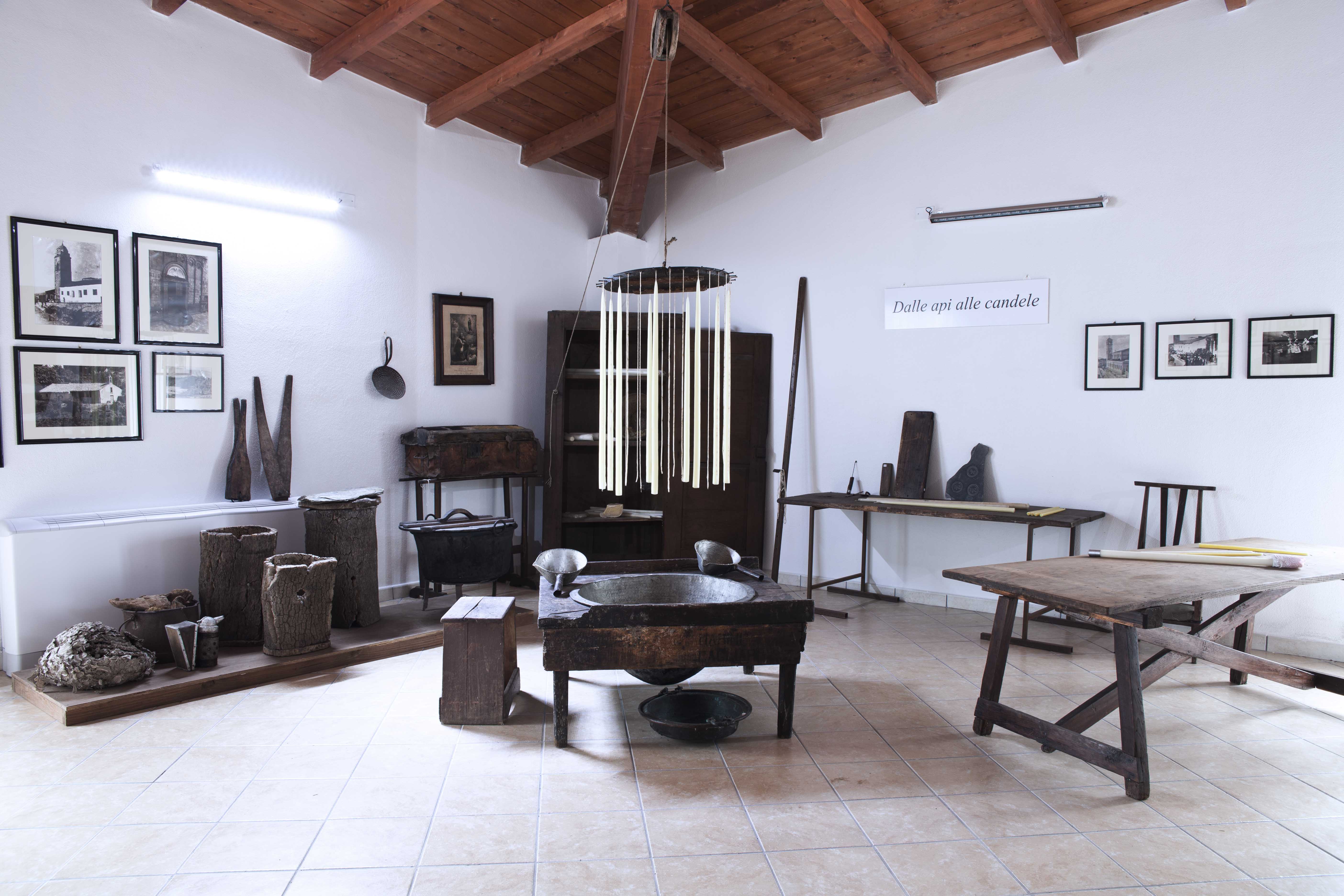
Your journey begins by deepening your knowledge of the topic of pastoral culture. The first room describes the milk processing procedure and care of livestock. The most unusual object on display is su Giuramentu, a group of medallions with sacred images and a crucifix, used until a few decades ago to settle disputes regarding grazing and livestock. The second room shows two distinctive elements of the village: forest products, especially chestnuts, and the ancient activity of ‘travelling merchants’. The renowned products of Aritzo were often found in festivals and markets: nougat, wooden artefacts, hazelnuts, chestnuts and carapigna, a typical lemon sorbet made using ice obtained from snow. The third room is dedicated to wool. Every phase of its processing is described right up to the finished products, among which the colourful traditional clothes stand out. The fourth room represents a wax processing and candle production laboratory. You can continue by ‘entering’ a traditional home, with a kitchen, bread-making and chestnut-processing tools, equipment for taking care of linens, a collection of carved trunks and objects for children, such as cribs, walkers and toys. Trunks are the protagonists again in room 6: in particular, a type of carved trunk known as the ‘Aritzo trunk’ or the ‘Barbaricina trunk’, a traditional element of the wedding trousseau, is on display. The next rooms explore the Aritzo landscapes: the forest and its resources – fruit and wood –, agriculture and the activity of blacksmiths and farriers.
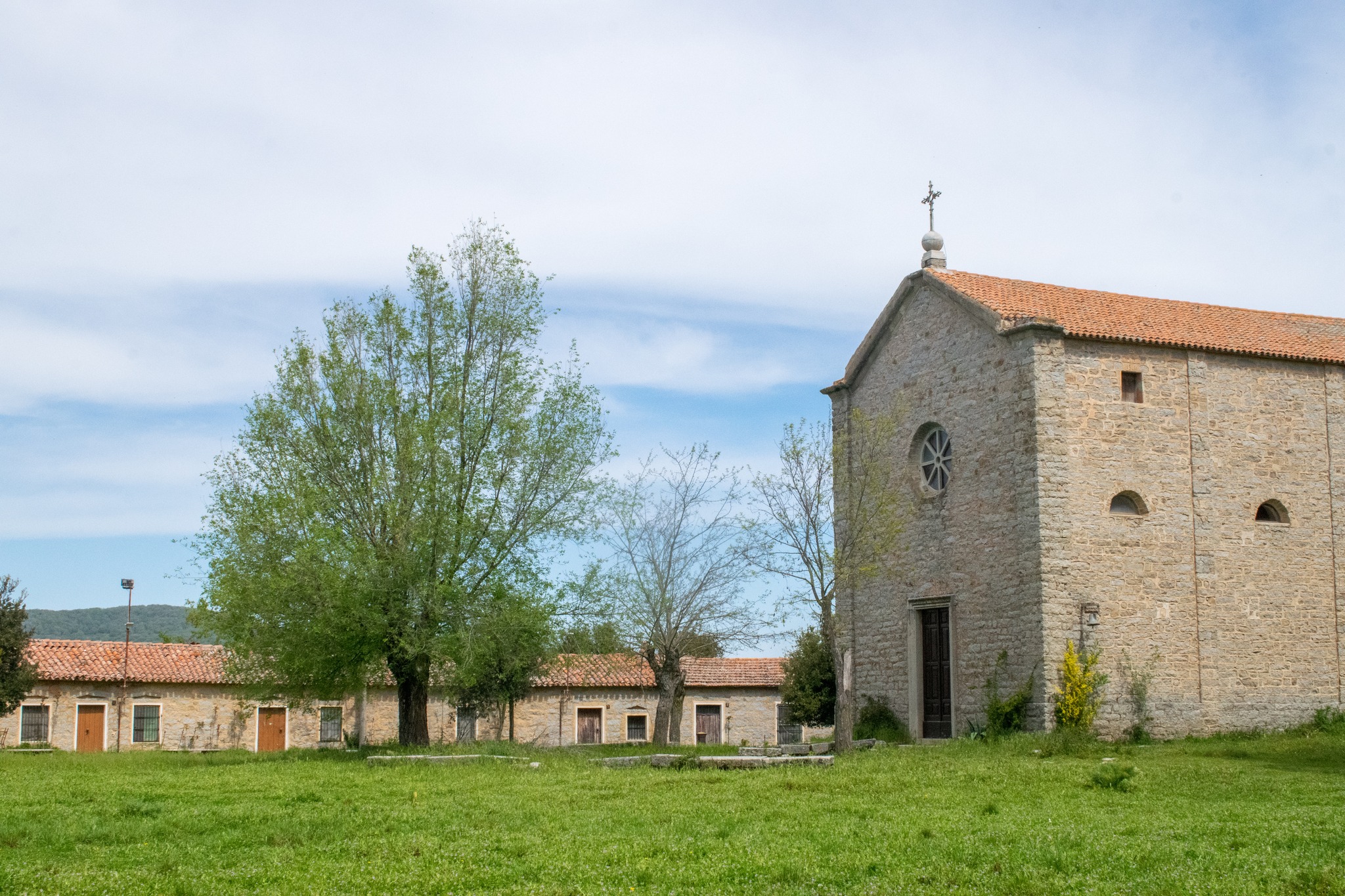
The other exhibitions linked to the ecomuseum will take you back in time: at Casa Devilla you can admire a home that belonged to a wealthy middle-glass family in the 19th century, while the Antonio Mura Museum exhibits works by the Aritzo-born painter, rich in references to the traditions and landscapes of Sardinia. Lastly, you will visit the Spanish prisons of sa Bovida, where there is a permanent exhibition on the subject of witchcraft and the Inquisition between the 15th and 17th centuries.
Nostra Signora d'Itria - Gavoi
Its appearance is solemn, like that of a cathedral. The church of Nostra Signora d’Itria is located eight kilometres east of Gavoi and what makes it special is the festive atmosphere and the hospitality that can be felt when the sanctuary and the cumbessias around it open up to the pilgrims, novena participants and visitors, especially during the celebration at the end of July, dedicated to the Madonna of Itria. The area in which the novenary is located has always been considered sacred: in fact, various archaeological evidence emerges in its surroundings: gigantic walls, Domus de Janas, Tombs of Giants and a few menhirs. In particular, sa Perda de sa Itria stands out. It is a granite monolith about four metres high, devoid of figurative elements and lodged in the green ‘garden’ to the south of the church, on the side not occupied by the cumbessias.
Sa Itria, as the people of Gavoi call it, stands on the Lidana plateau. It was rebuilt in the early 20th century on the site of a small church dedicated to the Virgin of Itria. There is no information about the previous sanctuary, except for an inscription on a bell kept inside the current church, which would confirm its title and testify to its existence at least in the mid-16th century. You can admire a building of considerable size, made of square blocks of granite, with a rectangular layout and an apse facing north-east. The façade is gabled, with an architraved portal above which there is a circular window. You will notice other windows on the sides, which are semicircular in shape and framed in mirrors punctuated by pilasters. Around it, positioned in a horseshoe shape, you will observe the cumbessias made of granite ashlars, surrounded by greenery. The novena and the procession come before the feast of Nostra Signora d’Itria, one of the most heartfelt by the inhabitants of Gavoi, on the last Sunday in July. The churchyard comes alive with dancing, singing and games, while fellow villagers and visitors are welcomed into the lodgings, transforming the novenary into a sort of village ‘district’ for ten days. The main event is su Palu de sa Itria, on Sunday afternoon: the palio has very ancient origins, dating back to 1388 - the year of the signing of the peace treaty between Eleanor of Arborea and John I of Aragon - and takes place in a natural ‘amphitheatre’ next to the sanctuary. Other tests of skill on horseback take place on Monday and Tuesday, while Wednesday is the day of sa ghirada a caddu, or the return to the village on horseback.
Gavoi is a town rich in attractions and traditions, which has received the Bandiera Arancione (Orange Flag) award from the Touring Club, and is ‘immersed’ in a breathtaking natural setting. Don't miss the carnival, during which there is a parade of tumbarinos – typical Gavoi drummers -, the stage of Autumn in Barbagia and the prestigious literary festival L'Isola delle Storie (Island of Stories).

Nostra Signora del Monte - Fonni
“The path that leads from Fonni to the mountain first runs past the foot of a small hill two kilometres from the village, on which the Church of Nostra Signora del Monte stands; every year, a big celebration takes place there with a large crowd”. This description is by General Alberto Della Marmora, one of the most prestigious ‘travellers’ in 19th-century Sardinia, in the passage on his ‘Itinerary of the island of Sardinia’ in which he describes the landscapes around Gennargentu. The sanctuary is less than five kilometres south of Fonni and is worth visiting, for various reasons: along with the Madonna della Neve (Madonna of the Snow) by Desulo – on the Tascusì pass -, Nostra Signora di Gonare between Orani and Sarule and Madonna della Neve on Monte Limbara in Tempio Pausania, it is the church located at the highest altitude in Sardinia (about a thousand metres). Furthermore, from the nearby lookout, you’ll see a breathtaking view embracing the peaks of Gennargentu, the basin of Lake Govossai and the Pratobello plain.
It is not just the surrounding landscape that makes Nostra Signora de su Monte – or also Madonna della Visitazione, two other names by which the church is known -, a stop not to be missed during a visit to Fonni: next to the church there are two rows of cumbessias or muristenes, typical lodgings for pilgrims and novena participants, especially during the festival also mentioned by General Della Marmora. The celebrations are traditionally organised by families from Fonni and include a novena, a procession and folklore shows. The ‘care’ dedicated to the church by private individuals has ancient origins: around the 17th century there was only a small chapel with a simulacrum of the Madonna, but later on it was extended thanks to the activity of lay families, who also handled its administration. In the first half of the 20th century, its custody passed to the diocese of Nuoro: the original building was demolished in 1976 and rebuilt in its current form.
Nostra Signora del Monte is one of the stops along La Via dei Santuari (Route of the Sanctuaries), through twenty novenas in the centre-north of the Island, from Cabras to Santa Teresa Gallura. You can also include it in an itinerary for discovering the archaeological and natural treasures of Fonni. A few steps away from the sanctuary, the remains of a nuraghe of the same name emerge, while the main evidence of the Bronze Age is found to the east, near the Correboi pass: the necropolis of Madau and the Nuragic Sanctuary of Gremanu. Along the way, on the right, the peaks of Monte Spada and Bruncu Spina stand out against the sky.
Nuraghe Corbos
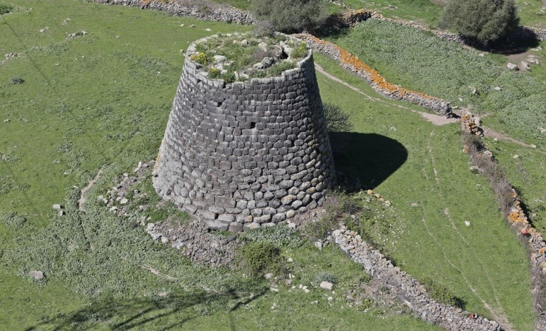
It is one of the most ‘technically’ well-finished nuraghi on the island, thanks to the level the Bronze Age builders reached when working and finishing the stone ashlars. The single-tower Nuraghe Corbos was built on a small hill seven kilometres from Silanus, between the plateau of the same name and the Ottana plain, in ana area dense with evidence dating back to the Nuragic age. You will see a truncated cone tower about twelve metres high, built using medium-sized skilfully-worked basalt blocks: in the first rows they are polygonal, while from the middle upwards they are roughly square-shaped and the exposed side is slightly convex.
The position of the architrave above the entrance is almost level with the walking surface. In fact, the collapsed stones have buried more than a metre of the tower. Nevertheless, access is possible through a breach on the west side, obtained by removing an ashlar, which leads to the staircase connecting the ground floor and the upper level.
In the access corridor you will notice the passageway niche and the staircase, lit up through three slits. The central chamber has a tholos vault and three niches positioned in the form of a cross. The staircase, a few rows of which still remain, led to the upper room that has a diameter of about three metres.
Traces of walls pertaining to the village emerge around the building. The area must have been frequented starting in the pre-Nuragic age: an isolated menhir, unusually made of granite, seems to bear witness to this, embedded in the ground about a hundred metres from the nuraghe in the north-easterly direction. At the same distance, but in the opposite direction, you will find the Corbos Giants’ Tomb. It is thought that it was a dolmen building, perhaps renovated at a later time. Also in the corridor of the tomb there is an ‘intruder’: one of the orthostates is made of granite. Next to the tomb you will see five baetyls, positioned irregularly and probably moved over time. Three hundred metres from the nuraghe are the remains of another Giants’ Tomb, called s’Abbaia. Traces of the funeral chamber, over eleven metres long, and of the right wing of the exedra still remain.
The territory of Silanus, a village belonging to the Borghi Autentici d’Italia club, is an open-air archaeological museum: it has more than 30 nuraghi, 19 Giants’ Tombs, five domus de Janas and a sacred well, as well as several fences and sacred fonts. Among the most significant are the Nuraghe Orolio (or Madrone), the Giants’ Tomb of Sa Pedra Longa – which is where the baetyls visible in the churchyard of the Church of San Lorenzo come from - and above all the complex of Santa Sabina, in which a nuraghe and a Byzantine church face each other a few dozen metres away.
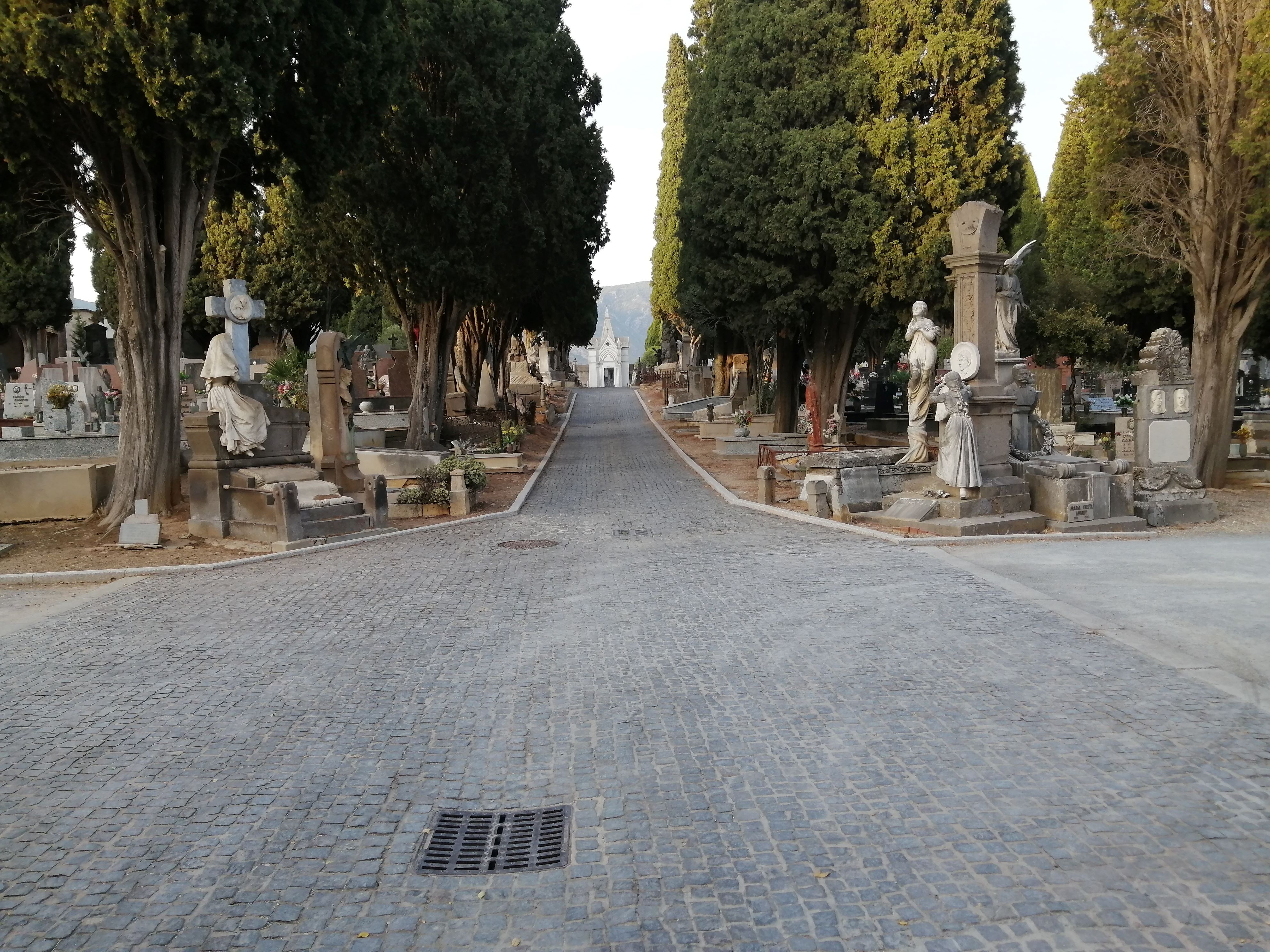
Monumental cemetery of Iglesias
It rivals the cemetery of Bonaria in Cagliari with its atmosphere and dark charm of the funeral works, so much so that it too is defined an ‘open-air museum’. Both also boast masterpieces created by the sculptor nicknamed ‘The Michelangelo of the dead’. The monumental cemetery of Iglesias extends close to the Church of Nostra Signora di Valverde, outside the city walls. It was inaugurated in 1835 and was extended several times starting from the second half of the 19th century, due to the progressive increase in population. The large central body is characterised by avenues with rows of cypress trees and Mediterranean plant species along the sides, creating quadrangular ‘islands’ and dedicated areas. One of these is delimited by what may be the best-known and most enchanting path, the ‘Viale dei Bambini’ (Avenue of the Children).
You will see statues and decorations in Art Nouveau and eclectic styles, also visible in the fences, urns and floral decorations, among which you will notice unusual symbolisms. The most famous work is the sepulchral monument of the little Zaira Deplano Pinna, known above all by the name of ‘Little Girl with a Hoop’. Daughter of a very well-known notary of the town, the little girl was stricken with acute meningitis, which ended her life at the tender age of six. The life-size statue portrays her sitting on a segment of a column. She is smiling and holding a hoop, her favourite pastime, which is made of bronze. Over time, dark legends arose around the tomb: it is said that the statue comes to life at midnight to play along the avenues and that the ghost wanders over the rooftops of the houses, every year on 2 November, in search of children who want to play with her, taking those who accept the invitation with her to the afterlife.
The work helped increase the fame of its author, sculptor Giuseppe Sartorio, who opened workshops in Cagliari and Sassari and created numerous works, now kept in the capital city and in various towns across the Island, as well as in the Verano cemetery in Rome. The cemetery of Iglesias contains 65 of them and the monument dedicated to Quintino Sella in the square of the same name in the city is also his work. Other sculptures by Sartorio are the funeral monuments of the Boldetti sisters and that of Domenica Antonietta Grimaldi, who also suffered a tragic fate.